Search

GEOGRAPHY EDUCATION

Supporting geography educators everywhere with current digital resources.

Month

May 2012

Kids Who Get Driven Everywhere Don’t Know Where They’re Going

See on Scoop.itGeography Education

A new study suggests vehicular travel affects children’s ability to navigate their neighborhood and connect to their community.


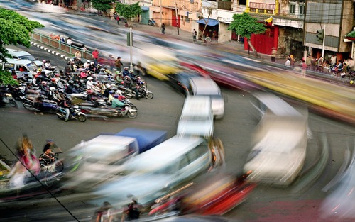
We learn about the places around us by exploring.  Literally our mental map is formed by making choices (in part through trial and error) and that process strengthens our spatial perception of the neighborhood.  Research is showing that kids with a ‘windshield perspective’ from being driven everywhere are not able to draw as accurate maps as children for who walk and bike their neighborhood.  The built environment and the transportation infrastructure in place play a role in developing spatial thinking skills for young minds. 


This is a compelling article with some important implications.  What are the ramifications for geographers?  City planners? Educators?  Families moving to a new neighborhood?   

See on www.theatlanticcities.com

NASA Earth Observatory – Vegetation Index

See on Scoop.itGeography Education

http://earthobservatory.nasa.gov/GlobalMaps/view.php?d1=MOD13A2_M_NDVI# Satellites observe global-scale patterns of vegetation that scientists use to study c…


The NDVI (Normalized Digital Vegetation Index) is on of the primary methods for detecting healthy vegetation using satellite imagery.  This also serves as a useful way to distinguish between distinct ecological and agricultural regions and the temporal patterns of planting seasons. 

See on www.youtube.com

Downtowns: How Did We Get Here?

See on Scoop.itGeography Education

Kennedy Smith is considered one of the nation’s leading experts on downtowns, downtown economics, independent business development and the economic impact of urban sprawl, with a long career in downtown revitalization.


This video discusses the decline of the American Central Business District, the rise of shopping malls, the importance of the automobile and spatial organization of particular economic sectors.


Parts Two ( http://vimeo.com/37041011 ) and Three ( http://vimeo.com/37050944 ) continue the discussion with an emphasis on practical urban planning policies for small cities to revitalize the downtown region with some domestic and foreign examples. 

See on vimeo.com

Living in the New Metropolis

See on Scoop.itGeography Education

Documenting the megacities of our time….

Over half of humanity is living in cities and that statistic is likely to reach 70% by 2050.  Studying the urban environment, especially the ‘megacities’ (cities with populations over 10 million people) which are growing especially fast, becomes increasingly important.  This photo gallery of the worlds 23 megacites employs long exposure images, with highlights the movements and dynamism of the urban networks.  To see the gallery and this stunning image of Jakarta’s rush hour traffic, visit: http://www.nytimes.com/slideshow/2012/05/06/sunday-review/06METROPOLIS.html?ref=sunday#4 

See on www.nytimes.com

South Asian floods take economic toll

See on Scoop.itGeography Education

Environmental degradation, seasonally high rainfall, a low elevation profile and climate change combine in a very bad way for Bangladesh.  Flooding, given these geographic characteristics, is essentially a regular occurence. 

See on www.youtube.com

London’s ‘Rudest’ Boroughs

See on Scoop.itGeography Education

A couple of weeks ago, I put up a post detailing how swearing on Twitter increases during the course of the average day.  It seemed people get more angry and sweary outside of work time, rather than during.


This is a curious combination of geospatial social media technologies (so of course I found out about it on Twitter).  To read an article about this on The Guardian’s site (with Google Fusion Tables to the data) see: http://www.guardian.co.uk/news/datablog/2012/may/04/twitter-swearing-london 

See on urbanmovements.posterous.com

ORBIS

This is a tremendous resources understanding the historical geography of the Ancient Roman Empire and the transportation network.  Using ORBIS you can simulate travel logistics in the pre-modern era.  The differences between the fastest, cheapest and shortest routes between any two given locations can be very telling about the geographic factors impacting transportation.

See on orbis.stanford.edu

Africa’s Population Surge

See on Scoop.itGeography Education

At current growth rates, sub-Saharan Africa, which now makes up 12 percent of the world’s population, will account for more than a third by 2100.


Africa is the world’s fastest growing region and consequently it is an incredibly young (demographically speaking) region.  This video show key reasons (primarily cultural and economic) for the population growth within Africa.  How does the  demographic transition model apply to Africa? 

See on video.nytimes.com

Regional Geography Resources

See on Scoop.itGeography Education

I’ve mentioned that http://geographyeducation.org  is another site that I’ve created to be a warehouse for the many of resources that are currently listed on this website.  While the “tag” function here can is somewhat helpful, I created this parallel site to archive and gather resources in a way that corresponds with how a share them with my students in my World Regional Geography classes at Rhode Island College.  First, I gathered all of my favorite resources within a regional context.  During the summer, I will be archiving my resources thematically and future projects will continue to build the http://geographyeducation.org site.  This is still a work in progress, so please leave comments and I’ll try to keep continually improve the sources as well as the format.     

See on geographyeducation.org

Blog at WordPress.com.

Up ↑