“This story map was created with ArcGIS Online to guide users on how to get the most out of the Geography Education websites on WordPress and Scoop.it.”
Source: www.arcgis.com
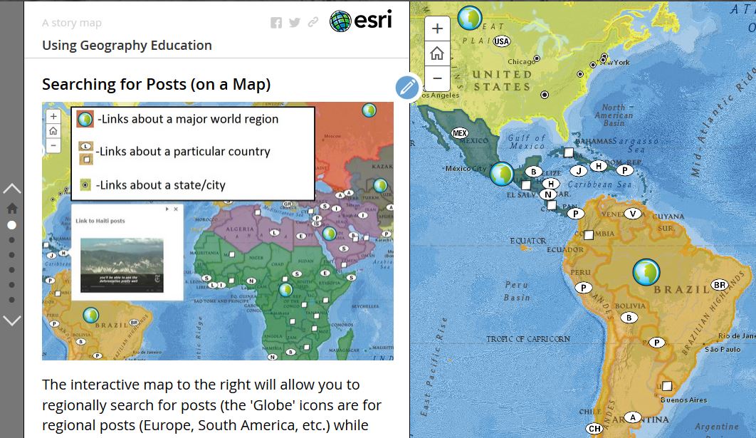
“This story map was created with ArcGIS Online to guide users on how to get the most out of the Geography Education websites on WordPress and Scoop.it.”
Source: www.arcgis.com

“While it’s easy to show that people differ in navigational ability, it has proved much harder for scientists to explain why. There’s new excitement brewing in the navigation research world, though. By leveraging technologies such as virtual reality and GPS tracking, scientists have been able to watch hundreds, sometimes even millions, of people trying to find their way through complex spaces, and to measure how well they do. Though there’s still much to learn, the research suggests that to some extent, navigation skills are shaped by upbringing.” SOURCE: Knowable Magazine
How do we know where we are, and why can some people find their way in the world, better than others? I knew my mom would always struggle to find her way around and when I was 11, we moved to San Diego. I took it upon myself to learn the freeway system, major roads, and key visible landmarks. I would help my mom drive around will be trusty Thomas Guide set of maps for San Diego County. Once she was going off alone and I drew her a simplified map with directions on how to get to Fashion Valley, but she also insisted that I make a second map that would show her how to get back (I did try to explain one map would suffice, but it was easier to make the second map).
I’ve often wondered why my mom and I are so different in this regard; our psychology, our interests, the information we value, the skills we believe are useful and within our grasps are quite distinct. We represent the extremes in our family and the linked article above explores how geographers and psychologists think about the differences in navigational abilities. GPS technologies serve both as great tools and crutches that limit some to expand their spatial skill set.
I love the podcast “Everything Everywhere Daily” Podcast. As the title implies it’s an omnivorous exploration of fascinating topics, often focusing on interesting places or pivotal moments in history. Most are approximately 10-minute summaries. Some island nations of the Pacific are very remote, and consequently, more distinct and less well-known to the outsiders. As you explore topics in the Pacific, the list below is an excellent place to start. Choose one! See where it takes you.
Wallace Line (island biogeography)
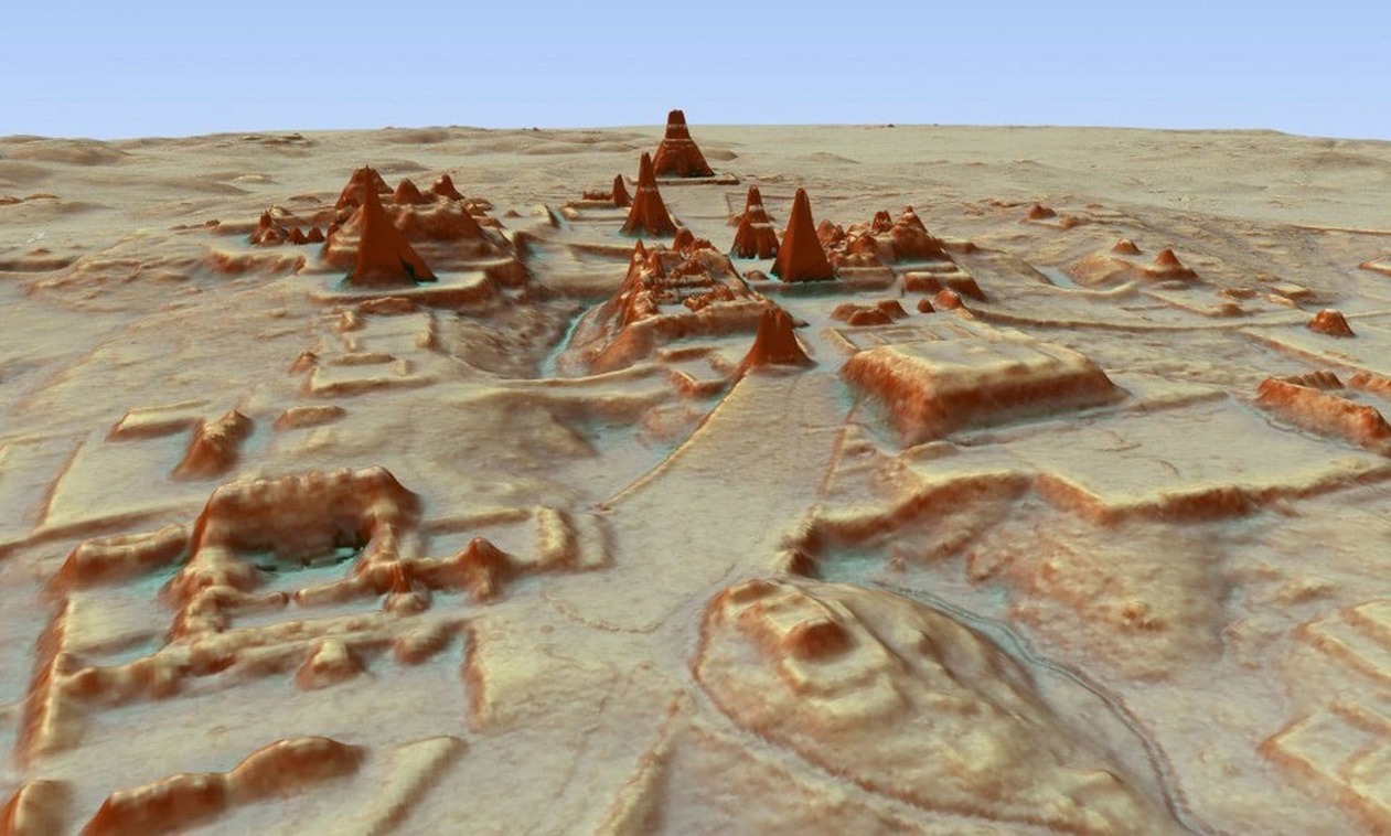
Archaeologists have spent more than a century traipsing through the Guatemalan jungle, Indiana Jones-style, searching through dense vegetation to learn what they could about the Maya civilization. Scientists using high-tech, airplane-based lidar mapping tools have discovered tens of thousands of structures constructed by the Maya: defense works, houses, buildings, industrial-size agricultural fields, even new pyramids. SOURCE– National Geographic: Everything we thought we knew about the Maya is being upended
Lidar technology gives us the visual answer to the question, “If you were to strip a forest of all its vegetation, what would you see? The lidar system fires rapid laser pulses at surfaces and measures how long it takes that light to return to sophisticated measuring equipment. Doing that over and over again lets scientists create a topographical map of sorts. Months of computer modeling allowed the researchers to virtually strip away half a million acres of jungle that has grown over the ruins. What’s left is a surprisingly clear picture of how a 10th-century Maya would see the landscape.

This technology also has local applications here in New England. New England’s wooded hills hold a secret—they weren’t always forested. Instead, many were once covered with colonial roads and farmsteads and food production was the primary local economic activity. Today we can use lidar to see remnants of this historical landscape by mapping stone walls and other features. SOURCE–National Geographic: Lost New England revealed by high-tech archaeology
ArcGIS application: Lidar can also be used quickly assess damage and change after a geologically violent incident, as seen in the Oso landslide in Washington state. View the impact in ArcGIS online in this ArcGIS map, utilizing LiDAR I and II data layers.
Questions to Ponder:
You know that I’m a fan of online geography games going way back. I’ve enjoyed the games like GeoGuessr as my go-to game to refine cultural landscape analysis and map navigation skills. Globle, Countryle, and Worldle have all riffed off of the popularity of Wordle, and there is now a new one of these, TRAVLE. Below is a brief introduction to all of these online geography/mapping games.
TRAVLE recap: Travle names two random countries, and you have to draw the most direct land route between the countries with the goal of minimizing the number of states, not essentially the miles.

COUNTRYLE recap: This is the one that relies most on geographic information since the hints are focus on real data. You guess any country, and the hints will tell you if the actual mystery country has a larger or smaller population, a warmer or colder climate…so that is the guesses aren’t just based on luck or hunches, but some evaluation.

WORLDLE recap: Worldle (not misspelled, but the two L’s are a mouthful). This one shows an outline of the a given country and will tell you the distance away from the actual country to help inform further guesses. The better you know the world map, the less “guessing” there is, but still fun.

GLOBLE recap: The game is quite simple but don’t let that fool you into thinking that it will be easy. Like the old game where one player searches for an item in the room, with the other players calling out “hot” or “cold,” until the player finds the object, this website shows a globe, and it will color your choice based on how accurate your guess is with a red color ramp (white=ice cold, deep burgundy=red hot). Each day, they have a new mystery country for you to guess, but the globe that it displays does not show international borders. This fun new guessing game requires a strong mental map as well as getting a little bit of luck…something to get the students’ brains fired at the start of class, especially for the competitive types.


GEOGUESSR recap: This is the granddaddy of them all. When I was a child I used to wonder if woke up somewhere far from home, would I be able to know where I was just by looking at the places around me (I was a geo-geek from way back when). GeoGuessr is the closest thing to finding yourself lost in the world and needing to figure out where you are without being wisked away. GeoGuessr will display 5 locations in GoogleMaps “StreetView” and you have to guess where the images are located. You can pan and zoom in the StreetView to explore the landscape and find more context clues as to where that location is. It is a fantastic exploration exercise.

SETERRA recap: This is my favorite app to recommend to brush up on basics for a map quiz. If you need students to learn where in the world things are without having to take up class time with map quizzes and the like, this app is great. It has basic “countries and capitals” quizzes for world regions, but it also has some more difficult quizzes for the those that need/want a challenge (Seterra is owned by GeoGuessr).

CITY LIGHTS AT NIGHT: The 14 questions from an article in The Guardian shows the outline, grid pattern, and (possibly) the coastline with rivers that flow through the city. This isn’t just about knowing a city, but also identifying regional and urban patterns.

I love the podcast “Everything Everywhere Daily” Podcast. As the title implies it’s an omnivorous exploration of fascinating topics, often focusing on interesting places or pivotal moments in history. Most are approximately 10-minute summaries and for exploring more about the middle East, these podcasts would be a great place to explore further. The links are to Apple Podcasts, but you can listen/search for it on any podcast platform. As you explore topics in the Middle East, the list below is an excellent place to start. Choose one! See where it takes you.
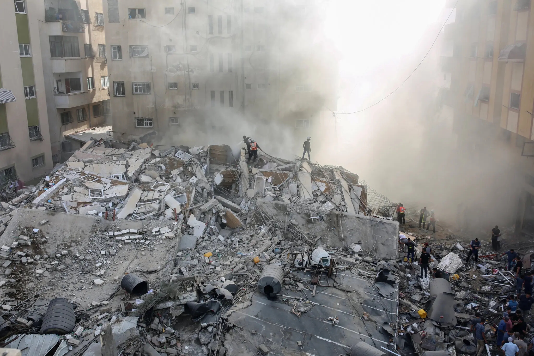
I’m still piecing sources together, but this weekend (Oct 7, 2023) has opened the always simmering geopolitical tensions of the Middle East into full-blown war. 50 years after the Yom Kippur War of 1973, Gaza launched a series of coordinated, sustained attacks. Over 250 Israelis were killed with approximately the same number of Palestinians killed with thousands injured; civilians were targeted and some even taken hostage (mostly young women). The scene was especially brutal; the world watched Palestinians parade corpses in the streets to cheering crowds jarred the international community. There are so many angles, actors, victims, and perspectives. A shocking reaction was Iran’s Supreme Leader calling Israel a “cancerous tumor” to be destroyed on social media. The Abraham Accords were a seemingly bright prospect for peace in the Middle East, but always one that side-stepped Palestine as Israel sought to normalize diplomatic relations with their Arab neighbors. Hamas might have attacked to keep some from straddling the fence of doing business with Israel with publicly stating they are for Palestine. There are times I wish not to know the news, but this is too monumental and seismic a change in the status quo to look away.
The region of Nagorno-Karabakh has had ethnic, political, and cultural strife ever since the fall of the Soviet Union. In October 2023, Azerbaijan militarily took over the region prompting many ethnic Armenians to flee to Armenia. Since 1994, this was the event that Armenia was trying to prevent, but couldn’t.
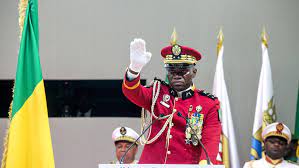
“Omar Bongo became president in 1967, remaining at the helm until his death in 2009. His son, Ali Bongo, succeeded him, until Gen Ngeuma toppled him last month. In Gabon’s capital Libreville, [some] sees coup leader General Brice Oligui Ngeuma as a Moses-like figure who has unshackled the nation from the chains of his former boss – President Ali Bongo.” SOURCE: BBC
This is a bit of current affairs looking at the recent coup in Gabon and the personalities of the power players. However, this BBC article also gives a broad perspective at the same time, looking at topics such as French colonialism, Chinese influence in Africa, “big man politics,” resource extraction, and the importance of a diversified economy. In other words, this can be a nice case-study to explore a variety of important Sub-Saharan issues.

“The historic Hope Mill in Scituate will soon be torn down after it was deemed unsafe. The long-vacant mill, which officially shut down in 2006, and has been slowly decaying ever since. The former textile mill sits along the Pawtuxet River in the Hope Village Historic District, which is listed on the National Register of Historic Places.” SOURCE: WPRI
This story about this old mill being demolished (which is less than 2 miles from my residence) definitely hits close to home.
Growth and development are signs in the cultural landscape that show change in the economic landscape. So too are decline and decay. Mills used to dot the large, navigable rivers of southern New England, helping to shape a distinctive feature of Rhode Island landscapes. As energy technology and local economics shifted, these mills no longer are used to serve their original purpose to manufacture light textiles. Today many have been retrofitted to be condominiums, apartments, warehouses, retails space and all kinds of other land uses. Even with this creative use of existing infrastructure, many mills are underutilized or even become abandoned. After years of neglect, these types of building have a negative impact on the community as visible signs of disuse create a depressing ambience that signals communal decline.
TAGS: Rhode Island, landscape.


