Search

GEOGRAPHY EDUCATION

Supporting geography educators everywhere with current digital resources.

Tag

Google Earth

Strange Things in Google Maps

This site “Map of Strange” is dedicated to showing strange things that can be seen in Google Maps. Displayed here is a beach that I loved to go to growing up in San Diego.  Coronado is written in large stones on this part of the beach right next to the red roof of the famous Hotel Del Corondo.

See on Scoop.itGeography Education  See on www.mapofstrange.com

10 Places You’re Not Allowed to See on Google Maps

Via Scoop.itGeography Education

Google maps brings the world to your desktop – well, most of it, anyway. Here are 10 locations that governments and other entities have blurred or removed from satellite photos.

A user of geospatial technologies is not free to explore all places of the Earth with equal levels of specificity. Why?  Where? How come?

Via mashable.com

Stratocam: Google Earth Imagery

Via Scoop.itGeography Education

Explore and vote on the best Google Maps satellite imagery around the world.

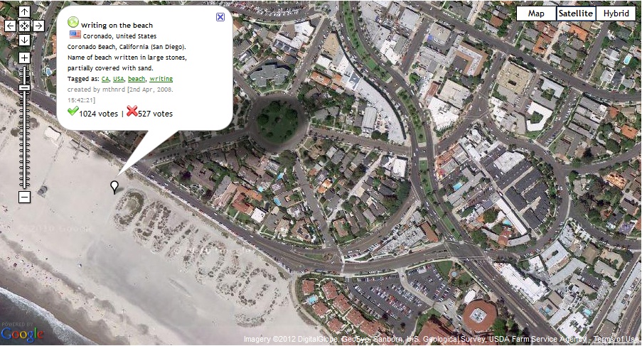
Much like sites that you can rate items up or down, you can rate the best aerial photography via Google Earth screen shots.  There are some beautiful images and places to be discovered through this site.  The physical and human landscapes are both intermingled in this fantastic collection of images…be careful, it can be amazingly addictive.  For more from the producer of this site, see: http://paulrademacher.com or follow on twitter @paulrademacher.

Some of my personal additions to this gallery include the Paseo de la Reforma sector of Mexico City, Hamburg, Germany, Venice, Italy, Cape Cod, MA, Drumlin city of Friedrichshafen-Raderach in Southwest Germany, a meteor create lake, Pingualuit Lake in Northern Quebec, the Angkor Wat complex in Cambodia, the Great Salt Lake, UT, Citadella, Italy, Mexican Hat, Utah, Mesa Verde National Park, Colorado (zoom out for a fire-ravaged image) and the “Twelve Apostles” in Australia.

Via www.stratocam.com

Google Earth in China

Via Scoop.itGeography Education

This gallery of Google Earth Screen shots primarily from Yunnan Province in Southern China (bordering Vietnam and Burma) brings some keen spatial analysis to those unfamiliar with the region.  This is also a great example of using geospatial technologies to interpret the cultural landscape–the merger of ‘people and pixels’ as the textbook of the same name encourages with classrooms.  While the quality of this work is above what would be expected of students, a Google Earth project designed to get students to reassess the spatial dynamics within their neighborhood or home state could lead some fantastic projects.
Via www.facebook.com

Blog at WordPress.com.

Up ↑