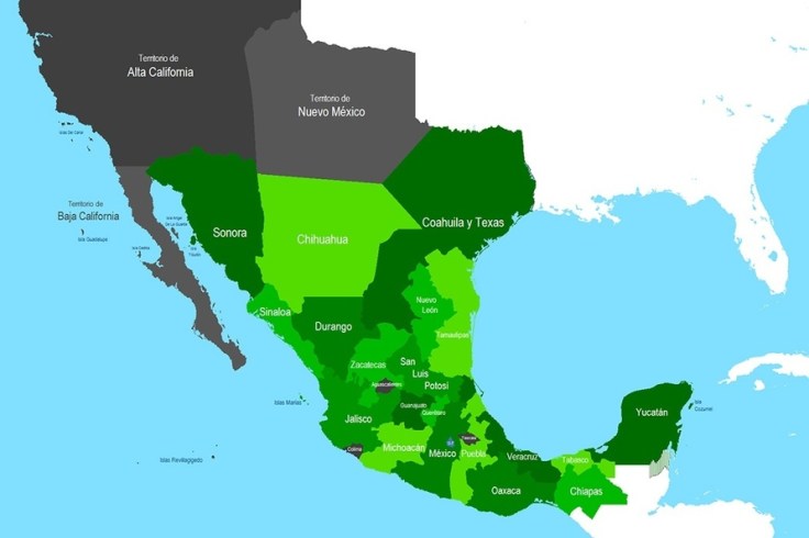
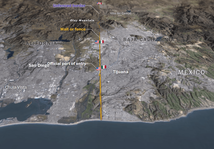
Search

GEOGRAPHY EDUCATION

Supporting geography educators everywhere with current digital resources.

Tag

North America

The World’s Most Economically Powerful Cities

“The newest ranking of the world’s most economically powerful cities put together by Martin Prosperity Institute (MPI) research team finds New York to be the clear winner [over London]. Our Global City Economic Power Index  is based on five core metrics: Overall Economic Clout, Financial Power, Global Competitiveness,

Equity and Quality of Life.” 

Source: www.citylab.com

100 years ago, the biggest trends in urbanization showed that the biggest cities in the world were also the most economically powerful cities in the world in core areas.  In the last 50 years, the most obvious change has been the remarkable growth in of the world’s largest cities in the developing world.   

Questions to Ponder: Why has there been such spectacular growth of megacities, especially in the developing world?  How is this map ranking global cities different from a list of the world’s largest cities?  What regional patterns do exist in the 25 most economically powerful cities in the world?  What are the implications of these patterns?    


Tags: urban, megacities, regions.

50% of the Canadian population lives in these counties

“I was inspired by 50% of the U.S. lives in these counties. map. I was wondering what the equivalent map for Canada would look like. I couldn’t find one, so I created my own.”

Source: www.reddit.com

During the U.S. presidential election much was made about the differences between rural and urban regions of the United States.  Clearly the United States isn’t the only North American country that has a highly clustered population distribution. 


Question to Ponder: How does this basic demographic reality impact Canadian politics, policies, infrastucture, culture, etc.?


TagsCanadamap, North America, population, density.

Finding North America’s lost medieval city

Cahokia was North America’s biggest city—then it was completely abandoned. I went there to find out why.

Source: arstechnica.com

The earthen mounds of Cahokia on the flat flood plains must have been the most awe-inspiring demonstration of political power and economic wealth in its day.  Like so many other civilizations before them (and many more in the future?), Cahokia probably declined from too many environmental modifications that led to unforeseen consequences.


Tagsurban ecology, indigenousenvironment, environment modify, historical, North America.

Nine Nations of North America, 30 Years Later

“Back in the ’70s, almost a hundred reporters around the country – Washington Post bureau chiefs, rovers, freelancers and me, their desk-bound editor – were trying to get our arms around how North America worked, really. Not how it should work. But how it did work. Forget those nice neat rectangles in the middle of the U.S. Let’s be real: The mountains of western Colorado are totally alien from the wheat fields of eastern Colorado. And Miami is part not of Florida, but its own watery Caribbean realm. And what a terrible idea is ‘California.’ It behaves as if it covers three warring civilizations. The result was my 1981 book, ‘The Nine Nations of North America.’ The reader reaction was astonishing. This map – drawn to anticipate the news – revealed something much deeper. It turned out to be a map of culture and values, which have nothing to do with our perversely drawn state and national boundaries.”

Source: www.nytimes.com

Question to Ponder: How would you divide up North America?  What would be some differences from this map?  What reasons do you have for making these different regional groupings?  What are the main criteria for what constitutes a region?

Tags: regions, North America.

Cahokia – why did North America’s largest city vanish?

Long before Columbus reached the Americas, Cahokia was the biggest, most cosmopolitan city north of Mexico. Yet by 1350 it had been deserted by its native inhabitants the Mississippians – and no one is sure why

Source: www.theguardian.com

This article is the eighth in the “Lost Cities” series (Babylon, Troy, Pompeii, Angkor, Fordlandia, etc.).  The earthen mounds of Cahokia on the flat flood plains must have been the most awe-inspiring demonstration of political power and economic wealth in its day.  Like so many other civilizations before them (and many more in the future?), Cahokia probably declined from too many environmental modifications that led to unforeseen consequences.


Tagsurban ecology, indigenousenvironment, environment modify, historical, North America.

Remembering September 11th

Video and Photographs of the event. All media is from the internet and not my own. I compiled all media from the internet and edited them together to tell the story of the deadliest attack on America.

Source: www.youtube.com

The compilation above was created by a teacher who realized that now none of his students were alive to remember how emotional it was for people to watch the horrific news unfold.  Additionally, this video of how Canadians helped the U.S. paired with this lesson plan from the Choices Program will help students explore the human dimension of the September 11 attacks as will this lesson from Teaching History. For a geospatial perspective on 9/11, this page from the Library of Congress, hosted by the Geography and Map Division is a visually rich resources (aerial photography, thermal imagery, LiDAR, etc.)  that show the extent of the damage and the physical change to the region that the terrorist attacks brought.  The images from that day are a part of American memory and change how the event is remembered and memorialized in public spaces (if you want a touching story of heroism, the Red Bandana is moving). .


When Mexico Was Flooded By Immigrants

In the early nineteenth-century, Mexico had a problem with American immigrants.

Source: daily.jstor.org

A century and a half ago, the immigration debate and geopolitical shifts in power on the United States-Mexico border reflected a profoundly different dynamic than it does today.  This history has enduring cultural impacts on southwestern states that had the international border jump them.


Tags: culture, demographicsmigration, North Americahistorical, colonialism, borders, political.

Old Mexico lives on

On February 2nd 1848, following a short and one-sided war, Mexico agreed to cede more than half its territory to the United States. An area covering most of present-day Arizona, California, Nevada, New Mexico and Utah, plus parts of several other states, was handed over to gringolandia. The rebellious state of Tejas, which had declared its independence from Mexico in 1836, was recognised as American soil too. But a century and a half later, communities have proved more durable than borders. The counties with the highest concentration of Mexicans (as defined by ethnicity, rather than citizenship) overlap closely with the area that belonged to Mexico before the great gringo land-grab of 1848. Some are recent arrivals; others trace their roots to long before the map was redrawn. They didn’t jump the border—it jumped them.


Tags: culture, demographics, North Americahistorical, colonialism, borders, political.

Source: www.economist.com

Canada is a huge country. Most of it is unfit for human habitation.

“The area below the red line includes most of Nova Scotia, in Canada’s east, but most of the population comes from the area a little farther west, in a sliver of Quebec and a densely populated stretch of Ontario near the Great Lakes.”

Source: www.vox.com

Admitted, the web Mercator projection of this map distorts the far northern territories of Canada, but still it hammers home some fascinating truths about Canada’s population distribution.  Land-wise, Canada one of the world’s biggest countries, but population-wise, most of it is quite barren.  What geographic factors explain the population concentration and distribution in Canada?  


TagsCanada, map, North America, population, density.

Create a free website or blog at WordPress.com.

Up ↑