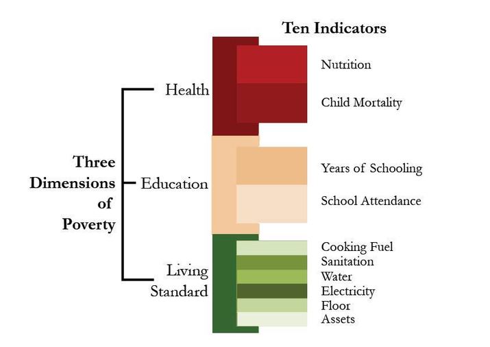
“The global Multidimensional Poverty Index (MPI) is an international measure of acute poverty covering over 100 developing countries. It complements traditional income-based poverty measures by capturing the severe deprivations that each person faces at the same time with respect to education, health and living standards.”
Source: www.ophi.org.uk
The MPI was developed out of a desire to fill some of the gaps in the HDI’s applicability and utility. Allow me to quote the editor of one the NCGE’s journals, the Geography Teacher, on the usefulness of the MPI website for classroom use: “With the infographics, maps, graphs, country briefings, and case studies, you have a ready-made lesson activities to demonstrate patterns of fertility, mortality, and health for a population unit, and access to health care, education, utilities, and sanitation for an Industrialization and Economic Development Unit. Connections can also be made to malnutrition and water, as well as to key concepts such as pattern and scale, to key geographical skills such as how to use and think about maps and geospatial data, and to the use of online maps and online data.” Also, this article from the World Bank also give a run-down on the key findings of the MPI in 2014.
Tags: statistics, population, development, unit 2 population, unit 6 industry.


