Search

GEOGRAPHY EDUCATION

Supporting geography educators everywhere with current digital resources.

Tag

social media

How Instagram Is Changing the Way We Design Cultural Spaces

“As neighborhoods, restaurants and museums become more photogenic, are we experiencing an ‘Instagramization’ of the world?”


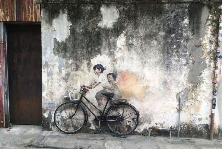
Penang is one of a number of cities capitalizing on the wild popularity of photo-based social media apps such as Instagram, which has 800 million users (that’s more than a tenth of the world’s population). It’s part of a wider phenomenon of public and private spaces being designed to appeal to users of such apps. This phenomenon is subtly changing our visual landscapes—on the streets, in restaurants, in stores, in museums and more. Call it the “Instagramization” of the world.

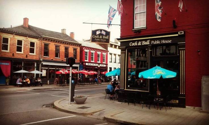
Restaurants have been at the forefront of Instagramization. Since social media mentions can make or break a restaurant’s success, owners have become attuned to what visual aspects of food and décor appeal to customers. Restaurant designers are going for photo-friendly background materials like slate and whitewashed wood, and using plain white plates. Some are deliberately incorporating Instagram-appealing visuals that feature the restaurant’s name or logo—floor tiles, neon signs—hoping they’ll wind up in a snap.


Tagssocial mediaplaceculture, architecture, urban.

Source: www.smithsonianmag.com

Bad Internet Maps: ‘A Social Media Plague’

“Business Insider’s widely mocked, since-deleted-from-Twitter, but very very viral map of the most popular fast food restaurants by state is the launching-off point for The Ringer’s Claire McNear, who rants about the maps clogging the Internet that are stupid, uninformed, wrong and exist only to generate clicks.”


Tags: mappingsocial media, cartography.

Source: www.maproomblog.com

xkcd: A Critique of Viral Maps

Source: xkcd.com

This ‘map’ is a pithy and quite pointed critique of the many maps that get shared on social media claiming to be based on big data, but they might be more fluff than true substance. 


Tags: XKCD, infographic, mapping, social media, cartography.

#APHGchat–Population

31763bfd-166e-4596-8261-835e1a2d1056.jpg

This isn’t a complete archive of yesterday’s #APHGchat on Population resources, but I’m sharing this to give a peek to the networking that is available online.  The next #APHGchat will be Oct. 18th, 9pm EST.

Tags: social media, APHG.

Source: storify.com

Flat Earth Theory

Source: www.youtube.com

I think we all need a laugh sometimes.  Flat earth videos are incredibly entertaining.  


DISCLAIMER THAT I WISH I DIDN’T HAVE TO MAKE: I don’t believe in the flat Earth theory and think that this video is total jibberish; but it is delightfully inaccurate!  This is a good way to get students to think critically about epistemology (how we know what we know) and defend their own world view.  This also helps students to assess the validity of online sources


Tagsfun, mapping, social media.

Linking the most interesting places in the world

“Every city has a picturesque spot or two where the probability of a photo being taken at any given time is pretty high. Now there’s a world atlas of maps showing the routes people follow while taking these pictures in every city around the world:Mapbox’s Eric Fischer has been working on the “Geotaggers’ World Atlas” for years, using locations of photos uploaded on Flickr over a decade. In his city maps, which now span the world, he connects the dots between subsequent photos taken by a photographer—representing their path in sketchy lines that criss-cross across the city.” 

—Tanvi Misra on CityLab

Tags: mapping, visualization, social media, tourism.

Source: www.mapbox.com

Questions to Ponder:

  1. How does the idea of crowdsourcing influence modern-day cartography and geographic data?
  2. What kind of meaning is there in this seemingly random assortment of geotagged images?
  3. Analyze a particular pattern (anywhere in the world). Describe the location, explain the patterns you see and analyze why they are the way they are.
  4. Analyze a particular pattern (somewhere else in the world). Describe the location, explain the patterns you see and analyze why they are the way they are.

Trailer: One Day on Earth

//cdn.embedly.com/widgets/media.html?src=https%3A%2F%2Fplayer.vimeo.com%2Fvideo%2F26378195&wmode=opaque&url=https%3A%2F%2Fvimeo.com%2F26378195&image=http%3A%2F%2Fi.vimeocdn.com%2Fvideo%2F215566910_1280.jpg&key=359ed8ab27db4f02a128049b1f89d6a1&type=text%2Fhtml&schema=vimeo

One Day on Earth is a unique global movement, community media creation platform, and collaborative film production engine. We invite you to join our international community of thousands of filmmakers, hundreds of schools, and dozens of non-profits, and contribute to this unique global project (with a map of all participants). Many future filming events will be announced in the coming year. One Day on Earth is a community that not only watches, but participates.”


Tagsvideo, mapping, social mediaplaceculture.

Source: vimeo.com

Crafting a Sense of Place

Talk about creating a sense of place! This neighborhood in #Covington draws on German roots to create a restaurant/pub district. Even the non-German restaurants in the area evoke an old world cultural landscape aesthetic in a way that makes the neighborhood appealing to visitors and prospective residents. #culturallandscape #placemaking.”


Source: www.instagram.com

I love exploring the cultural landscapes in and around Cincinnati every year during the #APHGreading.   


Tags: neighborhoodlandscapeurban, place, social media, APHG, Cincinnati


Create a free website or blog at WordPress.com.

Up ↑