As a geography educator who loves trivia and finding ways to make spatial thinking entertaining, games like Geoguessr and Timeguessr are right in my wheelhouse. These videos replicate the competitive experience using spatial information, using aerial photography zoomed in to a city and slowly zooming out to see if you can recognize the city from up above. Recognizing the coast or river is often an important way to discern which city you are analyzing. Can you tell the climate from the vegetation patterns? How is the city laid out? How is this layout similar to other cities that were created in the same region? What does the transportation network say about the public policies and technological context of this city? So many clues, but only 15 second to process all of it.
Fair warning, the hard ones are quite hard. I wouldn’t recommend showing these entire video in front of a classroom without some editing…choose the examples that are more locally relevant to your students and at their difficulty level. If you do need some more difficult examples, the state capitals example is quite hard.
If you are ready to branch out from “just” cities, try this video on the 20 landmarks in the United States.
And another one…just because. Find the ones that you like, with the formal and difficult that work for your situation.
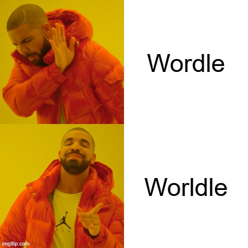
You know that I’m a fan of online geography games going way back. I’ve enjoyed the games like GeoGuessr as my go-to game to refine cultural landscape analysis and map navigation skills. Globle, Countryle, and Worldle have all riffed off of the popularity of Wordle, and there is now a new one of these, TRAVLE. Below is a brief introduction to all of these online geography/mapping games.
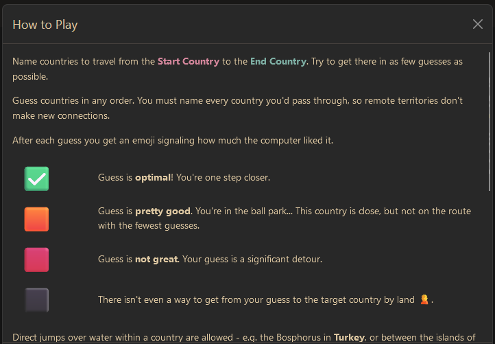
TRAVLE recap: Travle names two random countries, and you have to draw the most direct land route between the countries with the goal of minimizing the number of states, not essentially the miles.
COUNTRYLE recap: This is the one that relies most on geographic information since the hints are focus on real data. You guess any country, and the hints will tell you if the actual mystery country has a larger or smaller population, a warmer or colder climate…so that is the guesses aren’t just based on luck or hunches, but some evaluation.
WORLDLE recap: Worldle (not misspelled, but the two L’s are a mouthful). This one shows an outline of the a given country and will tell you the distance away from the actual country to help inform further guesses. The better you know the world map, the less “guessing” there is, but still fun.
GLOBLE recap: The game is quite simple but don’t let that fool you into thinking that it will be easy. Like the old game where one player searches for an item in the room, with the other players calling out “hot” or “cold,” until the player finds the object, this website shows a globe, and it will color your choice based on how accurate your guess is with a red color ramp (white=ice cold, deep burgundy=red hot). Each day, they have a new mystery country for you to guess, but the globe that it displays does not show international borders. This fun new guessing game requires a strong mental map as well as getting a little bit of luck…something to get the students’ brains fired at the start of class, especially for the competitive types.
GEOGUESSR recap: This is the granddaddy of them all. When I was a child I used to wonder if woke up somewhere far from home, would I be able to know where I was just by looking at the places around me (I was a geo-geek from way back when). GeoGuessr is the closest thing to finding yourself lost in the world and needing to figure out where you are without being wisked away. GeoGuessr will display 5 locations in GoogleMaps “StreetView” and you have to guess where the images are located. You can pan and zoom in the StreetView to explore the landscape and find more context clues as to where that location is. It is a fantastic exploration exercise.
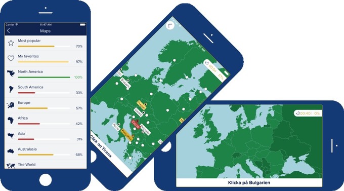
SETERRA recap: This is my favorite app to recommend to brush up on basics for a map quiz. If you need students to learn where in the world things are without having to take up class time with map quizzes and the like, this app is great. It has basic “countries and capitals” quizzes for world regions, but it also has some more difficult quizzes for the those that need/want a challenge (Seterra is owned by GeoGuessr).
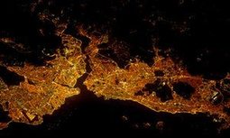
CITY LIGHTS AT NIGHT: The 14 questions from an article in The Guardian shows the outline, grid pattern, and (possibly) the coastline with rivers that flow through the city. This isn’t just about knowing a city, but also identifying regional and urban patterns.
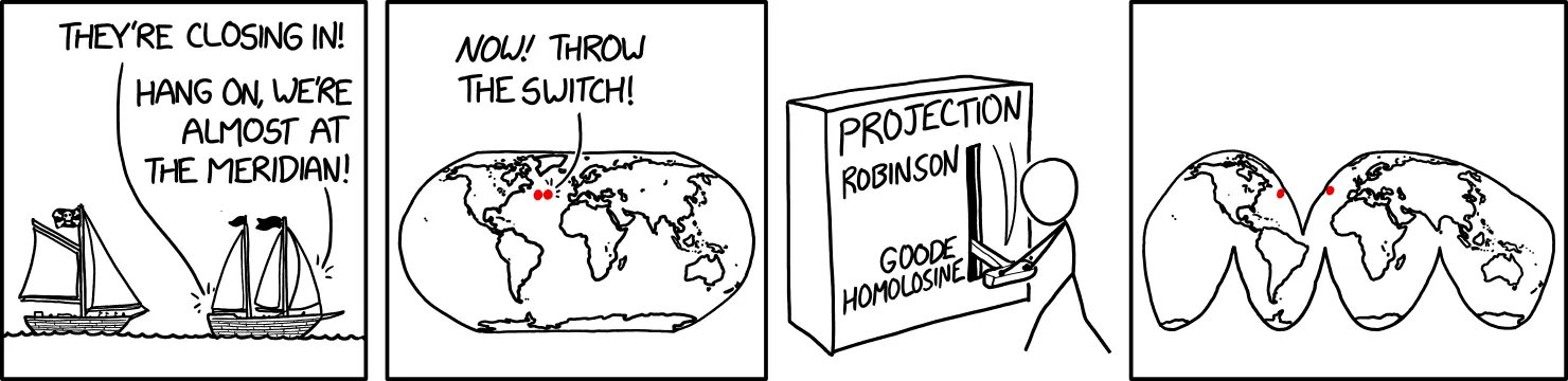
This is a fantastic comic strip that shows how map projections are perfect representation of planet Earth, but a 2D rendering of a 3D world. A map projection is like a personal perspective or worldview. There is no single perfect map projection (or perspective or worldview), but there are some strengths and limitations to organizing geographic and spatial information in any given system.
There are many great cartographically-themed XKCD comic strips (here are a bunch of my favorites). This particular one ALMOST looks right and finding the inaccuracies is a little harder than you might think (yes, I am proud of myself for finding them all, and yes, that is the ridiculous bit of profession pride).
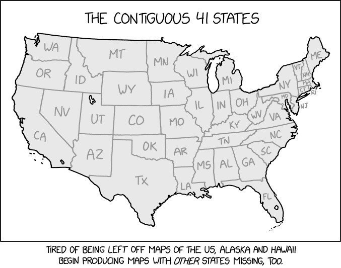
Questions to Ponder: When you see a map, do you assume that it is 100% accurate? If so, how come? Where you able to find the “missing states” in this psuedo-map?
After a 93 year hiatus, the elusive Jackalope has returned to the greater Yellowstone ecosystem! These beautiful, yet frightening, creatures were once widely collected by tourists, but better management practices have allowed a re-introduced pack to thrive again. These guys have been sporadically spotted all around the west, including Wyoming, Montana, Colorado, and New Mexico. Idaho allowed a “shoot on sight” policy for jackalopes, so they have not been seen there in quite a while.
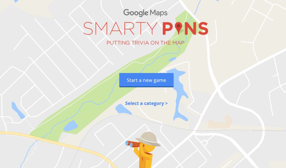
I’m a sucker for online quizzes like this. Here is another quiz that shows only the grid outlines of particular cities. This isn’t just about knowing a city, but also identifying regional and urban patterns. What are some other fun trivia quizzes? GeoGuessr is one of the more addictive quizzes where 5 locations in GoogleMaps “StreetView” are shown and you have to guess where. Smarty Pins is a fun game on Google Maps that tests players’ geography and trivia skills. In this Starbucks game you have to recognized the shape of the city, major street patterns and the economic patterns just to name a few (this is one way to make the urban model more relevant). If you want quizzes with more direct applicability in the classroom, click here for online regional quizzes.
I think we all need a laugh sometimes. Flat earth videos are incredibly entertaining.
DISCLAIMER THAT I WISH I DIDN’T HAVE TO MAKE: I don’t believe in the flat Earth theory and think that this video is total jibberish; but it is delightfully inaccurate! This is a good way to get students to think critically about epistemology (how we know what we know) and defend their own world view. This also helps students to assess the validity of online sources.
As stated in a review of Smarty Pins on Mashable, “Google unveiled a fun new game this week that tests players’ geography and trivia skills. Called ‘Smarty Pins’ the game starts players off with 1,000 miles (or 1,609 kilometers if they’re not based in the United States), and asks them to drop a pin on the city that corresponds with the correct answer to a given question.”
This game is wonderfully addictive…I haven’t enjoyed a mapping trivia platform this much since I discovered GeoGuessr. How far can you get before you run out of miles?
Smartphones and GPS watches now leave digital traces behind many urban runners, as they wind their way along the river or round the park. Can you identify the cities from the telltale tracks?
Last year, my running program was greatly enhanced by using a mapping app(I know, who could have guessed that Map My Run and Strava would help keep me motivated and inspired?). More runners are naturally going to be on more important roads, but they also love beautiful parks and runs along the water. With that in mind, can you identify these ten cities from around the world based on the density of running routes? You can explore your city’s raw data on Strava.