Search

GEOGRAPHY EDUCATION

Supporting geography educators everywhere with current digital resources.

Author

sethdixon

I am a geography professor at Rhode Island College.

Great Web Maps

Seth Dixon‘s insight:

Today was the first of the T3G Institute at the Esri headquarters and the wonderful team has shared great resources that I found incredibly useful for teachers to use great web maps.  So what makes a great web map. A great web map should be highly interactive, intuitive, and be able to function at various scales.  This video helps to show the power of maps to help tell a great story or to share spatial content. 

The presenters each shared an exemplary web map.

  • Lyn Malone selected a modern language map.
  • Charlie Fitzpatrick chose a land use change map with satellite imagery.
  • Amy Work highlighted a great storymap that shows global food supply data.
  • Roger Palmer selected a map from an AAG project Changing Planet.
  • Joesph Kerski created a map to show a impact of a proposed new road in the Serengeti.  
  • Kathryn Keranen shared a great iOS app QuakeFeed.

Tags: GIS, ESRI, mapping, cartography, geospatial, edtech, geography education, unit 1 GeoPrinciples.

See on www.youtube.com
T3Glogo

Using Humor to Learn

Iranian-American comedian Maz Jobrani takes to the TEDxSummit stage in Doha, Qatar to take on serious issues in the Middle East — like how many kisses to give when saying “Hi,” and what not to say on an American airplane.

Seth Dixon‘s insight:

This comedian doesn’t just get laughs; he uses stand-up as a platform for discussing important social issues and to foster greater cultural understanding.  His big goal is to break stereotypical perspectives of Muslims and show that “there are good people everywhere.”  Here is another of his entertaining and education TED talks.  

Tags: Middle East, TED, globalization, culture, Islam.

See on www.ted.com

UN projects Kenya to grow older and healthier

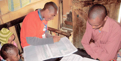
The UN projects Kenya to grow older and healthier
Summary:

  • The number of infant deaths per 1,000 live births currently totals 51.6, and is expected to drop sharply to 12.1 by the end of the century.
  • The country will also grow steadily older, with the current median age of 18 expected to more than double — to 37 years of age — by 2100.
  • A Kenyan born this year can expect to live for 61.6 years.
  • The nation’s population will reach 160 million by the start of the next century, according to the new outlook.


Seth Dixon‘s insight:

See on www.nation.co.ke

Fathers Day Dates around the world

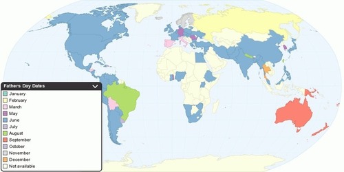
This map show Father’s Day celebration dates around the world. The Father’s Day is celebrated on various days in many parts of the world, most commonly in June, as a day to honor fathers and to express their love and affection for them.

Seth Dixon‘s insight:

Happy Father’s Day to those of you celebrating it this June 16th.  You can consult this interactive map to determine when countries officially celebrate Fathers Day and you may also wish to consult this map for Mothers Day.

See on chartsbin.com

Do Geography and Altitude Shape the Sounds of a Language?

Languages that evolve at high elevations are more likely to include a sound that’s easier to make when the air is thinner, new research shows

See on blogs.smithsonianmag.com

xkcd: Ice Sheets

See on xkcd.com

Atlas of True Names

The Atlas of True Names reveals the etymological roots, or original meanings,
of the familiar terms on today’s maps of the World, Europe, the British Isles and the United States.

For instance, where you would normally expect to see the Sahara indicated,
the Atlas gives you “The Tawny One”, derived from Arab. es-sahra “the fawn coloured, desert”.

Seth Dixon‘s insight:

This is a fun set of maps that forces us to reexamine the historical linguistic roots of place names.  Many toponyms have a complicated histories so the actual root of the name is not always a single straightforward translation as shown in these maps.  As you explore these maps, most readers will find something the they would dispute, correct, or want to see contextualized more but all in all, it is a fun set of maps.

Tags: language, mapping, art, cartography, toponyms, historical.

See on www.kalimedia.com

Land Unseen: What’s Beneath Antarctica’s Ice?

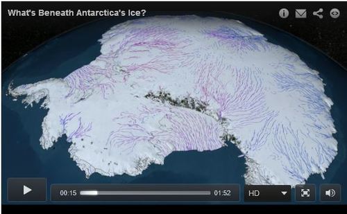
“Many of us tend to think of Antarctica as a sheet of solid snow and ice. But, in contrast with its peer to the north, the southern pole’s ice sheet lies atop a rocky continent. What are its features, its mountains and valleys, plains and coastlines?

A new dataset from the British Antarctic Survey provides the most detailed map ever of the bedrock below, information scientists hope will enable them to better model the affects of climate change on the ice, whose melting will have an impact on climate the world over.”

Seth Dixon‘s insight:

This video sheds some light on explorations to uncover truths about one of the most remote places on Earth.

Tags: Antarctica, water, physical, remote sensing, geospatial.

See on www.theatlantic.com

Bizarre Borders

Seth Dixon‘s insight:

If you haven’t discovered CGP Grey yet, his YouTube channel is a veritable fountain of geographic tidbits.  His distinctive style helps to contextualizes some of the more odd and complicated parts of Earth’s borders.   If you want another example, watch Bizarre Borders, part 1 which focuses on countries within countries and single-neighbor countries.

See on www.youtube.com

Blog at WordPress.com.

Up ↑