Search

GEOGRAPHY EDUCATION

Supporting geography educators everywhere with current digital resources.

Author

sethdixon

I am a geography professor at Rhode Island College.

2014 World Cup: Will Brazil Be Ready?

ESPN Video: With the FIFA World Cup two years away, will Brazil be ready to host soccers premiere event?

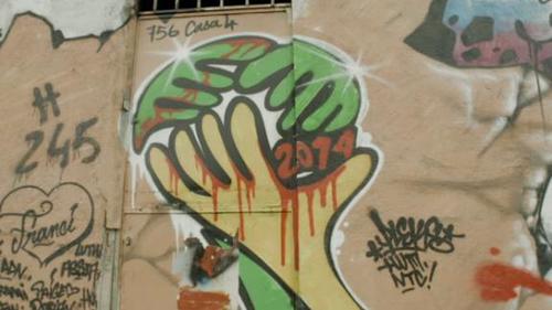
This short sports documentary (12 minutes) looks at some of the socioeconomic and urban planning issues that are a part of the logistics for a country to prepare for a sporting event on the magnitude of the World Cup.  The discussion of demolitions in the favelas (squatter settlements) is especially intriguing.  Major sporting events of this magnitude that last for two weeks can reshape local geographic patterns for decades.  

Tags: sport, Brazil, planning, squatter.

See on espn.go.com

Pre- and Post-Storm 3D Lidar Topography

This project investigates the coastal impacts of hurricanes and extreme storms.

Here is some more post-Sandy geo-spatial imagery. LIDAR (think sonar and radar but with light and lasers) is Light Detection And Ranging that can produce some amazing data. 

See on coastal.er.usgs.gov

Africa for Norway

This website is an incredibly humorous parody of Eurocentric charitable organizations that, while well-intentioned, propogate many negative stereotypes about Africa.

Questions to Ponder: What do you think the ‘point’ of Radi-Aid is?  DO you agree with their point?  How does the media influence our idea of places?

Tags: Africa, development, NGOs, Norway.

See on www.africafornorway.no

In 2009, Engineers Detailed Storm Surge Threat to NYC

One of the nation’s most influential groups of engineers said it presented detailed warnings that a devastating storm surge in the region was all but inevitable and proposed ways to prepare.


MH: Hey, you know what? A bunch of engineers accurately predicted the kinds of damage the East Coast would face from a strong storm surge. Maybe we should give that science stuff a little consideration in our future plans in designing our cities.

See on www.nytimes.com

A Life Revealed – National Geographic Magazine

Seventeen years after she stared out from the cover of National Geographic, a former Afghan refugee comes face-to-face with the world once more.

See on ngm.nationalgeographic.com

Persuasive Maps

John F. Smith’s smartly-designed biblical anti-slavery map of the mid-19th Century United States. Prepared in 1888; excerpted from “Maps for an emerging nation”.

Maps don’t just convey information–they can also shape the way that we think about the world that is being represented by that map.  Maps are texts and sometimes they have very strong perspectives that the cartographer put into that map.  This persausive map shows one way of interpreting American history after the end of reconstruction.  Notice that in addition to the very overt religious, moral tone condemning the South for slavery, they ideas of Manifest Destiny are also woven into the fabric of this map. 

Tags: cartography, historical, USA.

See on www.bigmapblog.com

Los Angeles Walking Tour

“This map-based site contains hundreds of images of downtown Los Angeles, Displaying its tremendous architectural, cultural, and economic diversity. Maps of seven downtown subregions are accessible either by clicking on this map or on the list of subregion names to the left. Each regional map provides access to specific places in downtown in the same way.”


This is a great example of a neighborhood project than shows the economic and cultural differences between places. 

See on dornsife.usc.edu

How Pandemics Spread

View Full Lesson on TED-ED BETA: http://ed.ted.com/lessons/how-pandemics-spread In our increasingly globalized world, a single infected person can board a pl…


This is a great demonstration of why spatial thinking is critical to so many fields, including medicine.


Tags: diffusion, medical, historical, spatial.

See on www.youtube.com

‘Geography Education’ posts Geo-coded

I’m pleased to announce that for GIS Day, I created a map that has hyperlinks to regionally specific posts that I put on ‘Geography Education.’  This map was created using ArcGIS Online (here’s a free tutorial on how to to use ArcGIS Online tailored for K-12 educators).  This is just another way to search for materials on this site.  Feel free to embed this map on your webpage or share the link.  Happy GIS Day!

See on www.arcgis.com

View Larger Map

Blog at WordPress.com.

Up ↑