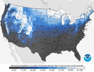
This is not a weather report; we are still too far out to start predicting that with any accuracy. What this map does show is the statistical probabilities of snow cover throughout the United States for December 25th based on past climatological data.
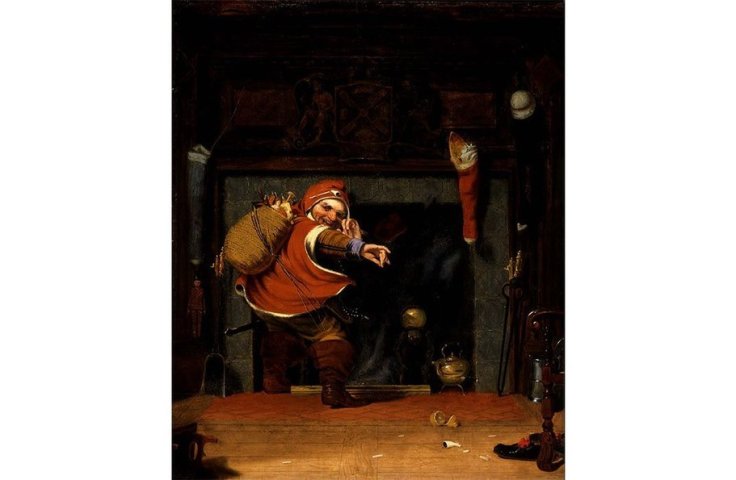
The picture archives show the historical evolution behind the cultural representations of Santa Claus. Additionally this ESRI story map shows some of the regional differences in Santa Claus, showing how the cultural diffusion of this icon of a Christian holiday takes on real local attributes. I also enjoyed these pictures from the BBC of Christmas around the world. Merry Christmas to those that celebrate it and a Happy New Year to all.
“In this Feed the Future video, narrator Matt Damon discusses the importance of increasing food production around the world and notes the importance of equipping women with the right tools, training, and technology to see as much as a 30 percent increase in food production. To feed our growing population we need to increase food production by 70 percent before 2050. Women make up the majority of the agricultural workforce in many areas of the world.”
A colleague mine thought that the ideas in this video were so obvious and non-controversial, he said, “Why does this even need to be stated? Why would we exclude women from agriculture?” The simple answer is that it wouldn’t need to be stated if women around the world did have equal access to resources. For many of the world’s poor, this is where the rubber meets the road.
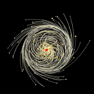
“Revolution and rotation are the terms we use to describe the motions of the earth and moon. Revolution is the movement of the earth in an orbit around the sun. The Earth completes one revolution around the sun every 365 days. The moon revolves around the Earth about once every month.”
Understanding the relationships between the Sun, Earth and moon are critical for for understanding the seasons, climate and other geographic factors. This interactive simulates gravity unlike anything I’ve every seen on a computer screen.
To exploring Earth-Sun interactions, playing around with the University of Nebraska-Lincoln’s Sun Simulator is a fun way to make a little more sense of the various factors that control how the Sun appears in the sky.
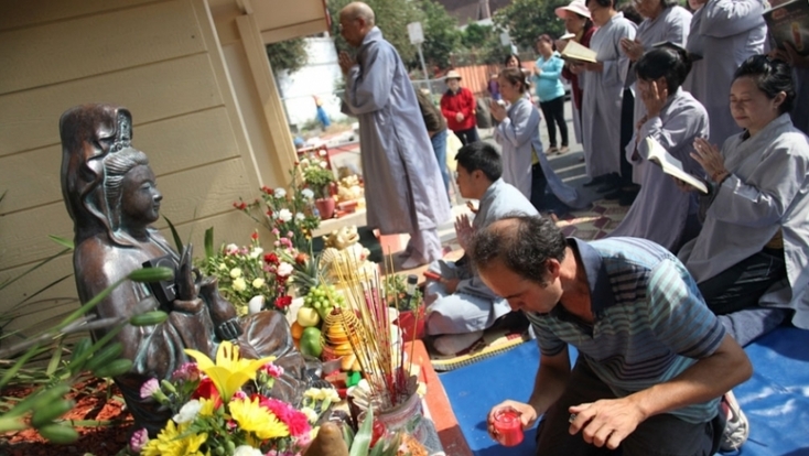
“Sometimes, rehabilitating a rough neighborhood is a tough process. But in one West Coast American city, it was as simple as adding a Buddha statue. Since the statue’s installation, a street corner has been transformed from a notorious eyesore to a daily prayer spot for local Vietnamese Buddhists. For this Geo Quiz, we’re looking for the city where this shrine is located — can you name it?”
This podcast is a great glimpse into an urban transformation that took place without any central planning nor can the changes be classified as gentrification.
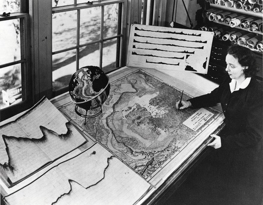
Without ever setting sail, Marie Tharp mapped the ocean floor and made a discovery that shook the foundations of geology. So why did the giants of her field dismiss her findings as “girl talk”?
“President Obama announced on December 17 that the United States will resume diplomatic relations with Cuba after more than 50 years of antagonism. Bloomberg’s Sam Grobart recaps the standoff between the two nations, and explains why the icy relationship has begun to thaw.”
By now I’m sure you’ve heard the news that the United States is seeking to normalize relations with Cuba and politicians are reacting to this news in diverse ways. This video gives a quick rundown of the history of Cold War tensions between these two neighbors.
Inequality isn’t just about money. It’s also about information. The lack of reliable data about developing countries makes things like development work and disaster relief much harder.
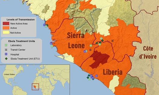
There is ‘mapping inequality’ throughout the world; poorer countries often don’t have comprehensive census information and geospatial data. Crowdsourced mapping is seeking to change and improve geographic awareness, especially in moments of crisis. For example the maps of Sierra Leone, Liberia and Guinea were essentially blank at the beginning of the Ebola outbreak but that glaring need meant volunteers were using geographic tools to improve developmental situations by providing more information.