See on Scoop.it – Geography Education
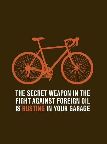
This cycling blog occasionally will have some political and urban commentary, especially arguing for more bike paths within our urban areas.
See on Scoop.it – Geography Education
This cycling blog occasionally will have some political and urban commentary, especially arguing for more bike paths within our urban areas.
See on Scoop.it – Geography Education
architectural conjecture :: urban speculation :: landscape futures…
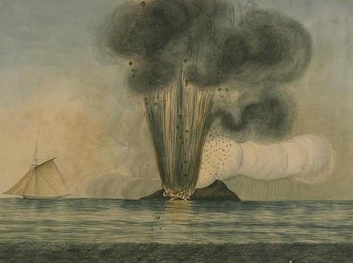
In the 1960s when the island of Surtsey (literally) erupted onto the scene off the coast of Iceland, it’s national sovereignty was not really called into question. The seamount, or near island named Ferdinandea in the Mediterranean is not even an island yet and countries are already positioning themselves to claim it. Only 6 feet below sea level, this seamount is incredibly valuable real estate because is a country can successfully came this territory, they could also lay claim to an Exclusive Economic Zone, extending up to 200 nautical miles beyond the coast.
See on bldgblog.blogspot.fr
See on Scoop.it – Geography Education
I found this on pinterest (where else?) and decided to share the cartographic love.
1. Paint your nails white/cream
2. Soak nails in alcohol for five minutes
3. Press nails to map and hold
4. Paint with clear protectant immediately after it dries.
This also works with newspaper, etc!!
See on 25.media.tumblr.com
This also works with newspaper, but don’t try it with NatGeo Maps because the paper is of too high a quality to have the ink bleed out; I would recommend using an old USGS Topo map.
See on Scoop.it – Geography Education
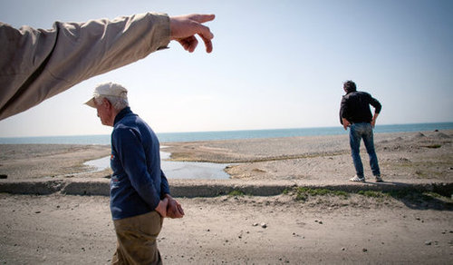
A building boom is underway in the former Soviet Republic of Georgia, and the country’s latest project is the most ambitious yet. Critics call it unrealistic.
There appears to be a new trend now happening in many Central Asian states where cities are built from nothing in the middle of nowhere with the hope that one day they will become major international economic hubs. This ambition vision of urbanization is fraught with peril as there is not a great track record of success for these types of ventures.
The article also contains a video of what the new city of Lazika and its Special Economic Region (SER) will look like. The video was produced by an outfit called “Silk Road” which may have also produced a similar idealized video of the city of Beijing in time for the Olympics (Thanks for sharing Lily!).
See on www.nytimes.com
See on Scoop.it – Geography Education
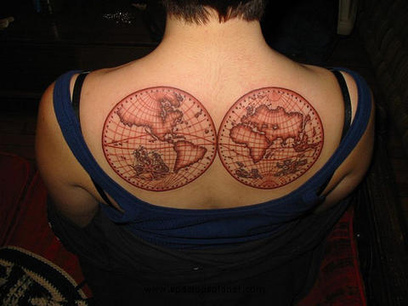
If you haven’t discoverd “Strange Maps,” consider this your online introduction to a great blog that explores some of the more interesting cartographic and geospatial forms of representation and themes that you never thought you would see mapped out. This particular post is about map tattoos (with many pictures). For more Strange Maps, see: http://bigthink.com/blogs/strange-maps
See on bigthink.com
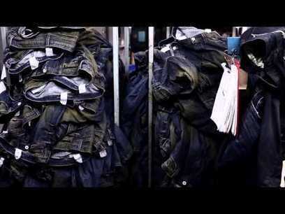
See on Scoop.it – Geography Education
Levi Strauss & Co. believes that water is a precious resource and everyone should do their part to lead a more WaterLess lifestyle. Find out more about our w…
More and more companies are strategically rethinking manufacturing to be less harmful to the environment. There are sound economic, cultural, marketing and sustainability reasons for rethinking the manufacturing process. Levi’s uses more than 11 gallons to produce 1 pair of jeans…this video looks at this restructuring process.
See on www.youtube.com
See on Scoop.it – Geography Education
OUTSIDE THE SPRAWLING Frankfurt Messe, home of innumerable German trade fairs, stands the “Hammering Man”, a 21-metre kinetic statue that steadily raises and lowers its arm to bash a piece of metal with a…
This article argues that as manufacturing increasing becomes a digital production, more goods will be produced in the more developed countries. If events unfold in this fashion, globalization and many other patterns with be significantly altered. Would this make a better world? For whom?
See on www.economist.com
See on Scoop.it – Geography Education


See on abcnews.go.com
See on Scoop.it – Geography Education
Every city is filled with different neighborhoods, but often, you won’t find these places on any map. They’re word-of-mouth zoning distinctions known only to locals.
How do you define the borders of a neighborhood? This intiguing look at the social media platform FourSquare to mathematically find like minded individuals that share spatial patterns. Interestingly, the digital map with algorithms lined up with residents mental maps.
See on www.fastcodesign.com


