Search

GEOGRAPHY EDUCATION

Supporting geography educators everywhere with current digital resources.

Category

Uncategorized

The Geographic Advantage

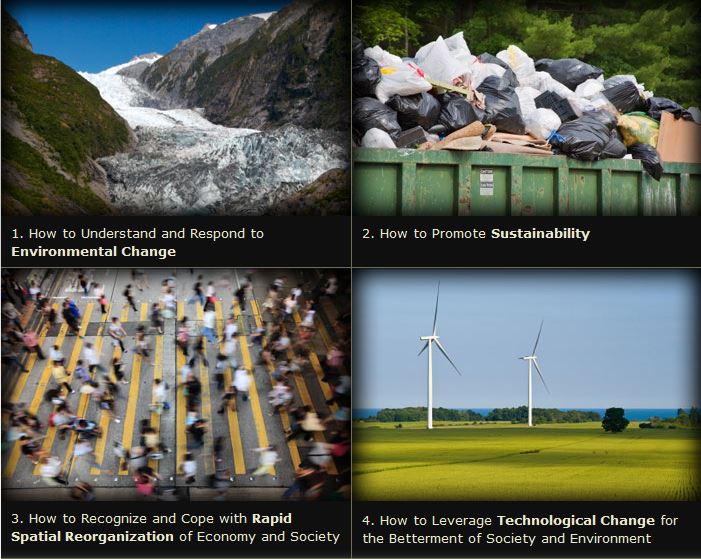
We are living in an era of receding glaciers, accelerating loss of species habitat, unprecedented population migration, growing inequalities within and between nations, rising concerns over resource depletion, and shifting patterns of interaction and identity. This website provides 11 geographic investigations aligned to the geographic questions in the NRC Understanding Our Changing Planet report. The report focuses on the future directions in the geographical sciences and how these key questions will guide research to help us understand the planet on which we live.

Source: geographicadvantage.aag.org

The four aspects the geographic advantage (as conceptualized by former AAG president Susan Hanson and solidified by the AAG team–see powerpoint) are:

1.  Relationships between people and the environment

2.  Importance of spatial variability

3.  Processes operating an multiple and interlocking geographic scales

4.  The integration of spatial and temporal analysis


To ensure that this advantage is harnessed, the AAG prepared 11 modules within these 4 categories of key issue facing the world:

–Environmental Change

–Sustainability

–Rapid Spatial Reorganization

–Technological Change


Tags unit 1 GeoprinciplesK12STEMsustainability, environment, spatial, technology.
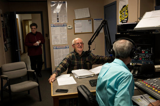
In Louisiana, Desire for a French Renaissance

From a long-running radio show to bilingual street signs, efforts are being made to preserve a vernacular once repressed by law.

This radio show is part of a conscious effort to sustain an iteration of French that followed its own evolutionary path here, far from the famed vigilance of the Académie française.  Many now believe Louisiana French to be endangered, even as other aspects of the state’s rural culture flourish amid the homogenizing forces of modern life.  “We’re not losing the music.  We’re not losing the food,” Mr. Layne said from his office, Ville Platte, a city of 7,500 about two and a half hours west of New Orleans. “But we’re losing what I think is the most important thing, which is language.”  

Tagslanguage, folk cultures, culture.

Source: www.nytimes.com

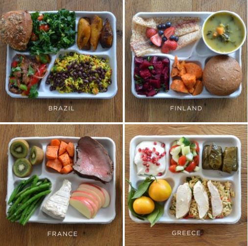
Take A Mouth-Watering Tour Of School Lunches From Around The World

Eating at the school cafeteria could’ve been amazing if you grew up almost anywhere but the U.S.

Tags: agriculturefood distribution

Source: www.fastcoexist.com

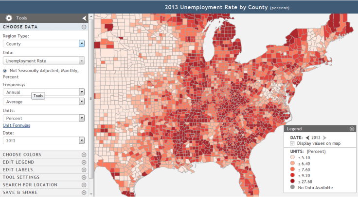
GeoFRED lesson

Creating and Analyzing a Binary Map: This online activity demonstrates how easy it is to master key functions in GeoFRED.

Source: www.stlouisfed.org

Last month I wrote an article about how to use GeoFRED for the National Geographic Education blog.  Since then, GeoFRED was produced this lesson plan that will walk students through the basics of how to use the site and introductory mapping skills.

Tags: development, statistics,  economic, mapping.

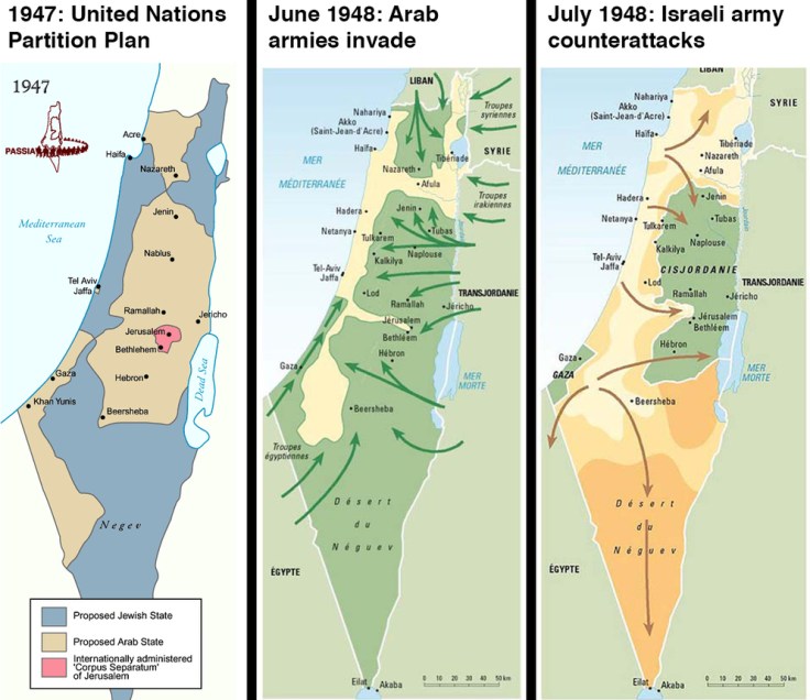
9 questions about the Israel-Palestine conflict you were too embarrassed to ask

Yes, one of the questions is “Why are Israelis and Palestinians fighting?”

Source: www.vox.com

There is no need to be embarrassed, since we all need to start somewhere.  This 2014 article provides some helpful context for students who don’t know what’s going on.   

Tags: Israel, Palestine, conflict, political, borders.

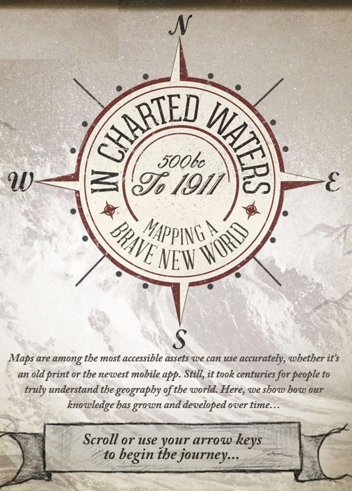
Evolution of the World Map

Use our interactive In Charted Waters tool which shows information & visuals on how our knowledge of the world map has evolved.

Source: www.msccruises.co.uk

This interactive map/timeline takes users around the world through the major events representing the expansion of human knowledge.  Admittedly, this is represents knowledge from a Eurocentric perspective, but that is somewhat appropriate in this instance since that was the largest store of spatial knowledge as this global information coalesced.  Users can visualize the coordination of absolute space and realize the actions undertaken that shifted geography from its predecessor, cosmology.  Each achievement cam through intensive exploration and the detailed mapping of those endeavors.

Tagshistoricalmapping, cartography, Unit 1 GeoPrinciples.

Is it all over for Greece in the EU?

Robert Peston crunches the numbers as finance ministers meet for vital loan talks.

Source: soundcloud.com

This audio clip shows how the Greek economic crisis is an issue on the national, regional, and global scales.  This BBC video and article also provide some nice context, asking the question, what would happen in Greece quits the Euro? 

Tags: Greece, Europe, supranationalism, currency, economic, podcast

Global Shipping Traffic Visualized

As stated in this NPR article: “The video shows satellite tracking of routes superimposed over Google Earth. It focuses on some of the main choke points for international shipping, such as the Strait of Malacca on the southern tip of Malaysia, Suez Canal, the Strait of Gibraltar and Panama Canal. It’s a good reminder that about 90 percent of all the goods traded globally spend at least some of their transit time on a ship.”

Tags: transportation, globalization, diffusion, industry, economic, mapping, video, visualization.

Source: www.youtube.com

Geographic data can be so beautiful…you’ve got to watch this.

Can these satellite images save lives? The U.N. thinks so

Stunning images taken from space put the world’s crises into context.

U.N. satellite imagery has tracked the evolution of the camp since its creation. The exponential growth is remarkable.  The refugee camp is rapidly taking the shape of a real city — structured, planned and even separated into neighborhoods and subject to gentrification.

Tags: refugees, migration, conflict, political, warsquatter, urban, unit 7 cities, remote sensing, geospatial. 

Source: www.washingtonpost.com

Create a free website or blog at WordPress.com.

Up ↑