
Fog envelops Table Mountain in Cape Town, South Africa, in this National Geographic Photo of the Day from our Your Shot community.
Fog envelops Table Mountain in Cape Town, South Africa, in this National Geographic Photo of the Day from our Your Shot community.
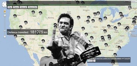
Source: www.johnnycashhasbeeneverywhere.com
This is more for the teachers than the students since this is most certainly not a current pop culture reference. Still, what’s better than an interactive map displaying the locations where Johnny Cash has been while listening to him sing “I’ve Been Everywhere?” (Tech support: Use Google Chrome or Safari to play and ignore the finger).
Tags: music, transportation, mapping, tourism.
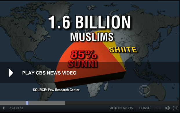
Clarissa Ward breaks down the history of differences between opposing sects of Islam
Source: www.cbsnews.com
The geography of the Sunni-Shiite division is incredibly important for a good understanding of world regional geography as well as modern geopolitics. This 5 minute video (as well as this NPR podcast) examine the historical and religious aspects of this split to then analyze the political and cultural implications in the Middle East today. Additionally this Pew Research article highlights the 5 countries where the the majority of Muslims are Shiite, with some good demographic data to add to the analysis. Take this quiz to test your knowledge.
Tags: MiddleEast, Islam, religion, historical, culture.

“
In ‘How to Make an Attractive City,’ a new video from the School of Life, London-based Swiss writer Alain de Botton offers a cheeky, thought-provoking, six-point manifesto on the need for making beauty a priority in urban architecture and design.”
Source: www.slate.com
Not everyone is a fan of Paris, but the author of this article feels that tourism can be seen as helpful proxy variable for what the general public perceives as good urbanism that makes for beautiful cities. The six main points of this article are:

“Based upon student reactions to their multiple choice exams, I can tell that the types of questions are NOT, ‘choose the correct definition for the vocabulary term.’ Instead, the types of questions are leading towards giving an example of a real world phenomenon and then requesting students to tell which term best applies. And though I have not seen an actual test, it sounds like the kids were saying that the questions require more reading than the answers (I would actually prefer that to the alternative).”
Source: magic.piktochart.com
This article (with the outstanding infographic above) from the Human Imprint is an excellent primer to get students ready for the APHG exam.
Tags: APHG, infographic.
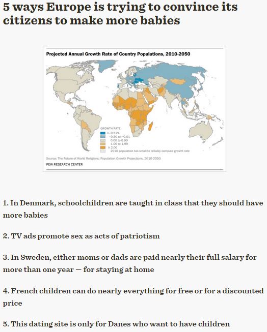
“All over the continent, potential parents have shown reluctance to have more babies. Hence, governments and advocacy groups are becoming increasingly creative about getting their citizens to make babies.”
Tag: Europe, declining populations, population, demographic transition model.
Source: www.washingtonpost.com
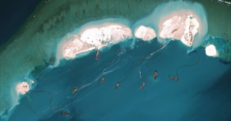
Satellite photos show the speed, scale and ambition China has exerted to assert ownership over South China Sea islands, far from the mainland.
Source: www.nytimes.com
In addition to the original BBC article, here is another article from the Telegraph with some aerial imagery showing the extent of this geo-engineering project. This has plenty of geopolitical implications and the United States government is on record saying that it is “concerned.”
Questions to Ponder: Why is China building up this island? What advantage would that give them? Why aren’t other countries with competing claims stopping China?
Tags: borders, political, conflict, water, China, East Asia.
The Greater Mississippi Basin is the United States’ core and serves as the underpinning of its role as a global superpower. For more analysis, visit: http://...
Source: www.youtube.com
I wouldn’t use the word “core” to describe America’s breadbasket, simply because of the economic core/periphery connotations. Other than that, this video highlights some aspects of U.S. regional geography that I cover ever semester. 1) The United States is bi-coastal on the two most important oceans for global trade. 2) Between those coasts is a large agricultural region overlayed on the most navigable river network. These two basic facts go a long way in explaining the United States’ position in global affairs.
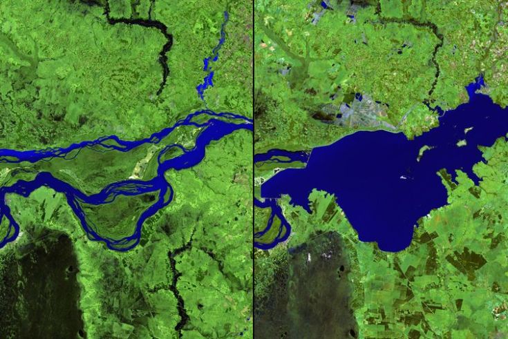
We’ve dammed mighty rivers, built hundreds of artificial islands, and made the world’s fourth-largest lake disappear.
Source: www.vox.com
This article highlights 15 classroom-ready examples of environmental change that can readily detected with satellite imagery. See these 25 from NASA’s Earth Observatory.
Tags: remote sensing, land use, environment, geospatial, environment modify, unit 1 Geoprinciples.


