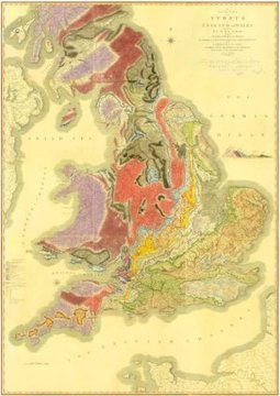
A rare early copy of William Smith’s 1815 Geological Map of England and Wales, previously thought lost, has been uncovered by Geological Society archivists.
Source: www.sciencedaily.com
A rare early copy of William Smith’s 1815 Geological Map of England and Wales, previously thought lost, has been uncovered by Geological Society archivists.
Source: www.sciencedaily.com
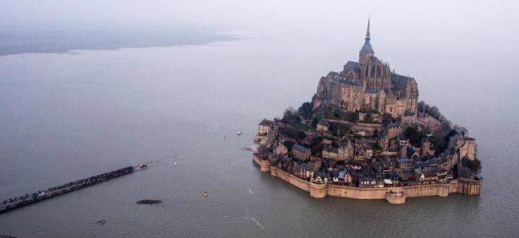
The historic abbey of Mont Saint-Michel became an island on March 21 after a rare “supertide” flooded a causeway.
Source: news.nationalgeographic.com
Coastal physical geography produces some beautiful landforms such as tombolos. A tombolo is created when sand deposits attach an island to a larger piece of land–think of it as special type of isthmus. Mont St. Michel (picture above) is the world’s most famous example because of the iconic walled city with crowned with a striking medieval abbey. As the tides fluctuated, the city and abbey were alternately connected or disconnected from the mainland. However, a ‘super-tide’ that occurs once every 18.6 years wiped out the artificial causeway stranding motorists on France’s most visited tourist destination (I wouldn’t mind be stranded there right about now).
Tags: water, physical, coastal, geomorphology, landforms, France,
tourism.
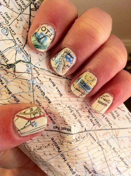
I found this on pinterest (where else?) and decided to share the geographically inspired craftiness:
1. Paint your nails white/cream
2. Soak nails in alcohol for five minutes
3. Press nails to map and hold
4. Paint with clear protectant immediately after it dries.
This also works with newspaper, but don’t try it with NatGeo Maps because the paper is of too high a quality to have the ink bleed out; I would recommend using an old USGS Topo map.
Source: geographyeducation.org

Three African leaders sign an initial deal to end a long-running dispute over the sharing of Nile waters and the building of Africa’s biggest hydroelectric dam.
Source: www.bbc.com
85% of the Nile’s water comes from the Blue Nile that originates in the Ethiopian highlands–it is the Blue Nile that Ethiopia has been working on damming since 2011. The Grand Ethiopia Renaissance Dam (GERD) will be located near the border with Sudan (see in Google Maps). Prior to this trilateral agreement, Egypt and Sudan received the majority of the Nile’s waters because of outdated colonial-era treaties that ignored upstream riparian states. This explains why in the past, Egypt was so adamantly opposed to Ethiopia’s plan fearing that their water supply with be threatened. Today though, the Egyptian President said, “We have chosen cooperation, and to trust one another for the sake of development.”
Tags: Ethiopia, Africa, supranationalism, political, development, environment, water, energy, borders.
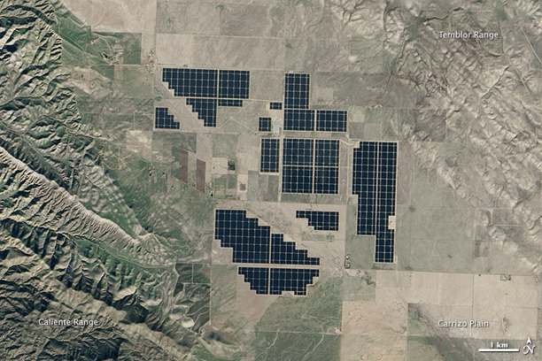
The new 550 megawatt facility in California produces enough electricity to power 180,000 homes.
The modules are part of Topaz Solar Farm, one of the largest photovoltaic power plants in the world. At 9.5 square miles (25.6 square kilometers), the facility is about one-third the size of Manhattan island, or the equivalent of 4,600 football fields.
Construction at Topaz began in 2011. The plant was mostly complete by November 2014, when it was turned on and began to generate electricity.
Tags: energy, resources, unit 6 industry, California, images, remote sensing.
Source: earthobservatory.nasa.gov

Most of the world’s major religions are made up of multiple sects or denominations, and Islam is no different. Islam’s two major sects are the Sunnis and the Shiites, and the division and interplay between the two is a major factor in the geopolitics of the Middle East. How well do you understand Sunni and Shiite Islam? Take our quiz and find out!
Source: www.csmonitor.com
The ghosts of religious wars past are rattling in Iraq; The geography of the Sunni-Shiite division is incredibly important for a good understanding of world regional geography as well as modern geopolitics. This NPR podcast examines the historical and religious aspects of this split to then analyze the political and cultural implications in the Middle East today. Additionally this Pew Research article highlights the 5 countries where the the majority of Muslims are Shiite, with some good demographic data to add to the analysis. Take this quiz to test your knowledge.
Tags: MiddleEast, Islam, religion, historical, culture.
“Fantasy cartography: An animated redrawing of the map of Europe.
Imagine a world in which countries could move as easily as people. A suggestion for a rearranged Europe.”
Source: www.youtube.com
What makes a region a region? What criteria is being used? This video could be used to ask questions on how they would create regions. Which places will get split apart and which places will be lumped together?
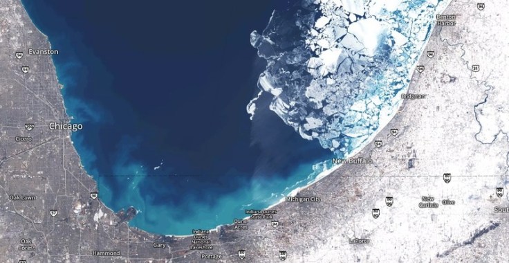
A groundbreaking Mapbox project ushers in a new era for online cartography.
On Google Earth, the seasons rarely change. Most anywhere a digital traveler goes, the sky is cloudless and the grass is green. No snow on the ground in Iowa. No fire in Valparaiso. It’s a big gap between the world as it is and as it’s mapped.
Launched Thursday, a landmark project from Mapbox has changed the summertime paradigm for online cartography. Landsat-live reveals the planet’s surface in real time and in stunning resolution, fed by a constant stream of public-domain imagery from NASA’s Landsat 8 satellite.
Source: www.citylab.com
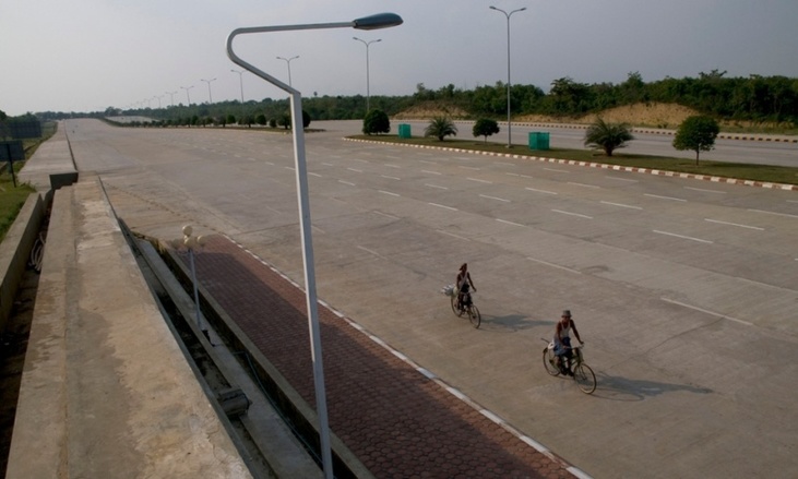
The purpose-built city of Naypyidaw – unveiled a decade ago this year – boasts 20-lane highways, golf courses, fast Wi-Fi and reliable electricity. The only thing it doesn’t seem to have is people, report Matt Kennard and Claire Provost
Tags: Burma, Southeast Asia, urban, urbanism.
Source: www.theguardian.com