Search

GEOGRAPHY EDUCATION

Supporting geography educators everywhere with current digital resources.

The Islands of Rhode Island

“How many islands are in Rhode Island?”

Seth Dixon‘s insight:

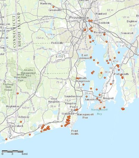
I recently received this question and immediately thought that this is a great geographic question, but one that geographic tools can be used to find the answer.  I downloaded all the Rhode Island toponymns (place names) listed by the United States Board on Geographic Names and filtered out all the listed Islands (108 is the answer!!).  A spreadsheet of the data didn’t help to visualize this data so I created this interactive map.  Only 1 of the locations didn’t have coordinates, some are scarcely more than rocks, and this is only according to the the U.S. Board on Geographic Names, but this is the most complete map of islands in the state of Rhode Island that I could produce.  Additionally, here is an article about some sailors who sought to explore every island of the Narragansett Bay.  

See on www.arcgis.com
Top 20 Earth Images

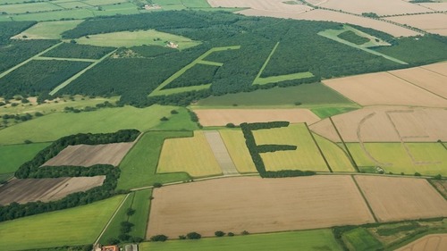
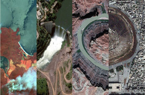
With five satellites scanning the globe, DigitalGlobe has collected impressive imagery of planet Earth this year. Check out their top 20 images here.

Seth Dixon‘s insight:

The Earth itself is the great source of inspiration for art.  Enjoy the gallery.

Tags: images, art, landscape. 

See on news.discovery.com

A. R. Wallace: The Other Guy to Discover Natural Selection

This paper-puppet animation celebrates the life of Alfred Russel Wallace, who is co-credited with Charles Darwin for the theory of natural selection.  Read the story here: http://nyti.ms/1fhBbGw

Seth Dixon‘s insight:

Some of the greatest discoveries in biology began as spatial discoveries.  Alfred Russel Wallace made some amazing advances in biogeography and discovered appropriately named Wallace Line. 

Tags: biogeography, environment, ecology, historical.

See on www.youtube.com

Click that ’Hood!

Seth Dixon‘s insight:

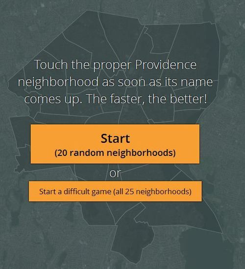
I had the shapefiles with the various neighborhoods of Providence and the good folks at “Click that ‘Hood” were gracious enough to upload it and make a local quiz based on the the 25 neighborhoods of Providence (as defined by the city government officials).  In addition to city neighborhood quizzes, they also have quizzes for regions such as Africa, South America and Europe.  This is a crowd-sourced database, so if you have the right data, you can help them to create more online quizzes.

See on click-that-hood.com

Mount Moriah: The most contested real estate on Earth?

“Muslims call it the Noble Sanctuary. Jews and Christians call it the Temple Mount.” 

What happens when various religious groups claim the same territory as their own?

See on apps.washingtonpost.com

Gaming to Help Farmers

A computer game wants you to map the world’s cropland so farmers can get more out of each harvest.

Seth Dixon‘s insight:

NPR has recently highlighted Crop Capture; Crop Capture is a game that uses Google Earth imagery to crowd-source agricultural data.  From a pedagogical standpoint, this is a great way to visually introduce students the variety of agricultural landscapes that can be found around the world.  This is an example of what many refer to as citizen science games which provides an alternative rationale for playing the game.


Tags: agriculture, food production, mapping, geospatial, edtech.

See on www.npr.org

Geographers: Occupational Outlook

Seth Dixon‘s insight:

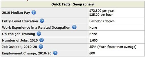
For those looking to justify the inclusion of geography in the curriculum, wanting to add a geography major at a school or need to justify the existence of geography education to a non-geo-evangelist, this is something to share.  The Bureau of Labor Studies has declared “”Employment of geographers is expected to grow 35 percent from 2010 to 2020, much faster than the average for all occupations. Employment growth will be fastest in the professional, scientific, and technical services industry.”

See on www.bls.gov

In the East China Sea, a Far Bigger Test of Power Looms


In an era when the United States has been focused on new forms of conflict, the dangerous contest suddenly erupting in the East China Sea seems almost like a throwback to the Cold War.

Seth Dixon‘s insight:

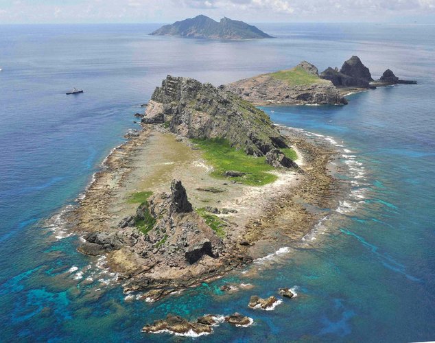
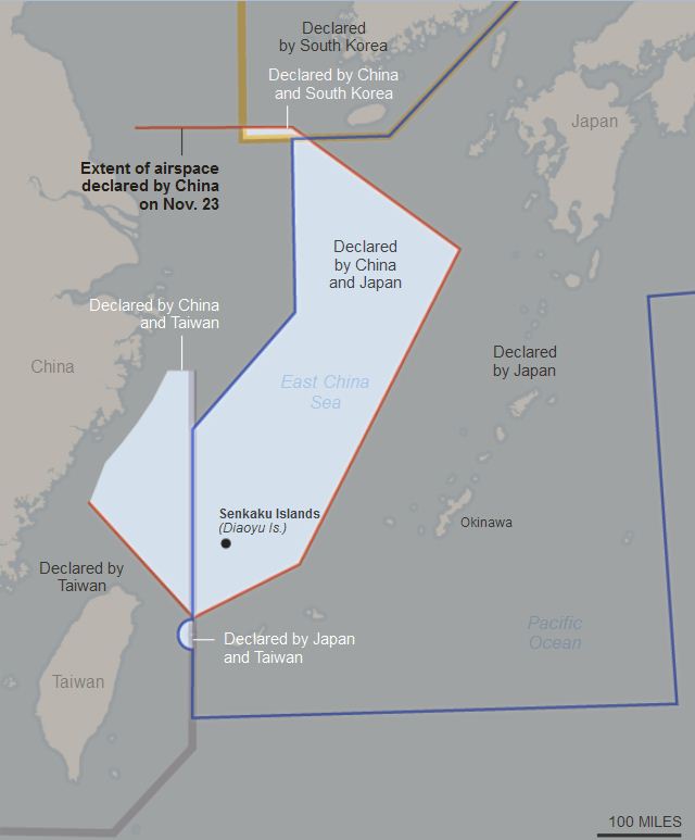
China has been very aggressive in how they assert their territorial claims in both the South and East China Sea.  China is claiming control over the airspace of the East China Sea and the Senkaku Islands. While the U.S. government rejects this claim, they are encouraging commercial airlines to comply with China’s request that all flight is this zone submit their flight plans to the Chinese government.  Japan, on the other hand, does not want the Chinese to have this as a symbolic victory that would further legitimize their political control over this space.  Why does China care so much about some minor islands?  Why would other countries not want to accept China’s territorial assertions?

Tags: borders, political, conflict, China, Japan, East Asia.

See on www.nytimes.com

ChinaAir

PACIFIC-popup

Geospatial Technologies Transforming Lives – Geoporter

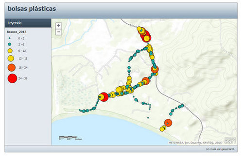
Educating residents, teachers and youth in a costal community in Costa Rica to use geospatial technologies to investigate, map and make a difference.

Seth Dixon‘s insight:

If you are looking to find a practical example of how geospatial technologies can empower neighborhoods and students, take a look at the GEOPORTER project.  If you can assist, I can say that I know the people working on this project and am impressed by their work. 

See on www.indiegogo.com

Create a free website or blog at WordPress.com.

Up ↑