Search

GEOGRAPHY EDUCATION

Supporting geography educators everywhere with current digital resources.

Washington Journal Tim Frazier Discusses Hurricane Irma Disaster

https://www.c-span.org/assets/swf/CSPANPlayer.swf?pid=433726-4
//www.c-span.org/video/standalone/?433726-4

“Georgetown University’s Tim Frazier talks about the federal government’s management of disaster relief related to Hurricanes Irma and Harvey.”

Tim Frazier is not only a fantastic geographer with an expertise in disaster management, he was also my volleyball partner on the “Bad Latitudes” team at Penn State.  Good job Tim; great geographic insight and context to understand the response efforts.

Tags: disasters.

Disaster Mapping: Hurricane Irma, Mexico Earthquake and Bangladesh Floods

This week has seen disasters and destruction on an unprecedented scale, and the HOT Community has activated to respond. Hurricane Irma is the largest Hurricane ever recorded, and has torn death and destruction through the Caribbean. Destruction on some islands is estimated at 95%, affecting the lives of 1.2 million so far, and on track to cause severe destruction across the entire Florida State, where mass evacuation is currently underway. Barbuda’s prime minister, Gaston Browne, described the damage as absolutely heart-wrenching. ‘The island is literally under water and barely habitable,’ Browne said. ‘About 95% of properties are damaged, there is a serious threat of disease. Additionally, those already affected by Irma fear a second brutal battering by Hurricane Jose.'”

Source: www.hotosm.org

Want to see geographic knowledge and geospatial skills in action?  Crowd-sourced mapping is increasingly an important resource during an emergency.  Poorer places are often not as well mapped out by the commercial cartographic organizations and these are oftentimes the places that are most vulnerable to natural disasters.  Relief agencies depend on mapping platforms to handle the logistics of administering aid and assessing the extent of the damage and rely on these crowd-sourced data sets.  My students and I join OpenStreetMap (OSM) projects, especially when there is a major humanitarian need…it’s a great way to make service learning and geospatial technologies come together. The projects that are marked urgent by the Red Cross are all in Haiti right now.  Here are is a video playlist that explains the project and how you can help if you are new to OpenStreetMap (OSM).


Tags: disasters, mapping, edtechSTEM, weather and climate.

Mexico City 1968

“The 1968 Olympics took place in Mexico City, Mexico. It was the first Games ever hosted in a Latin American country. And for Mexico City, the event was an opportunity to show the world that they were a metropolis as worthy as London, Berlin, Rome or Tokyo to host this huge international affair. The 1968 Olympics were decreed ‘the Games of Peace.’ So Wyman designed a little outline of a dove, which shop owners all over the city had been given to stick in their windows. A protest movement, led by students, was growing in the city around [the organizers and designers]. These protestors believed the long-ruling Institutional Revolutionary Party (PRI) catered to wealthy Mexicans rather than the poor, rural and working class. Although the country had been experiencing huge economic growth, millions of people had still been left behind. The ‘Mexican Miracle’ hadn’t reached everyone.”

Source: 99percentinvisible.org

Few years are as powerful in the minds of Mexican identity as the year 1968.  Like so many 99 percent invisible podcasts, this blends urban design, social geography, local history in a way that deepens our understanding of place. The built environment can be molded to project an image, and can be used to subvert that same message by the opposition.    


Tagssport, Mexico, Middle America, urban, architecture, place, landscape.


The Edge of the Plates

“Tomales Bay lies about 50 kilometers (30 miles) northwest of San Francisco, along the edges of two tectonic plates that are grinding past each other. The boundary between them is the San Andreas Fault, the famous rift that partitions California for hundreds of miles. To the west of the Bay is the Pacific plate; to the east is the North American plate. The rock on the western shore of the Bay is granite, an igneous rock that formed underground when molten material slowly cooled over time. On the opposite shore, the land is a mix of several types of marine sedimentary rocks. In Assembling California, John McPhee calls that side “a boneyard of exotica,” a mixture of rock of ‘such widespread provenance that it is quite literally a collection from the entire Pacific basin, or even half of the surface of the planet.'”


Tags: geomorphologyremote sensing, tectonics, geology, Californiacoastal, physical.

Source: earthobservatory.nasa.gov

How Does it Grow? Garlic

How Does it Grow? Garlic from How Does it Grow? on Vimeo.

Telling the stories of our food from field to fork.
Episode Two: Peeling back the layers of nature’s most powerful superfood.

Source: vimeo.com

This 5-minute video is a good introduction to garlic, it’s production, environmental requirements, nutritional profile and diffusion.  Historically, garlic was far more important than I ever imagined.  The geography of food goes far beyond the kitchen and there are many more episodes in the “How Does it Grow?” series to show that.

Tags: foodeconomicfood production, agribusiness, industryvideo, agriculture.

How a Texas grocery chain kept running after Hurricane Harvey

“One of my stores, we had 300 employees; 140 of them were displaced by the flooding. So how do you put your store back together quickly? We asked for volunteers in the rest of the company. We brought over 2,000 partners from Austin, San Antonio, the Rio Grande Valley. They hopped into cars and they just drove to Houston. They said, we’re here to help. For 18 hours a day, they’re going to help us restock and then they’ll go sleep on the couch at somebody’s house.”

Source: www.linkedin.com

Natural disasters complicate the logistics that make our modern economy run.  We take these flows for granted–until they are disrupted. This article is a excellent view into how to operate when disaster strikes. 


Tagseconomicindustry, laborglobalizationplace, transportation.

Announcing a New Feature to Build Students’ Geography Skills

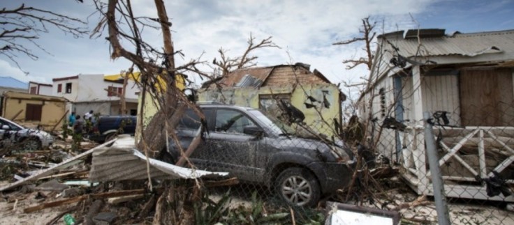
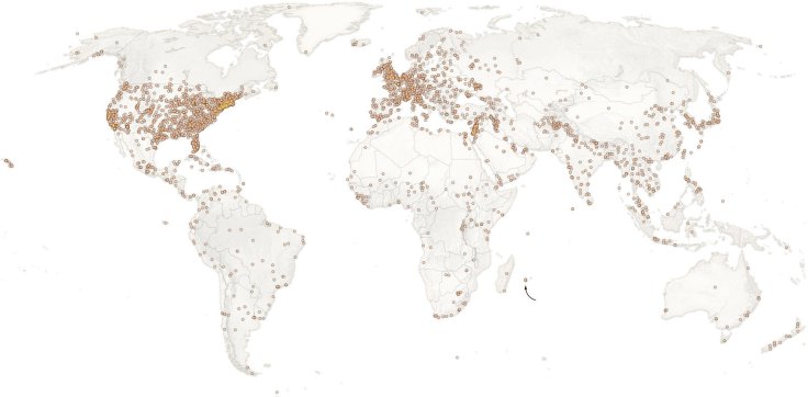
“As the image above shows, The Times reports from all over the globe. We have journalists in more than 30 international news bureaus worldwide, and every day we publish news, feature stories, videos, slide shows and more from dozens of countries around the world. Our new ‘Country of the Week’ feature celebrates this abundance to help build students’ geography skills. A weekly interactive quiz will first introduce students to a country via a recent video or photograph, then ask them to find that place on a map. Next, the quiz will focus on the demographics and culture of the country. Finally, we’ll include links to recent reporting from that place in case they, or you, would like to go further.

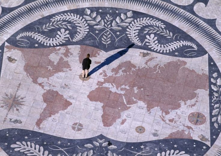
In ‘Why Geography Matters,’ Harm de Blij wrote that geography is ‘a superb antidote to isolationism and provincialism,’ and argued that ‘the American public is the geographically most illiterate society of consequence on the planet, at a time when United States power can affect countries and peoples around the world.’

This spatial illiteracy, geographers say, can leave citizens without a framework to think about foreign policy questions more substantively. ‘The paucity of geographical knowledge means there is no check on misleading public representations about international matters,’ said Alec Murphy, a professor of geography at the University of Oregon.”


Tagseducation, K12geography education, geography matters.

Source: www.nytimes.com

Why geography matters now more than ever

“Students need to know human geography; they need to understand the relationships that exist between cultures.”

Source: worldgeochat.wordpress.com

You might have seen this article on PBS’s Teacher’s Lounge, but here is a link to the original (and a good reason to give a shout-out to #worldgeochat on Twitter Tuesday nights at 9pm EST).  This might be seen as another example of me preaching to the choir, but I hope that this will arm you with resources to use in discussions with administrators and colleagues in the fight against geographic ignorance.  This is a great article to put into my new tag of article that discuss why geography matters.   


Tagseducation, K12geography education, geography matters.

10 countries that desperately want people to have more sex

Roughly half the countries around the world experience low fertility rates, and some get pretty creative in how they encourage procreation.

Source: www.businessinsider.com

While many countries have anti-natalist policies (policies to discourage more births), other countries with declining populations have pro-natalist policies in an attempt to increase fertility rates.  While not an exhaustive list, this list gives a few more examples that teachers can use to show how countries in stage 4 of the demographic transition are dealing with declining fertility rates.  


Tags: declining populations, population, demographic transition model, modelsunit 2 population. 

Create a free website or blog at WordPress.com.

Up ↑