Search

GEOGRAPHY EDUCATION

Supporting geography educators everywhere with current digital resources.

Countries Participating in the 2012 Olympic Games in London

See on Scoop.itGeography Education

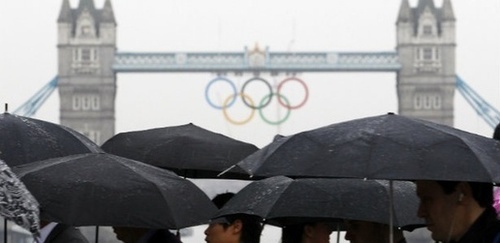
Discover the number of countries participating in the 2012 Summer Olympic Games in London. Find out which countries are not participating in the Olympic Games and learn which non-countries are participating as well.


204 countries are participating in the Olympics?  There aren’t even 204 countries in the world!  This article looks at the political geography of international recognition.   One interesting case not discussed in the article is that of Taiwan.  Taiwan is participating, but marched under a non-Taiwanese flag under the name Chinese Taipei because the IOC wanted the mainland Chinese to return to the games. Also, South Sudan, Kosovo and the Vatican are not participating (although pondering them competing, especially the Vatican, is something that deeply amuses me).  Another intriguing thought: how many of the participants were former British colonies? 

See on geography.about.com

London, the Olympics and Geography

See on Scoop.itHistory and Social Studies Education

The Geographical Association has produced numerous resources specifically for the 2012 Olympic and Paralympic Games being held in London.  The Olympics as an event work as an important teaching moment that operates on numerous scales.  What local developmental projects reshaped the urban fabric of London in preparation for these Games?  Do international events such as the Olympics foster a global community?  Is this idea of a global community perfectly harmonious?    

See on www.geography.org.uk

Why We Travel…

See on Scoop.itGeography Education

So go ‘read’ some more!

See on j-stin.tumblr.com

Advancing STEM Education with GIS

See on Scoop.itGeography Education


ESRI has recently released a free PDF book entitled “Advancing STEM Education with GIS.”  GIS and STEM represent an important opportunity for geography.

See on www.esri.com

Ramadan 2012 begins

See on Scoop.itGeography Education

All over the world Muslims have begun their holiest month of the year by fasting from dawn until dusk each day, broken each evening by large, communal meals.


This photoessay is a visual and cultural delight.  Pictured above is a Pakistani boy who prays next to plates of fruits donated to worshippers to break their fast (Karachi, July 21, 2012).  On the first day of the holy fasting month of Ramadan, we see the communal ethos of Ramadan.

See on www.boston.com

London vs. The City of London

See on Scoop.itGeography Education

London and the City of London are the same political and territorial entity right? Of course not. Why have something simple when we can have a rich archaic legacy with a fascinating (albeit convoluted) history. Here’s a great political geography lesson just in time for the Olympic Ceremonies.

See on www.youtube.com

Why Hosting the Olympics Is Bad for Cities

See on Scoop.itGeography Education

Don’t count on gaining much from your moment in the sporting sun.


Cities love the advantages of having the Olympics in town; the cultural prestige, the international publicity and the recognition as a globally significant city.  The tourism and economic impact is the rationale for so many expensive infrastructure projects, yet research indicates that economic boost during the Olympics is not always the boon that it is made out to be. 

See on www.theatlanticcities.com

Cartographic Table

I’ve always loved this 1784 map of the United States produced by Abel Buell.

One of the most striking differences from the modern maps of this region is the massive area of disjointed territory that is classified as Connecticut as well as the western extensions of most southern states.  This map’s title is a stunning as it’s cartography.  Entitled “A New and Correct Map of the United States of North America,” this made is a making a bold political statement, not just attempting to describe the current borders.  At this point it is important to note that Abel Buell, the engraver who created this made was from Connecticut and this map was commissioned by the Governor and State of Connecticut.  As a National Geographic reproduction of this map states, “He [Buell] portrayed the confused status of Connecticut’s western claim, which is based on the 1662 charter to all land between the 41st and 42nd parallels.”  Both Pennsylvania and Connecticut encouraged residents to settle this region, and Connecticut was not to be deterred by the fact that New York State’s eastern border functionally ended Connecticut’s claim to the land.  Despite the map, Connecticut eventually retracted their claim to land in Pennsylvania and even lands  in Ohio as well.

But beyond being a gorgeous map and a an early attempt to use a map to legitimatize territorial claims in United States history, I’m thrilled with this map because it is now a part of my home decor.  My crafty and ingenious spouse collected assorted items (all free discarded items, mind you) to put together this fantastic end table!

With a little bit of paint (okay it’s now a $4  investment) and a lot of  hard work and love, this is the end product.  There isn’t a thing about this table that doesn’t make me just positively elated.

U.S. Cities With Bigger Economies Than Entire Countries

See on Scoop.itGeography Education

How do the individual economies of U.S. cities stack up against the world? Here’s a few quiz questions that can be answered with our chart of the 50 largest U.S. metro areas.

This WSJ article shows the economic strength of numerous greater metropolitan regions in the United States.  Even more important than the article is the “Interactive Graphics” which presents the tabular data of the top countries by GDP interlaced with U.S. metro area’s GDPs.  Amazingly, 11 metropolitan areas (if they were independent countries) would rank in the top 50 countries of the world based on total GDP.

See on blogs.wsj.com

Create a free website or blog at WordPress.com.

Up ↑