See on Scoop.it – Geography Education
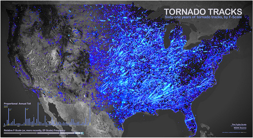
This strangely beautiful map shows every tornado to hit the U.S. between 1950 and 2011. What physical geographic factors lead to this distribution? What are the impacts of this data on human geography?
See on boingboing.net


Leave a comment