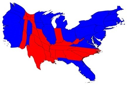
I’m sure most of you have seen the 2008 version of these fantastic maps and cartograms and they’ve been a go-to reference for me since the last election. The typical red state/blue state map conceals much concerning the spatial voting patterns in the United States and fails to account for the population densities of these distributions. That’s what makes this county level voting maps and cartograms so valuable.
Questions to Ponder: What new patterns can you see in the county map that you couldn’t see in the state map? What do the cartograms tell you about the United States population?
Tags: cartography, mapping, rural, zbestofzbest.
See on www-personal.umich.edu


November 11, 2012 at 2:53 am
Now it looks like the conservatives on the court will get their chance. A cursory review of recent Republican shenanigans with voting rules should put the notion that the VRA is obsolete entirely to bed. With voting growing more racially polarized , the temptations to alter voting rules to disenfranchise particular constituencies is obvious. Indeed, the Department of Justice successfully challenged Texas’ redistricting map because it diluted the voting power of Latinos . If the court strikes Section 5 down, one of the most effective and important powers the federal government has for ensuring that the right to vote is not abridged on the basis of race will be destroyed.