Seth Dixon‘s insight:
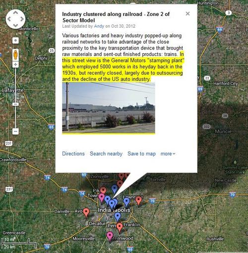
Essay #3 for the AP Human Geography 2013 exam focused on how railroads and highways impacted the size and form of U.S. cities. Andy Baker, one of the great readers on that question has put together an interactive map filled with tangible examples of how Indianapolis’ land use history has been heavily influenced by the railroads and highways. This would be a great resource to prepare students to answer that FRQ.
Tags: transportation, urban, models, APHG.
See on www.google.com


Leave a comment