“David Greene talks to writer Jeremy Miller about the American Centroid. That’s the place where an imaginary, flat, weightless and rigid map of the U.S. would balance perfectly if all 300 million of us weighed the exact same.”
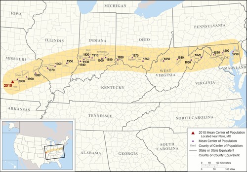
Every 10 years the centroid (the center of U.S. population) is calculated using the latest census data. As the map above shows, the centroid has continued moved west throughout history, but in the last 60 years has moved to the south and west. The recent shift to the south coincides with the mass availability of air conditioning (among other factors) which opened up the Sun Belt. In this article in Orion Magazine, Jeremy Miller discusses the historical shifts in the spatial patterns of the U.S. population and the history of the centroid. you can listen to podcast versions of this article as well, one by NPR and a more in depth one by Orion Magazine.
Questions to Ponder: Would the centroids of other countries be as mobile or predictable? Why or why not? What does the centroid tell us?
Tags: statistics, census, mapping, migration, population, historical, USA.
See on www.npr.org


Leave a comment