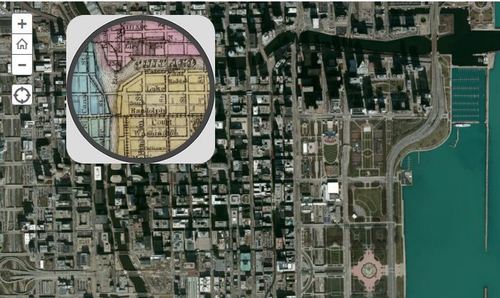
This 1868 pocket map of Chicago shows the city in full-blown expansion, a mere 3 years before the infamous blaze
Seth Dixon‘s insight:
This interactive map with a ‘spyglass’ feature Chicago is displaced during a economic boom period as the U.S. was expanding westward. Where where the railroads located then? Why have some of them vanished today? Notice anything curious about the coastline along Lake Michigan? Follow this link to see similar interactives of other major U.S. cities.
Tags: Chicago, historical.
See on www.smithsonianmag.com


Leave a comment