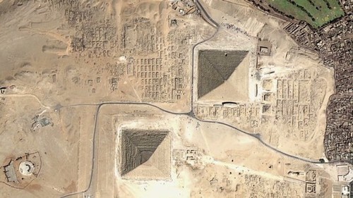
Dr Sarah Parcak uses satellite technology to unearth Egypt’s ancient settlements, pyramids and palaces lost in the sands of time.
Seth Dixon‘s insight:
The uses of geospatial technologies are NOT limited to studying geography, but it is the bedrock of many research projects that involve spatial thinking (as demonstrated in this CNN article and the TED talk below). Geographic principles and geographers can be very important components of interdisciplinary research teams.
Tags: spatial, remote sensing, geospatial, Egypt, historical.
See on edition.cnn.com


Leave a comment