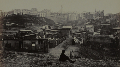
“Charles Marville photographed Paris’ transition from medieval hodgepodge to modern metropolis. Marville made more than 425 photographs of the narrow streets and crumbling buildings of premodern Paris, including this view from the top of Rue Champlain in 1877-1878.”
This NPR podcast adds some great insight into Charles Marville’s 19th century photography currently on display at the National Gallery of Art in Washington D.C. The urban transformations designed by Haussmann made Paris the global capital of modernity and the many cities around the world copied the principles of Haussmannization. A photographic glimpse into Paris before and during these changes that brought about social upheaval is a marvelous tool for an historical geographic analysis of urbanization.
Tags: urban, historical, Paris, place, France, podcast, images.
See on www.wbur.org
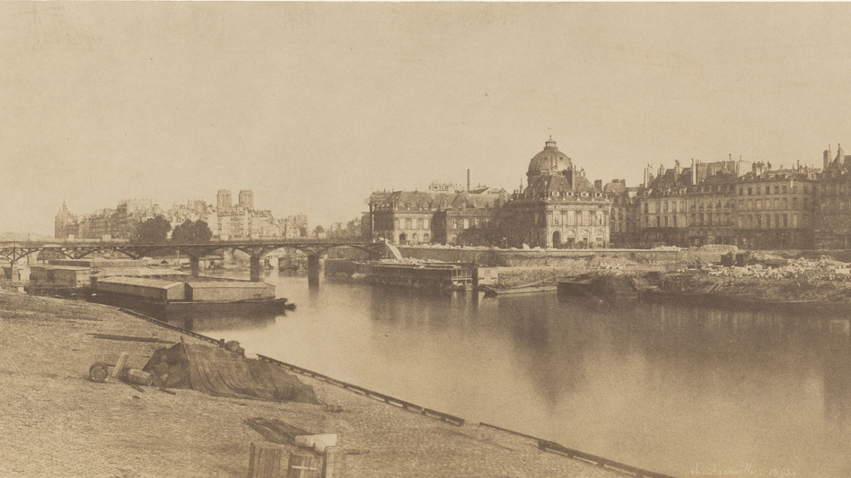
Marville’s images show the evidence in a picture taken on the right bank of the Seine: There’s the river, Notre Dame Cathedral in the far background and a new wing of the Louvre going up along the riverside. Back then, before Napoleon and Haussmann, the river was the highway — everything went up and down the Seine.
In analysis of this image, museum curator Sarah Kennel says, “You can see the banks lined with chunks of quarry stone that are going to be used to build Paris, also enigmatic, covered piles of things,” Kennel says. “And you also get a real sense of how much the Seine was the center of industry. Then they built all the grand boulevards, and it became a place where now you can take nice, lovely boat rides and look at all the monuments.”


Leave a comment