
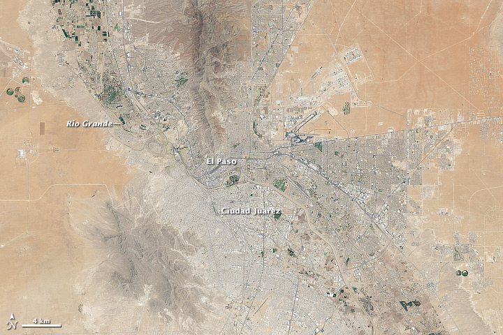
“Landsat has seen a lot in its day. In one spot of desert, where the Rio Grande marks the border between the United States and Mexico, the satellite program captured hundreds of images of fields turning green with the season, new developments expanding from El Paso, Texas, and clouds moving over the neighboring mountains.”
Since I have family on both sides of this line, I’ve always be fascinated by the U.S.-Mexico border as a cultural, political and economic phenomenon. Ciudad Juárez/El Paso are examples of ‘twin cities’ that form along the border and in many ways are one metropolitan area that has been brought together by the interactions available at the border; at the same time this regions is highly divided by spatial governance policies. Click here to download high resolution images El Paso/Ciudad Juárez.
See on www.youtube.com


Leave a comment