See on Scoop.it – Geography Education
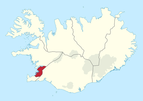
“60% of Iceland’s population lives in the red area.”
Seth Dixon‘s insight:
Similar to Iceland, Australia’s population is also highly clustered.
Questions to Ponder: Why is Iceland’s population so highly clustered? What is it about the red (and white) areas on the map that explain this pattern? What other layers of information do we need to properly contextualize this information?
Tags: Iceland, population, density.
See on www.reddit.com


Leave a comment