Search

GEOGRAPHY EDUCATION

Supporting geography educators everywhere with current digital resources.

Month

February 2015

How the warming Arctic might be behind Boston’s deep freeze

There may be a counterintuitive explanation for the deep freeze that hit New England this winter: The rapidly warming Arctic is causing big disruptions in the jet stream, which carries weather across North America. Is this the worst winter you’ve experienced?

Tags: physical, weather and climate, ArcticBoston, climate change, podcast.

Source: www.pri.org

Damage from cancelled Canadian census as bad as feared

The cancellation of the mandatory long-form census has damaged research in key areas, from how immigrants are doing in the labour market to how the middle class is faring, while making it more difficult for cities to ensure taxpayer dollars are being spent wisely, planners and researchers say.

Source: www.theglobeandmail.com

Canada got rid of the mandatory census, and is discovering it can no longer know much about itself. 


Tag: Canada, populationcensus.

15 Countries In 4 Minutes (Time Lapse)

“During the past two years, Kien Lam went on the kind of trip most could only dream about. The photographer wanted to “see as much of the world as possible,” so he visited 15 countries around the globe, from Mexico to New Zealand, snapping more than 10,000 photographs along the way. He edited his work together to make this stupendous time-lapse, which may be one of the most envy-inducing travel diaries I’ve ever seen.”

Tags: landscape, time lapsevideo.

Source: www.youtube.com

The Geographic Advantage

We are living in an era of receding glaciers, accelerating loss of species habitat, unprecedented population migration, growing inequalities within and between nations, rising concerns over resource depletion, and shifting patterns of interaction and identity. This website provides 11 geographic investigations aligned to the geographic questions in the NRC Understanding Our Changing Planet report. The report focuses on the future directions in the geographical sciences and how these key questions will guide research to help us understand the planet on which we live.

Source: geographicadvantage.aag.org

The four aspects the geographic advantage (as conceptualized by former AAG president Susan Hanson and solidified by the AAG team–see powerpoint) are:

1.  Relationships between people and the environment

2.  Importance of spatial variability

3.  Processes operating an multiple and interlocking geographic scales

4.  The integration of spatial and temporal analysis


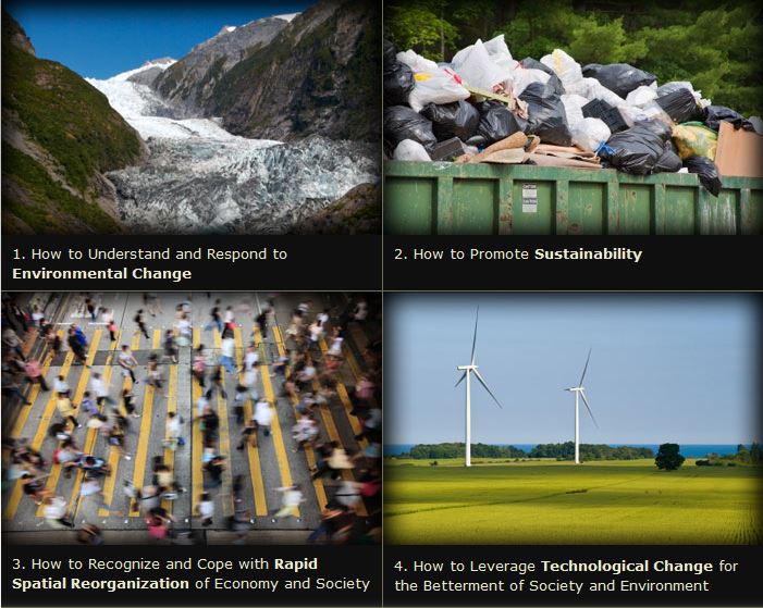
To ensure that this advantage is harnessed, the AAG prepared 11 modules within these 4 categories of key issue facing the world:

–Environmental Change

–Sustainability

–Rapid Spatial Reorganization

–Technological Change


Tags unit 1 GeoprinciplesK12STEMsustainability, environment, spatial, technology.

In Louisiana, Desire for a French Renaissance

From a long-running radio show to bilingual street signs, efforts are being made to preserve a vernacular once repressed by law.

This radio show is part of a conscious effort to sustain an iteration of French that followed its own evolutionary path here, far from the famed vigilance of the Académie française.  Many now believe Louisiana French to be endangered, even as other aspects of the state’s rural culture flourish amid the homogenizing forces of modern life.  “We’re not losing the music.  We’re not losing the food,” Mr. Layne said from his office, Ville Platte, a city of 7,500 about two and a half hours west of New Orleans. “But we’re losing what I think is the most important thing, which is language.”  

Tagslanguage, folk cultures, culture.

Source: www.nytimes.com

Take A Mouth-Watering Tour Of School Lunches From Around The World

Eating at the school cafeteria could’ve been amazing if you grew up almost anywhere but the U.S.

Tags: agriculturefood distribution

Source: www.fastcoexist.com

GeoFRED lesson

Creating and Analyzing a Binary Map: This online activity demonstrates how easy it is to master key functions in GeoFRED.

Source: www.stlouisfed.org

Last month I wrote an article about how to use GeoFRED for the National Geographic Education blog.  Since then, GeoFRED was produced this lesson plan that will walk students through the basics of how to use the site and introductory mapping skills.

Tags: development, statistics,  economic, mapping.

9 questions about the Israel-Palestine conflict you were too embarrassed to ask

Yes, one of the questions is “Why are Israelis and Palestinians fighting?”

Source: www.vox.com

There is no need to be embarrassed, since we all need to start somewhere.  This 2014 article provides some helpful context for students who don’t know what’s going on.   

Tags: Israel, Palestine, conflict, political, borders.

Evolution of the World Map

Use our interactive In Charted Waters tool which shows information & visuals on how our knowledge of the world map has evolved.

Source: www.msccruises.co.uk

This interactive map/timeline takes users around the world through the major events representing the expansion of human knowledge.  Admittedly, this is represents knowledge from a Eurocentric perspective, but that is somewhat appropriate in this instance since that was the largest store of spatial knowledge as this global information coalesced.  Users can visualize the coordination of absolute space and realize the actions undertaken that shifted geography from its predecessor, cosmology.  Each achievement cam through intensive exploration and the detailed mapping of those endeavors.

Tagshistoricalmapping, cartography, Unit 1 GeoPrinciples.

Blog at WordPress.com.

Up ↑