“The research shows that kids who have tough childhoods — because of poverty, abuse, neglect, or witnessing domestic violence, for instance — are actually more likely to be sick when they grow up. They’re more likely to get diseases like asthma, diabetes and heart disease. And they tend to have shorter lives than people who haven’t experienced those difficult events as kids.”
Source: www.npr.org
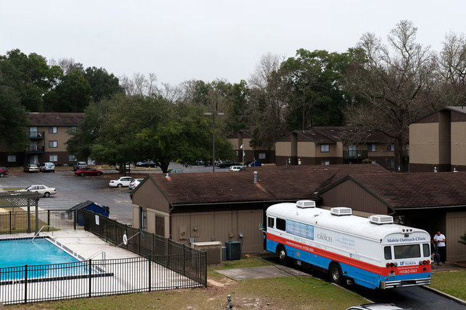
The hotspot maps of crime and poverty are correlated (not a big surprise), but this is another example of using spatial data to drive public policy. After making these initially correlations, they noticed a total lack of services, including medical care in the area that needed it most. This podcast is the story on how geographic analysis gave birth to a “clinic on wheels.”
Tags: medical, mapping, GIS, spatial, neighborhood, podcast, urban, place, poverty.


Leave a comment