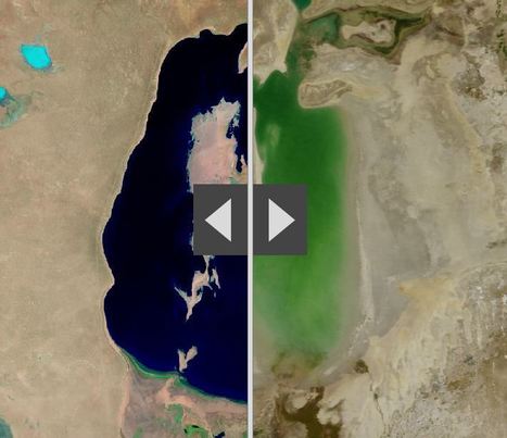
“By moving the slider, the user can compare 1990 false-color Landsat views (left) with recent true-color imagery (right). Humans are increasingly transforming Earth’s surface—through direct activities such as farming, mining, and building, and indirectly by altering its climate.”
Source: storymaps.esri.com
This ESRI interactive web app uses the “swipe” function to compare 12 places over time. These locations have experienced significant environmental change since 1990. This is an user-friendly way to compare remote sensing images over time. Pictured above is the Aral Sea, which is and under-the-radar environmental catastrophe in Central Asia that has its roots in the Soviet era’s (mis)management policies.
Tags: remote sensing, land use, environment, geospatial, environment modify, esri, unit 1 Geoprinciples.


Leave a comment