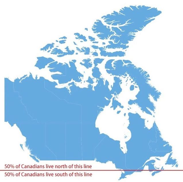
“The area below the red line includes most of Nova Scotia, in Canada’s east, but most of the population comes from the area a little farther west, in a sliver of Quebec and a densely populated stretch of Ontario near the Great Lakes.”
Source: www.vox.com
Admitted, the web Mercator projection of this map distorts the far northern territories of Canada, but still it hammers home some fascinating truths about Canada’s population distribution. Land-wise, Canada one of the world’s biggest countries, but population-wise, most of it is quite barren. What geographic factors explain the population concentration and distribution in Canada?
Tags: Canada, map, North America, population, density.


Leave a comment