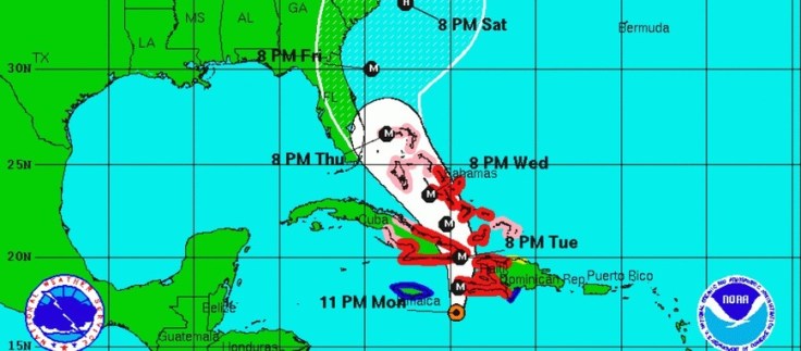
“The Humanitarian OpenSteetMap Team (HOT) has activated to provide geographic base data in areas affected by Hurricane Matthew. Category 4 Hurricane Matthew continues to strengthen and is advancing on Haiti and the Bahamas. Hurricane Matthew is expected to cause ‘catastrophic‘ damage including extreme flooding and landslides potentially affecting millions in Haiti, Jamaica, and Bahamas. To start we are mapping coastal communities in the storm path.”
Source: hotosm.org
Want to see geographic knowledge and geospatial skills in action? Crowd-sourced mapping is increasingly an important resource during an emergency. Poorer places are often not as well mapped out by the commercial cartographic organizations and these are oftentimes the places that are most vulnerable to natural disasters. Relief agencies depend on mapping platforms to handle the logistics of administering aid and assessing the extent of the damage and rely on these crowd-sourced data sets. My students and I are working on this over the weekend; can you join in and help? The projects that are marked urgent by the Red Cross are all in Haiti right now. Here are is a video playlist that explains the project and how you can help if you are new to OpenStreetMap (OSM).
Tags: disasters, mapping, STEM, physical, Haiti, weather and climate.


Leave a comment