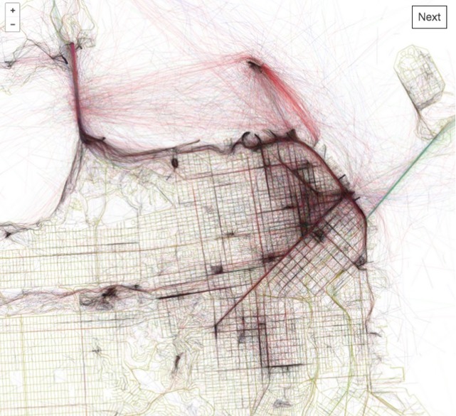
“Every city has a picturesque spot or two where the probability of a photo being taken at any given time is pretty high. Now there’s a world atlas of maps showing the routes people follow while taking these pictures in every city around the world:Mapbox’s Eric Fischer has been working on the “Geotaggers’ World Atlas” for years, using locations of photos uploaded on Flickr over a decade. In his city maps, which now span the world, he connects the dots between subsequent photos taken by a photographer—representing their path in sketchy lines that criss-cross across the city.”
—Tanvi Misra on CityLab
Tags: mapping, visualization, social media, tourism.
Source: www.mapbox.com
Questions to Ponder:
- How does the idea of crowdsourcing influence modern-day cartography and geographic data?
- What kind of meaning is there in this seemingly random assortment of geotagged images?
- Analyze a particular pattern (anywhere in the world). Describe the location, explain the patterns you see and analyze why they are the way they are.
- Analyze a particular pattern (somewhere else in the world). Describe the location, explain the patterns you see and analyze why they are the way they are.


Leave a comment