If you could go back in time to the 1980s, you would find a city that is drastically different than today’s Shanghai.
Source: earthobservatory.nasa.gov
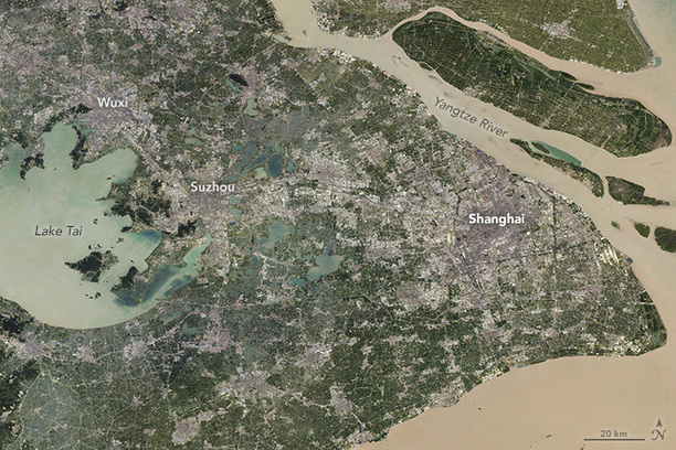
This series of seven satellite images shows how quickly the economic development of China has impacted the urban sprawl of China’s biggest cities. Pictures of the downtown area’s growth are impressive, but these aerial images show the full magnitude of the change.
Tags: urban, remote sensing, megacities, China, urban ecology.


Leave a comment