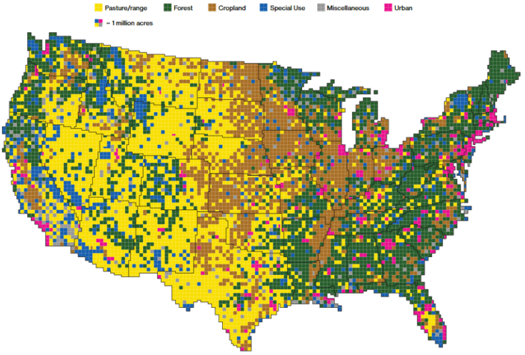
The 48 contiguous states alone are a 1.9 billion-acre jigsaw puzzle of cities, farms, forests and pastures.
Source: www.bloomberg.com
This set of 15 maps on how land is used in the 48 contiguous U.S. states is a phenomenal resource to visualize how we use our land (admittedly this does exclude Alaska and Hawaii, but given that Alaska’s land use patterns can skew the patterns considerably). This is especially useful in agricultural units, but has many other applications.
Scoop.it Tags: agriculture, food production, land use, rural, USA.
WordPress TAGS: agriculture, food production, land use, rural, USA.


Leave a comment