Search

GEOGRAPHY EDUCATION

Supporting geography educators everywhere with current digital resources.

Author

sethdixon

I am a geography professor at Rhode Island College.

Crisis Guide: Iran

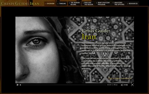
“Iran poses steep challenges to its Middle East neighbors and the world. Explore the country’s complex regime structure and controversial nuclear program, and watch experts debate the range of policy options.”


Seth Dixon, Ph.D.‘s insight:

Iran is in the middle of one of the most important geopolitical regions. One the bordered with Iraq and the Persian Gulf, Iran is stratgeically positioned to have considerable control over the world’s most important waterway for oil shipping and trade, the Strait of Hormuz.


Given it’s context, Iran is a country that students should more about than the three main facts that that most Americans are already aware of (1-Iran has an Islamic-based government, 2-an emerging nuclear program and 3-a ton of oil).  This interactive feature is a good starting point with great videos, timelines, maps, articles that assess the current situation in Iran. 


Tags: Iran, political, Middle East.

See on www.cfr.org

Writing FRQs

“AP Human Geography Free Response Questions should be approached in a very deliberate and specific way. APHG teacher Tom Landon explains his approach to teaching students how to do it.”

Seth Dixon, Ph.D.‘s insight:

For those preparing students for the AP Human Geography test, this video gives great advice to help you instruct students on how to approach the Free Response Questions (FRQs).  Understanding the content always comes first, but some bright students who I know understand the content fail to read the instructions or to answer every portion of the questions.  This will help those APHG students.

TagsAPHG, training, geography education.

See on www.youtube.com

Climographs

Seth Dixon, Ph.D.‘s insight:

Climographs chart the monthly temperature and rainfall data and are a useful tool is studying climatology.  Here are links to dozens of selected United States and International cities that come from the National Drought Mitigation Center.  The image above is a climograph of Providence, RI.


Tags: physical, weather and climate, Rhode Island, statistics, visualization.

Downtown LA: Always Changing

“The Los Angeles of America’s imagination is rarely downtown Los Angeles. When we envision L.A., we think of the beach, 15 miles away, or the starred sidewalk of Hollywood, or the sprawling suburbs of the San Fernando Valley. While not the center of our Los Angeles, downtown Los Angeles is nonetheless visible —it is a backdrop to films and television shows set in L.A., and, just as frequently, serves as Any City, U.S.A., easily transformed into New York City, Washington, D.C., and the generic cities of car, cell phone, or drug store commercials.”

Seth Dixon, Ph.D.‘s insight:

This AAG annual meeting will be in Los Angeles this year, and geographer Jennifer Mapes gives readers a virtual walking tour of downtown LA before thousands of geographers converge on the city.

Tags: Los Angeles, AAG, urban, landscape.

See on www.aag.org

Song: European Union

“Germany and France spent decades at each others’ throats. Now, bound by a common currency, they’re working together to save the euro zone. It’s a story that’s begging for a musical number — which, as it happens, we have right here.”

Seth Dixon, Ph.D.‘s insight:

This playful song dramatizes the current E.U. financial crisis.  This humourous highlights what the E.U. was designed to be, and showing the advantages and disadvantages of enhanced regional cooperation.  This is certainly worth a listen.     


Tags: Europe, supranationalism, currency, economic

See on www.npr.org

euflags

1832 Cholera Epidemic in NYC

A cholera outbreak in New York in 1832 led to broad efforts to clean up the city and others like it.

See on www.nytimes.com

Why do Map Projections Matter?

This is a clip from the TV show West Wing (Season 2-Episode 16) where cartography plays a key role in the plot.  In this episode the fictitious (but still on Facebook) group named “the Organization of Cartographers for Social Justice” is campaigning to have the President officially endorse the Gall-Peters Projection in schools and denounce the Mercator projection.  The argument being that children will grow up thinking some places are not as important because they are minimized by the map projection.

As Salvatore Natoli (a leader in geography education) was quoted in the video clip: “In our society we unconsciously equate size with importance and even power.” This is one reason why many people have underestimated the true size of Africa relative to places that they view as more important or more powerful.

Questions to PonderWhy do map projections matter?  Is one global map projection inherently better than the rest? 

true-size-of-africa

6 Ways Climate Change Will Affect You

From the food we eat to the energy, transportation, and water we all need, a warmer world will bring big changes for everyone.


B Sinica: This article touches every aspect of geography from culture to climate [considering] how the growing population plays the biggest role in determining the future of life on Earth.  People need to recognize the problems and potential future issues with global warming and the rapidly changing environment.  Though not many issues can be prevented or even solved, the least we can do is try to lessen the severity of devastation and prolong the current conditions as much as possible before the world becomes too extreme to manage.

Seth Dixon, Ph.D.‘s insight:

Some tangible ways that climate change can impact us in the future:

  • Food Security
  • Energy consumption
  • Extreme Weather
  • Drought
  • Health risks (more air-born diseases)
  • Vulnerable urban ecologies


Tags: climate change, environment, environment adapt, sustainability. National Geographic.

See on news.nationalgeographic.com

Chimamanda Adichie: The danger of a single story

“Our lives, our cultures, are composed of many overlapping stories. Novelist Chimamanda Adichie tells the story of how she found her authentic cultural voice — and warns that if we hear only a single story about another person or country, we risk a critical misunderstanding.”

Seth Dixon, Ph.D.‘s insight:

To gain a global perspective inherently requires understanding multiple perspectives.  Africa is frequently portrayed as ‘the other’ but also homogenized within a single narrative that ‘flattens’ truth.  How can we teach and learn about other places in a way that develops geographic empathy and shows the many stories of that can belong to any one place? 

Tags: Africa, perspective, TED.

See on www.youtube.com

Create a free website or blog at WordPress.com.

Up ↑