Search

GEOGRAPHY EDUCATION

Supporting geography educators everywhere with current digital resources.

Author

sethdixon

I am a geography professor at Rhode Island College.

Mapping A History Of The World, And Our Place In It

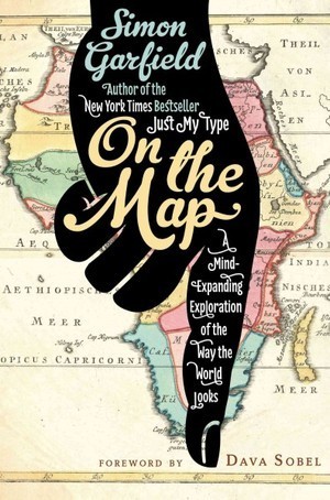
On the Map author Simon Garfield speaks with NPR’s Steve Inskeep about the history of maps, how they can be used as political tools, and how GPS and modern mapping applications are changing the way we see ourselves and our place in the world.

Seth Dixon, Ph.D.‘s insight:

This NPR podcast is a review of the book On the Map that explores how our minds perceive maps and how maps influence or perception of the world we live in.  Here is the NY Times review of the same book. 

See on www.npr.org

Perception and Place

Poll conversation

Seth Dixon, Ph.D.‘s insight:

50% yes, 50% no.  The raw statistics would tell you that the country is perfectly divided on this question of whether or not the University of Alabama has the greatest college football program of all time.  Not surprising to geographers, in a evenly split polls, elections, or other data results, there are oftentimes strong regional factors that influence variation in the data (in this case, local allegiances, media bias and general sport fanaticism).  

Questions to Ponder:  Alabama’s voting pattern is obvious, what explains for some of the other poll results from particular states?  Why is there a general East/West divide on this question?  What are the regional factors that influence the voting patterns?  Would the result be different on 6 months from now?

Tags: sport, statistics, mapping, regions.

See on espn.go.com

Breaking World North Korea News

World news about North Korea. Breaking news and archival information about its people, politics and economy from The New York Times.

EA: As mentioned in class, North and South Korea would be better off united. By the looks of things, that will not be happening. Scary to think that North Korea is “testing” missiles could endanger its close neighbors. But, maybe that was the intention. I thought a new, younger president would bring a modern way of thinking to North Korea, instead it sounds like they are spiralling downhill. High unemployment, high fuel and food prices. Hopefully South Korea is prepared for any wrongdoing on North Korea’s part…. The Peace Dam may keep flooding away, however it is no match for nuclear weapons

See on topics.nytimes.com

The Great Mosque of Djenné

The Great Mosque of Djenné, Mali, is a magnet for tourists, but it is increasingly difficult for locals to live a normal life around it.

Seth Dixon, Ph.D.‘s insight:

This New York Times short video is an intriguing glimpse into some of the cultural pressures behind having the designation of being an official world heritage site.  The grerat mosque combined with the traditional mud-brick feel to the whole city draws in tourists and is a source of communal pride, but many homeowners want to modernize and feel locked into traditional architecture by outside organizations that want them to preserve an ‘authentic’ cultural legacy.

Tags: Islam, tourism, place, religion, culture, historical, community, Mali, Africa.

See on www.nytimes.com

GeoEd Voices Online

Seth Dixon, Ph.D.‘s insight:

Some of the best free professional development opportunities are found online as educators develop Personal Leaning Networks (PLN).  This is a sampling of important voices from my PLN, with important links, updates and perspectives–so glad to be a part of your PLNs!

See on storify.com

Restoring Geography in America

Focus (WILL) – listen online, on demand topics and episodes, location, contact, schedule and broadcast information

Seth Dixon, Ph.D.‘s insight:

This is the audio archive of a 2007 radio interview with Jerome Dobson, Geography Professor at the University of Kansas and President of the American Geographical Society.  In this interview he discusses many topics including the importance of geographic education, how to define geography and showing the relevance of the disciple in solving real-world problems.  He gives historical context as to why geography became minimized within the United States.   


Tags: geography education, geo-inspiration, podcast.

See on tunein.com

Canada: As immigration booms, ethnic enclaves swell and segregate

More than 600 newcomers per day have arrived in Canada since 2006, and many of them have settled in neighbourhoods like Richmond, B.C.

Seth Dixon, Ph.D.‘s insight:

Over 6 million of those living in Canada were born outside of Canada an migrated there.  This infographic cleverly outlines both where migrants live in Canada and where they came from.  Ethnic enclaves are an important part of Canada’s rural and urban cultural landscapes.  Since the 1960s, the majority of immigrants have come from Asia, changing some traditional neighborhoods. 

Tags: Canada, ethnicity, migration, infographic, neighborhood

See on news.nationalpost.com

Allentown- Billy Joel

Home-made music video of Billy Joel’s “Allentown”.

Seth Dixon, Ph.D.‘s insight:

Many teachers use Billy Joel’s classic song and music video Allentown as a teaching tool to introduce the topic of deindustrialization in the Rust Belt of the United States.  This alternative music video version adds some useful teaching images to help students contextualize the lyrics

Tags: labor, industry, economic, unit 6 industry and video.

See on www.youtube.com

Another song to consider using is Telegraph Road by Dire Straits; the song follows a town as it industrialized and as it later deindustrialized.

AllenTown

Korea and the Yellow Sea

While city lights at night serve as a good proxy for population density, North Korea provides a dark exception.

Seth Dixon, Ph.D.‘s insight:

This image is appears to be a regional inset of the classic Earth at Night composite image however this nighttime remote sensing image was taken from Sept. 2012.  The Earth at Night image is typically used in classrooms to discuss what this actually means for human geography (Population density?  Development? Consumption? Where? How come?).  However, this particular portion of the global image focused on the Korean Peninsula highlights two other specific issues:

  1. the impact of a totalitarian state can actually be seen from space as South Korea has a per captia income level 17 times higher than that of North Korea. 
  2. the Exclusive Economic Zones (EEZs) can be seen in the Yellow Sea as fishing vessels form a line approximately 200 nautical miles off the coast of South Korea.     

Tagseconomic, political, resources, water, sovereignty, coastal, territoriality, states, unit 4 political, remote sensing.

See on earthobservatory.nasa.gov

Blog at WordPress.com.

Up ↑