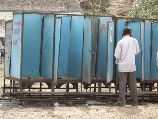
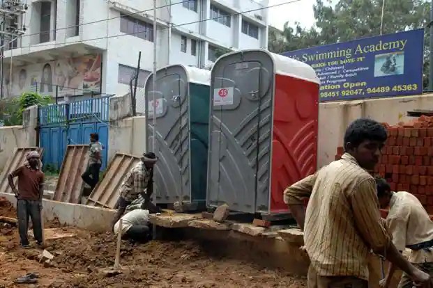
I’ve been teaching about the lack of toilets, open defecation, and adequate sanitation in India for years now, but over the pandemic, some of those articles I referenced became outdated (2016). So today I wanted to refresh my teaching materials. While the statistics have improved, it is still a serious health issue that remains a major impediment to economic and social development. The government proudly states that 100% of Indians have access to toilets, but a national survey found that 10% of the rural areas still defecate in the open (with other estimates much worse). Below are some good articles to get a sense of the current situation.
This video is a good assessment about the some of the geopolitical threads that are emerging after the first three weeks of the Russian-Ukrainian War. While it is unsure what will happen in the future, I think the musing of this are not just guesses, but solid analysis given the information that we have at the moment. Below are a few of my favorite articles that I’ve read that give some insight into the conflict:
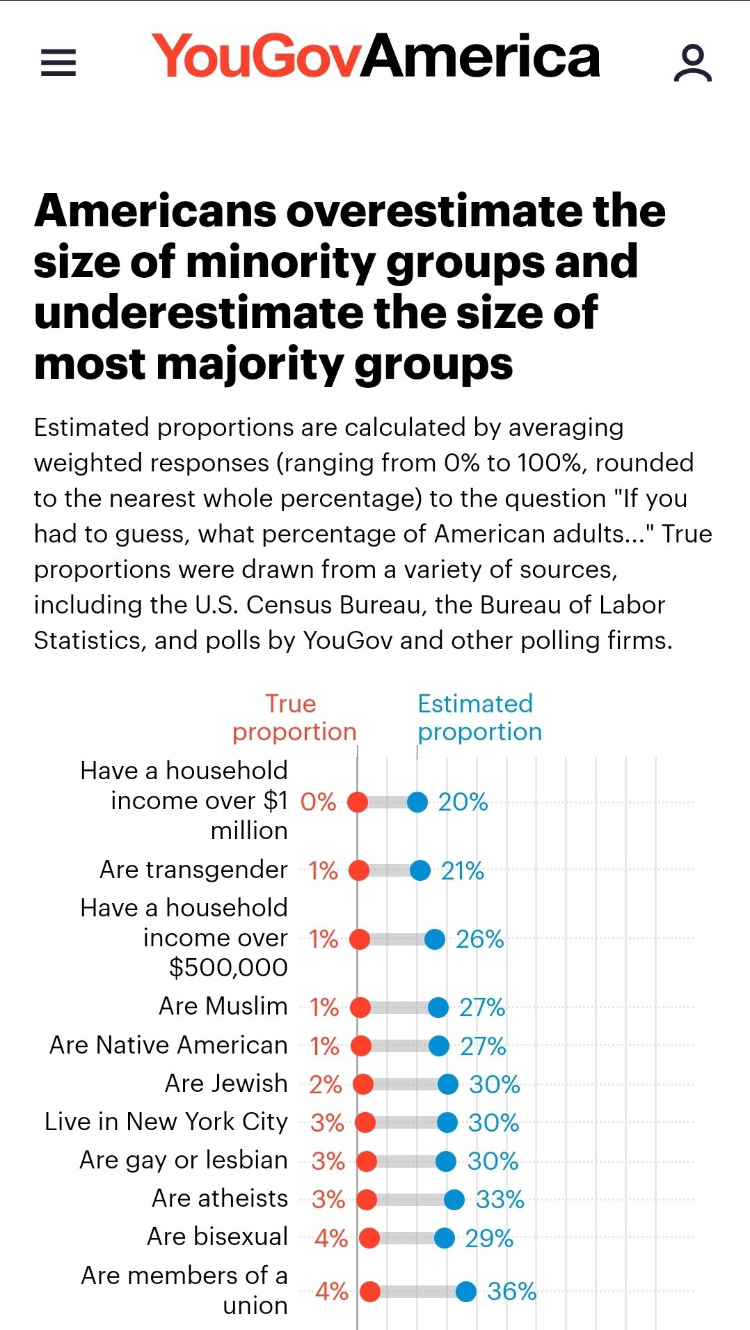
Which low number surprised you by how low it was? How come?
Which high number surprised you by how high it was? How come?
Is there are results that makes you question the validity of the survey for that question? How come? After doing some online research, how close was the original survey to other estimates?
Explain TWO reasons as to why we are so inaccurate with our guesses.
I created this ArcGIS Storymap using online maps circulating in the news and social media, but especially with the assistance of a map created at Lurgan College. While this StoryMap was intended for my students in my cartography, regional geography, and education courses, I hope that others might find it useful. I specifically went light on the analysis as I hope my students will use these materials to draw their own conclusions. I also posted the materials in several formats to highlight the advantages and disadvantages of several presentation strategies. If you have an ArcGIS account you can use these layers to create your own customized map. There are many other digital resources that students can use on projects to create a country report.
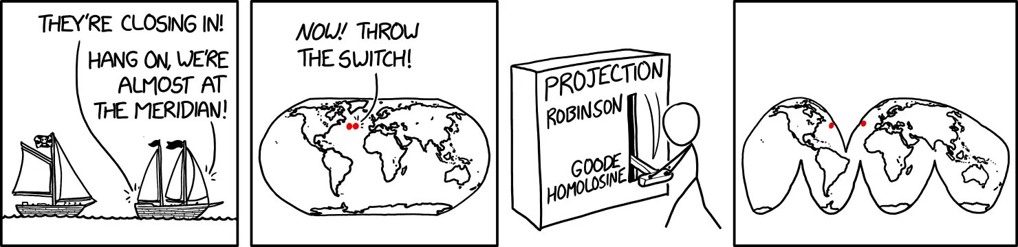
This is a fantastic comic strip that shows how map projections are perfect representation of planet Earth, but a 2D rendering of a 3D world. A map projection is like a personal perspective or worldview. There is no single perfect map projection (or perspective or worldview), but there are some strengths and limitations to organizing geographic and spatial information in any given system.
NEW UPDATE: Countryle. This is the one that relies most on geographic information since the hints are focus on real data. You guess any country, and the hints will tell you if the actual mystery country has a larger or smaller population, a warmer or colder climate…so that is the guesses aren’t just based on luck or hunches, but some evaluation.
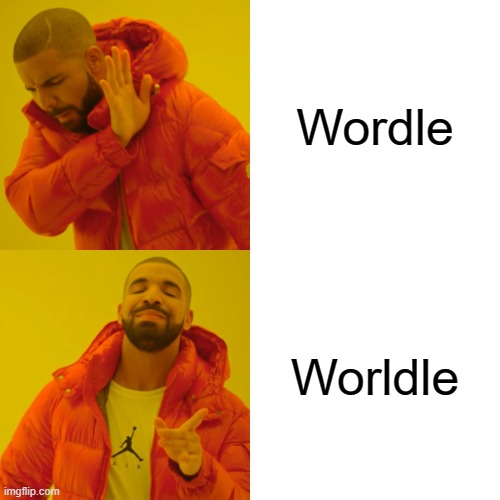
UPDATE ANOTHER GEOGRAPHY GUESSING GAME!! Worldle (not misspelled, although I would forgive your mind for auto-correcting and not noticing that there is not just one L, but two L’s). This one shows an outline of the a given country, and will tell you the distance away from the actual country to help inform further guesses. The better you know the world map, the less “guessing” there is, but still fun. SOURCE: WORLDLE
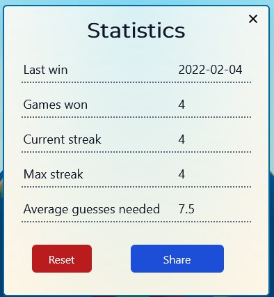
THE ORIGINAL: I love online geography games (I know, huge surprise). This newest one, The Globle Game, is riffing off Wordle which took the internet and social media by storm recently and I’m hooked.
The game is quite simple but don’t let that fool you into thinking that it will be easy. Like the old game where one player searches for an item in the room, with the other players calling out “hot” or “cold,” until the player finds the object, this website shows a globe, and it will color your choice based on how accurate your guess is with a red color ramp (white=ice cold, deep burgundy=red hot). Each day, they have a new mystery country for you to guess, but the globe that it displays does not show international borders. This fun new guessing game requires a strong mental map as well as getting a little bit of luck…something to get the students’ brains fired at the start of class, especially for the competitive types. For fun, there is as a “Night mode” with a purple color scheme, and a CITY version is forthcoming.
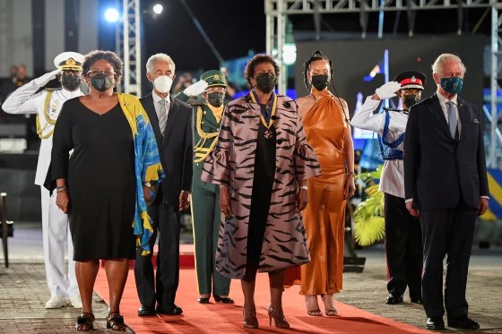
Barbados’ Prime Minister Mia Mottley, new President Sandra Mason, singer Rihanna, former cricketer Garfield Sobers and Britain’s Prince Charles stand during the Presidential Inauguration Ceremony to mark the birth of a new republic in Barbados.
“Perhaps against the wishes of an older West Indian generation, the new republic made a move that leaves an open question about what comes next. Barbados breaking with the Queen shows how younger leaders of color will continue to push their countries out of the shadows of colonial rule.” SOURCE: NBC News
Barbados has been an independent country since 1966, so what does this push against the remaining vestiges of the old British Empire mean? It means that the Queen will no longer be the nominal head of state with a local Prime Minister in Barbados; the new position of President will be fully acknowledged as the head of state without any deference to the Queen of England or the United Kingdom. Barbados is NOT, however, leaving the British Commonwealth, a trade association among former members of the British colonial empire. The great thing about the article linked above is the that while skeptics might say this is window dressing, but this symbolic shift is has some powerful cultural reverberations as a new generation is reconsidering the legacy of slavery and colonialism as they frame their future. Jamaica is another country in the Commonwealth now reconsidering their relationship with the British crown.
I’d like to share three resources I’ve used in FYS 100 class (Cultural Landscapes)
1. This 6-minute video that I’ve share earlier shows how landscapes change over time. In this example, a rural West Virginia county is hit with stark economic and demographic decline after the resource extraction-based economy gave out. The societal factors that created these hills and towns no longer are present and change doesn’t always feel like progress. How do these landscape changes impact a place like McDowell County, WV?
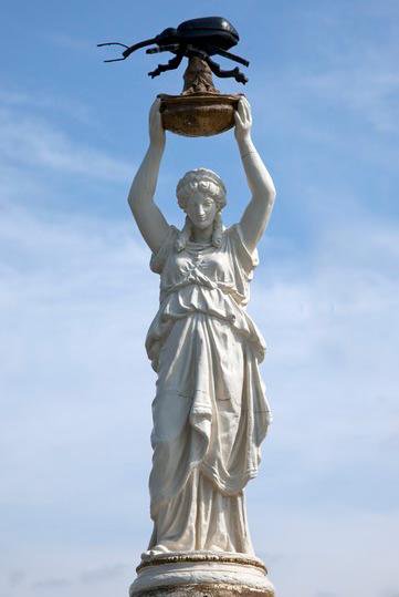
2. There are some truly odd things in the cultural landscape; some on the surface are complete head-scratchers. This article from the Smithsonian Magazine highlights the bizarre history that led to an Alabama monument to the Deep South’s most destructive 20th century pest: the boll weevil. The article is more historical than landscape, but it helps to answer why some unexpected items might be memorialized. What is the strangest thing you’ve seen in the landscape?
3. There are relics of the past that bring up difficult historical conversations with competing perspectives. In this UK article, a classics professor argues for the preservation of monuments with the idea that they were products of their time that are insights into past societies, not just things to be celebrated today. Do you agree with this perspective? Why or why not?
“What does the world look like when you map it using data? Social geographer Danny Dorling invites us to see the world anew, with his captivating and insightful maps that show Earth as it truly is — a connected, ever-changing and fascinating place in which we all belong. You’ll never look at a map the same way again.”
This was a great TED talk that is firmly in my wheelhouse and hits many of the key big ideas that I want my undergraduates to learn (importance of human geography, using statistics to update people’s world views, fun and intelligent cartography…the list goes on). I wish I had seen this a few years ago when I was preparing my TEDx talk in 2019, which was just one of many talks that day about geography education.