Search

GEOGRAPHY EDUCATION

Supporting geography educators everywhere with current digital resources.

Category

Uncategorized

What Do We Mean by ‘Reading’ Maps?

The common-core standards present an ambiguous message on how to draw information from maps and charts, Phil Gersmehl says.

Seth Dixon‘s insight:

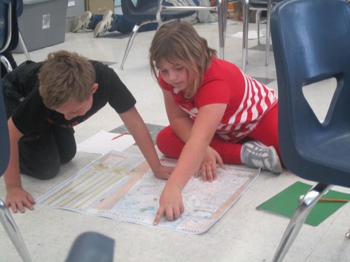
Written by Phil Gersmehl, the author of Teaching Geography, this article shows how teachers can read maps to gather contextual information about places in a way that fosters deeper learning.  The Common Core ELA standards emphasize a “close reading,” but the examples of reading of maps and charts are often rather superficial.  The National Geographic has recently produced Interconnections to be a guide for teachers of both geography and English to see how the two are interrelated and to promote geo-literacy for a more profound appreciation for spatial analysis and place-based knowledge.    

TagsEnglish, National Geographic, geography education, spatial, teacher training, mapping.

See on www.edweek.org

South Sudan’s President relieves VP and dissolves government

July 23, 2013 (JUBA) – South Sudan’s president, Salva Kiir Mayardit, has issued a presidential decree removing the vice-president, Riek Machar Teny, and dissolved the whole government.

Seth Dixon‘s insight:

Just today I mentioned in class that South Sudan had some serious issues in establishing effective governance over their territory and building a legitimate government…then I read this.  Starting a new country is difficult, especially with the hand South Sudan has been dealt–stay tuned. 

Tags: South Sudanpolitical, Africa, states.

See on www.sudantribune.com

In Climbing Income Ladder, Location Matters

The odds of rising to another income level are notably low in certain cities, like Atlanta and Charlotte, and much higher in New York and Boston.

Seth Dixon‘s insight:

Questions to Ponder: Why does place matter for creating opportunities for social mobility?  What geographic obstacles to  economic improvement do you see for the poorest America


Tags: classpoverty, place,  USA.

See on www.nytimes.com

Don’t Let Bankruptcy Fool You: Detroit’s Not Dead

The city’s fiscal crisis is an opportunity to harness the region’s economic promise.

Seth Dixon‘s insight:

Earlier this week when Detoit filed for bankruptcy I posted that Detroit has failed as a major U.S. city.  While Detroit’s days of being the 4th largest city in the U.S. and a prominent industrial center are over, that doesn’t equate with the total economic ruin of the region.  Some are seeing this as an opportunity for for their businesses build a new Detroit out of Motown’s ashes, foster regional collaboration and restructure the economic base of the city.  The region is still rich with resources.  

Tags: urban, economic, industry, Detroit

See on www.theatlanticcities.com

In Kenya, Using Tech To Put An ‘Invisible’ Slum On The Map

A billion people worldwide live in slums, largely invisible to city services and governments — but not to satellites.

Seth Dixon‘s insight:

Most slums are systematically ignored by politicians and public utilities; squatter settlements are not built legally and they are treated as though they did not exist.  Mapping these communities makes them visible, literally putting them on the map can be an important step to legitimize the needs and requests of these poor residents and grant them greater access to public, municipal resources. 

Tagsmapping, GPS, podcast, GIS, poverty, squatter settlements, developmentAfricaKenya.

See on www.npr.org

Finding the True Border Between Yankee and Red Sox Nation Using Facebook Data

“By using Facebook data from the 2.5 million people in New York or New England that ‘like’ either the Red Sox or Yankees I was able to create a more accurate rivalry map than ever before.”

Seth Dixon‘s insight:

Sports maps with team logos on them are often hand-drawn works of art without much data to back them up–not so with this map.  Read the article to find the actual data which is much messier than these bold color proclaim.  These regions aren’t homogenous (are they ever?) but this is the best fit line between the major groups of fans.  The Vermont-New York State border is a fairly crisp dividing line and demonstrated by the data.

The border that winds through Connecticut is much more complex, showing that Connecticut is the true ‘battle ground’ for this regional rivalry.

As the cartographer Ben Blatt states, “Drawing a border through Connecticut using the map above and the data was not easy. I decided that a border should be contiguous. This made it impossible to group all the Sox-leaning towns on one side and all Yankee-leaning towns in the other. The border I came up with is below. There are several other borders that could have been drawn that would have been similarly accurate. My border tried to maximize the number of towns with more than 50% Sox fans on the Red Sox side and the number of towns with more than 50% Yankee fans on the Yankee side.”

This is quite different for this map which is explained in this New York Times article.

Tags: sport, statistics, mapping, regions, Rhode Island, Boston, NYC.

See on harvardsportsanalysis.wordpress.com

Mountain Fire: Natural Hazards

On July 18, 2013, a fierce wildfire threatened Palm Springs, California.

Seth Dixon‘s insight:

In a dry climate where urban expansion gets closer to dry brush, wild fires become a major summer hazard.


Tags: remote sensing, images, environment, land use, disasters, biogeography.

See on earthobservatory.nasa.gov

Density and Emptiness

“In the end of 2012 I travelled to USA to experience something new. And it was something I didn’t expect: emptiness and density.  ‘Merge’ is the last part of a project series ‘Empty, Dense, Merge’ which explores two opposite feelings through the photos of places located in USA.  In this project two opposite places are merged into one: New York City, where, it seems like everyone wants to live there, and Grand Canyon / Death Valley, which are unlivable.”

Seth Dixon‘s insight:

This is geographically inspired art at it’s finest.  It goes beyond making beautiul jewelry with maps or showing majestic vistas of natural landscapes; the artistic concept that motivated the photographer was geographic in nature.  Population density is highly clustered leaving great spaces of open, empty, unpopulated land and some major cities that are jam-packed with human activity and settlements.  Merging both of these concepts into the same image produced this series of 6 images (as seen in this Atlantic Cities article).

Tags: art, density, NYC, landscape.

See on guspetro.com

Detroit’s Struggles

1,419 square feet with two bath? The house is worth $1,250 in Detroit.
Seth Dixon‘s insight:

In the 1950s, Detroit was the 4th largest city in the US with a population around 2 million as seen in some vintage footage of Detroit.  As de-industrialization process restructured the US economy, globalization restructured the world’s economy, and Detroit’s local economic strategy crumbled.  The tax base continued to shrink, city services were spread thin and the poor services encouraged people to migrate elsewhere, leaving current homeowners unable to sell their homes at a fair price.  Today, Detroit is $18-20 million in debt with a population around 700,000 and is unable to pull out of this nosedive.  Detroit filed for bankruptcy July 18, 2013 and became the largest U.S. city ever to file for bankruptcy and more importantly the first major American city to essentially fail (photo gallery of ‘ruin photography’).

See on vimeo.com

“Young entrepreneur Andy Didorosi believes that the way to Detroit’s new era depends on better leadership and a solid connection between the city and the suburbs. The city in 2012 axed its plans to build the M-1 light rail, the transit solution that would’ve bridged that vital connection, Didorosi bought a bus, had a local artist trick it out with a wicked mural, and he started the Detroit Bus Company.  Dedicated to a more connected city, Andy Didorosi is bringing Detroit home one ride at a time.”

Packard Motors Plant
Hotel Room (Lee Hotel)

Blog at WordPress.com.

Up ↑