I never thought that I would be so emotionally invested in people dancing to Germans rapping tongue-twisters, but that is the modern era of cultural production and the amazing impacts of cultural diffusion. Barbara’s Rhubarb Bar–it sounds silly, and it is, but that doesn’t mean it’s simple. In fact, the deeper you go, the more delightfully complex this cultural phenomenon becomes.
This particular online story of why the dance became a viral sensation in 2024 isn’t Earth-changing, but it so perfectly shows the cultural patterns and processes in the modern online ecosystem. I was in the midst of compiling videos to help explain this when my favorite German Youtuber living in the U.S. who explains Germany for Americas (very niche, I know, but that’s want makes the internet fun) explained it far more comprehensively than I ever could because I don’t get all the references, play on words, and allusions to other styles—or in other words—the cultural context. Culture matters, even when we aren’t fully getting it.
This explains probably more context than you ever wanted…and I love it.
QUESTIONS TO PONDER:
What made this funny/fun for Germans? Americans?
What about the German language makes this distinct?
How did social media make this “a thing?”
How do other music, dance, or literary cultural traits play a role in this?
Tourism is a perfect geographic topic; the allure of exotic places, different cultural activities, and distinct cuisines drives the industry and the human impulse to experience the unknown. Tourists are drawn to unfamiliar biomes and dramatic landforms. Tourists go to see the world and experience things they wouldn’t in their homeland. I’m an unabashed advocate for experiencing more of the world as a way to learn, grow, and develop. That isn’t to say that tourism doesn’t have its downsides.
Tourists aren’t just learning about new places, often they are partying and letting loose in a place away from home precisely because they are out of their normal environment. People also go to the same places that are iconic, in search of the perfect Instagram shot of the most viral Tik Tok video. Some places are getting a massive seasonal influx of tourists, more than the local transportation network can handle.
The British media is especially (BBC and the Guardian) aware of this topic, publishing pieces about the adverse impacts of tourism. The negative stereotypes (loud, drunk, culturally insensitive, etc.) are more than off-putting to the local residences in party destinations like Ibiza. People flock to some party destinations, and the picturesque rural community can be confronted with needing a stronger nighttime police force to deal with public drunkenness and more serious criminal activities.
QUESTIONS TO PONDER: What are the responsibilities of tourists? Can a region both foster a tourist-based economy AND keep the place untouched by the industry?
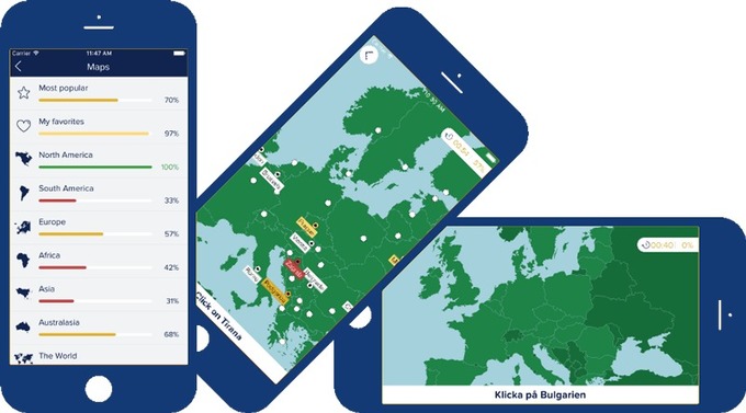
“GeoInquiries™ are short, standards-based inquiry activities for teaching map-based content found in commonly used textbooks. Each activity is designed using a common inquiry model and can be presented quickly from a single computer and projector or modified for students’ hands-on engagement. Collections of 15–20 activities per topic enhance your curriculum throughout the year.” SOURCE: ESRI
ESRI has produced GeoInquires for many diverse subjects, from American Literature to World History. Not surprisingly, I’m especially interested in the AP Human Geography collection with 15 mapping activities that align with content and skills of the course. You don’t need mapping expertise to use these lessons–check them out!
“The news that the world has America, not Italy, to thank for the tomato base on pizza has gone down about as well as putting cream in carbonara among Italian gastro-nationalists. In a new book called La Cucina Italiana Non Esiste (literally “Italian Cuisine Does Not Exist”), food historian Alberto Grandi claims, among other things, that Italians only discovered tomato sauce when they emigrated to the Americas, where tomatoes are native, in the 19th century.” SOURCE: The Independent
A food historian has kicked up controversy after claiming that there is ‘no such thing’ as Italian cuisine, sparking debate over the origins and ownership of food. But perhaps we should reconsider our ideas about so-called ‘national dishes.’
This article highlights great, everyday examples that shows how cultural patterns and processes change and why they matter. Places and cultures are proud of what they see as their accomplishments that are foundational to their heritage. Interestingly though, many communities jealously guard what they see as their contributions as dislike hearing that their other communities may have had a hand in that contribution.
In an analogous example to those given in the article, Mexicans are very proud of their cuisine, but must remember that nothing is created in cultural or geographic isolation. Street tacos made with meat cooked on a rotating spit (al pastor) came to Mexican after WWI and the collapse of the Ottoman Empire. Migrant from what are now the countries of Syria, Lebanon, Israel, and Turkey brought the Middle Eastern traditional manner of cooking meat and it became a new thing when it can to Mexico. So, is it “authentically” Mexican? Of course it’s still authentic, but there is a tendency in some circles to judge something to be less authentic when the origins are more diffused. I think we should resist the temptation though, to judge the value of a culture or a cultural trait based on it’s perceived “authenticity” or “purity.” Cultures all over the world have their own regional variants of flatbread—partly as a result of stimulus diffusion from other places and partly bringing their own local flavor and customs. Cultures are delightfully intermixed, and the diffusion of cultural practices is what leads to continual human progress that shapes our modern world.
Towards the end of the article, they say: “does it really matter who invented tomato sauce on pizza? Or where your croissant is from? To acknowledge that one country might have had an impact on the food of another isn’t to be complicit in cultural appropriation. Point to any dish on a menu and you’ll have a hard time finding one that hasn’t got war, politics, economics, emigration or poverty to thank for its place there.” In essence, geographic processes can be seen everywhere you look.
“While it’s easy to show that people differ in navigational ability, it has proved much harder for scientists to explain why. There’s new excitement brewing in the navigation research world, though. By leveraging technologies such as virtual reality and GPS tracking, scientists have been able to watch hundreds, sometimes even millions, of people trying to find their way through complex spaces, and to measure how well they do. Though there’s still much to learn, the research suggests that to some extent, navigation skills are shaped by upbringing.” SOURCE: Knowable Magazine
How do we know where we are, and why can some people find their way in the world, better than others? I knew my mom would always struggle to find her way around and when I was 11, we moved to San Diego. I took it upon myself to learn the freeway system, major roads, and key visible landmarks. I would help my mom drive around will be trusty Thomas Guide set of maps for San Diego County. Once she was going off alone and I drew her a simplified map with directions on how to get to Fashion Valley, but she also insisted that I make a second map that would show her how to get back (I did try to explain one map would suffice, but it was easier to make the second map).
I’ve often wondered why my mom and I are so different in this regard; our psychology, our interests, the information we value, the skills we believe are useful and within our grasps are quite distinct. We represent the extremes in our family and the linked article above explores how geographers and psychologists think about the differences in navigational abilities. GPS technologies serve both as great tools and crutches that limit some to expand their spatial skill set.
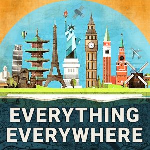
I love the podcast “Everything Everywhere Daily” Podcast. As the title implies it’s an omnivorous exploration of fascinating topics, often focusing on interesting places or pivotal moments in history. Most are approximately 10-minute summaries. Some island nations of the Pacific are very remote, and consequently, more distinct and less well-known to the outsiders. As you explore topics in the Pacific, the list below is an excellent place to start. Choose one! See where it takes you.
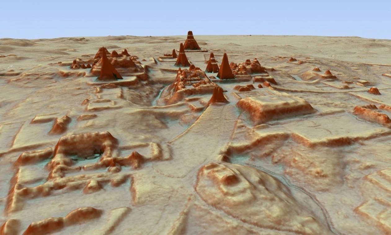
Archaeologists have spent more than a century traipsing through the Guatemalan jungle, Indiana Jones-style, searching through dense vegetation to learn what they could about the Maya civilization. Scientists using high-tech, airplane-based lidar mapping tools have discovered tens of thousands of structures constructed by the Maya: defense works, houses, buildings, industrial-size agricultural fields, even new pyramids. SOURCE– National Geographic: Everything we thought we knew about the Maya is being upended
Lidar technology gives us the visual answer to the question, “If you were to strip a forest of all its vegetation, what would you see? The lidar system fires rapid laser pulses at surfaces and measures how long it takes that light to return to sophisticated measuring equipment. Doing that over and over again lets scientists create a topographical map of sorts. Months of computer modeling allowed the researchers to virtually strip away half a million acres of jungle that has grown over the ruins. What’s left is a surprisingly clear picture of how a 10th-century Maya would see the landscape.
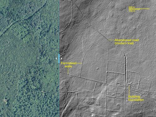
A New England lidar images reveals old land use patterns.
This technology also has local applications here in New England. New England’s wooded hills hold a secret—they weren’t always forested. Instead, many were once covered with colonial roads and farmsteads and food production was the primary local economic activity. Today we can use lidar to see remnants of this historical landscape by mapping stone walls and other features. SOURCE–National Geographic: Lost New England revealed by high-tech archaeology
ArcGIS application: Lidar can also be used quickly assess damage and change after a geologically violent incident, as seen in the Oso landslide in Washington state. View the impact in ArcGIS online in this ArcGIS map, utilizing LiDAR I and II data layers.
Questions to Ponder:
How does lidar work?
How can it be used in GIS?
What are 2 changes to our understanding of the Maya that come out of this Lidar data?
What are 2 New England applications that you found interesting?
Examine the Oso landslide in ArcGIS online. How does this visual representation change your understanding?
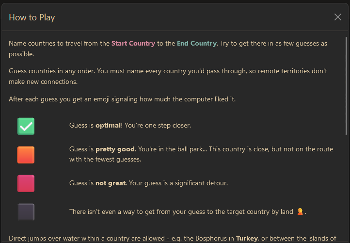
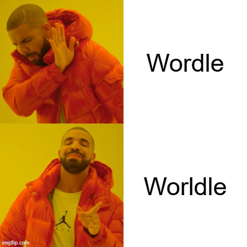
You know that I’m a fan of online geography games going way back. I’ve enjoyed the games like GeoGuessr as my go-to game to refine cultural landscape analysis and map navigation skills. Globle, Countryle, and Worldle have all riffed off of the popularity of Wordle, and there is now a new one of these, TRAVLE. Below is a brief introduction to all of these online geography/mapping games.
TRAVLE recap: Travle names two random countries, and you have to draw the most direct land route between the countries with the goal of minimizing the number of states, not essentially the miles.
COUNTRYLE recap: This is the one that relies most on geographic information since the hints are focus on real data. You guess any country, and the hints will tell you if the actual mystery country has a larger or smaller population, a warmer or colder climate…so that is the guesses aren’t just based on luck or hunches, but some evaluation.
WORLDLE recap: Worldle (not misspelled, but the two L’s are a mouthful). This one shows an outline of the a given country and will tell you the distance away from the actual country to help inform further guesses. The better you know the world map, the less “guessing” there is, but still fun.
GLOBLE recap: The game is quite simple but don’t let that fool you into thinking that it will be easy. Like the old game where one player searches for an item in the room, with the other players calling out “hot” or “cold,” until the player finds the object, this website shows a globe, and it will color your choice based on how accurate your guess is with a red color ramp (white=ice cold, deep burgundy=red hot). Each day, they have a new mystery country for you to guess, but the globe that it displays does not show international borders. This fun new guessing game requires a strong mental map as well as getting a little bit of luck…something to get the students’ brains fired at the start of class, especially for the competitive types.
GEOGUESSR recap: This is the granddaddy of them all. When I was a child I used to wonder if woke up somewhere far from home, would I be able to know where I was just by looking at the places around me (I was a geo-geek from way back when). GeoGuessr is the closest thing to finding yourself lost in the world and needing to figure out where you are without being wisked away. GeoGuessr will display 5 locations in GoogleMaps “StreetView” and you have to guess where the images are located. You can pan and zoom in the StreetView to explore the landscape and find more context clues as to where that location is. It is a fantastic exploration exercise.
SETERRA recap: This is my favorite app to recommend to brush up on basics for a map quiz. If you need students to learn where in the world things are without having to take up class time with map quizzes and the like, this app is great. It has basic “countries and capitals” quizzes for world regions, but it also has some more difficult quizzes for the those that need/want a challenge (Seterra is owned by GeoGuessr).
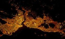
CITY LIGHTS AT NIGHT: The 14 questions from an article in The Guardian shows the outline, grid pattern, and (possibly) the coastline with rivers that flow through the city. This isn’t just about knowing a city, but also identifying regional and urban patterns.
I love the podcast “Everything Everywhere Daily” Podcast. As the title implies it’s an omnivorous exploration of fascinating topics, often focusing on interesting places or pivotal moments in history. Most are approximately 10-minute summaries and for exploring more about the middle East, these podcasts would be a great place to explore further. The links are to Apple Podcasts, but you can listen/search for it on any podcast platform. As you explore topics in the Middle East, the list below is an excellent place to start. Choose one! See where it takes you.