Search

GEOGRAPHY EDUCATION

Supporting geography educators everywhere with current digital resources.

Category

Uncategorized

Czech Republic’s Ambassador

“The Czech Republic and Chechnya are two very different entities – the Czech Republic is a Central European country; Chechnya is a part of the Russian Federation.”

Seth Dixon, Ph.D.‘s insight:

The fact that this official statement is even made by the Ambassador of the Czech Republic is an indictment of the state of geo-literacy in the United States. 

See on www.mzv.cz

Social Studies Praxis Exam: Geographic Content

“Preparing to Teach Social Studies: Geographic Content for the Praxis Exam.”

Seth Dixon, Ph.D.‘s insight:

I know that most of my readers are in-service teachers as opposed to pre-service teachers, but I thought it was still worth sharing.  Several schools have noticed that without geography classes, social studies teachers have difficulty becoming certified without some core geographic content.  As a part of job at the Alliance coordinator for the Rhode Island Geography Education Alliance, I’m giving a workshop tonight at Salve Regina University designed to strengthen pre-service teachers geographic content as outlined on the Praxis Exam.  I have  prepared these materials with that audience in mind, but if there is anything you find useful, please use it or share it with those that could use it (local School of Education, Alliance, etc).  Most of the images in the presentation are hyperlinked to articles, videos and infographics that I have posted here in the past. 

Tags:  Rhode Island, training, geography education.

See on www.slideshare.net

Boston and Syria

LANDFILL HARMONIC: Inspiring dreams one note at a time!

A heartfelt & moving story of how instruments made from recycled trash bring hope to children whose future is otherwise spiritless.

Seth Dixon, Ph.D.‘s insight:

I’ve shared this video before, but this worthy project is now asking for assistance on kickstarter and I feel it merits reposting.  This video shows that the human spirit of beauty and joy can come shining through from the poorest of places.  Slums are not new, but rapid population growth coupled with rural-to-urban migration patterns have led to an increasing amount of slums.  Despite all the stereotypical images of destitute poverty, slums can also be places with a strong vibrant communities with residents filled with innovation, hope and ambition.  For more on this organization, see their Facebook page.   

Tags: urban, squatter, poverty, South America, community, Paraguay.


See on www.kickstarter.com

Topographic Maps

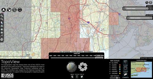
USGS National Geologic Database- TopoView

Seth Dixon, Ph.D.‘s insight:

The National Geologic Map Database is a simple interactive tool to find USGS topographic maps to you can dowload.  Users can search for current or historic maps.  


Tags: geospatial, GIS, mapping, cartography.

See on ngmdb.usgs.gov

How Geography Explains the United States

Seth Dixon, Ph.D.‘s insight:

Questions to ponder: How much do you agree with the author’s assertion that geography explains the foreign affairs of the U.S.?  Is there any environmental determinism in this argument?  

See on www.foreignpolicy.com

Regions of Interaction

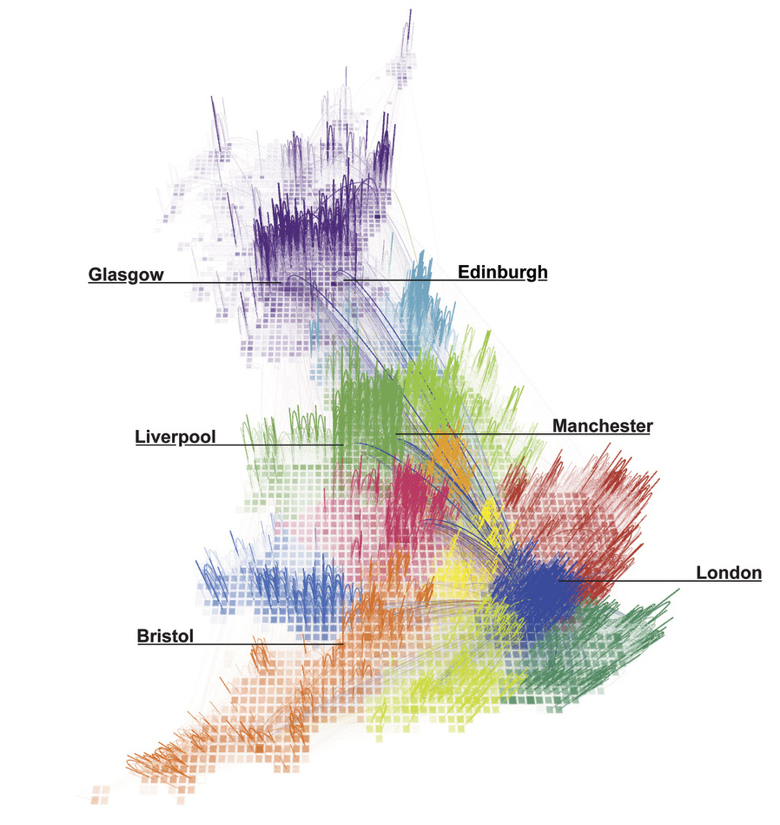
Put away that old Rand McNally map — it’s time for a new way to see what America really looks like.

Seth Dixon, Ph.D.‘s insight:

There is a great series of maps in this NPR article that shows that internal political divisions do not always line up with actual regional interactions.  The map of the United States shows the what money flows within regions that do not always follow state borders (see Wisconsin, Idaho and Pennsylvania).  The map of Great Britain shows the connections based on telephone calls.

Tags: USA, UK, borders, mapping, regions.

See on www.npr.org

british

Toronto at Night

Seth Dixon, Ph.D.‘s insight:

Ironically, some land use patterns become more visible as the sun goes down.  There are some sharp borders in this image of Toronto that was taken by the Canadian astronaut, Chris Hadfield and it is a wonderful teaching image. 

Questions to ponder: Why is there such sharp divisions between the illuminated and obscure portions of the image?  What does this sharp division say about the land use patterns?  Would we see this pattern in the United States?  Why or why not?  What urban model(s) can help explain the spatial layout of Toronto? 

Tags: urban, planning, remote sensing, geospatial, Canada, models, unit 7 cities.

See on twitter.com

In Fact, the U.S. Has Been Winning the War on Terror

Terror in the United States have evolved since 1970: once the tool of left-wing radicals, then right-wing radicals, terrorist attacks are now uncommon, often unsuccessful, and not nearly as deadly.

Seth Dixon, Ph.D.‘s insight:

While terrorism is being discussed in the media as a rising trend in the United States after the Boston Marathon, the statistics don’t show that analysis to be true.  This resources compiles maps, charts and graphs so you can evaluate the historical terrorist patterns for yourself.


Tags: terrorism, statistics, USA.

See on www.theatlanticwire.com

Create a free website or blog at WordPress.com.

Up ↑