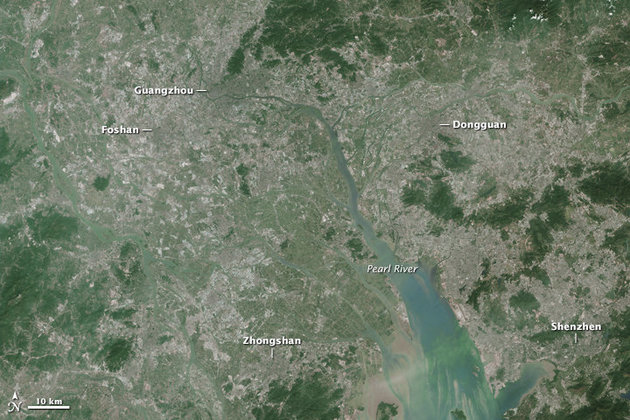
Rapid growth in several cities along the Pearl River Delta has made a Chinese megacity larger and more populous than any other urban area in the world.
What was a rural landscape dominated by rice paddy fields just a few decades ago is now home to the largest Metropolitan region in the world (depending on who is counting and what areas they are including). The “slider” comparison of these two satellite images taken of the same area in 1988 and 2014 is staggering (click here for an animated GIF of the same imagery).
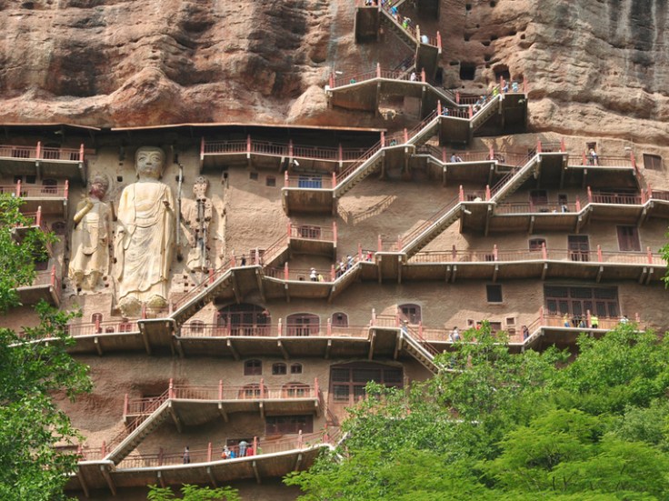
Gansu Province, in northwestern China, is about the same size as California, with a population of about 26 million people. Gansu’s diverse landscapes include parts of the Gobi Desert, the Yellow River, numerous mountain formations, and remnants of the Silk Road and the Great Wall of China.
This photo gallery is filled with dozens of great teaching images, displaying the dramatic human and physical landscapes of the Gansu Province of China.
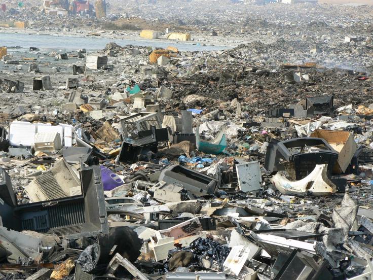
The world is increasingly going hi-tech. Many people in our high consumption society want the latest and the greatest; last year’s much anticipated laptops and cell phones are miles behind the newest models that are coming out. So what happens with the old models? Even thrift stores are politely not accepting them as donations. Even some workable machines that were highly valuable 10 years ago are now functionally trash in our society. We can’t put it to the curb to end up in the landfill because of the lead, mercury, and other hazardous materials that can leak into the environment. This type of trash is what we call e-waste. The geography of e-waste is an ‘out of sight out of mind’ problem that we rarely think about but need to due to the ecological impacts of our collective consumption.
I’ve received an advance copy of Australia to Zimbabwe and it is a delightful book that appeals to all ages (everyone in my house ate it up). Carefully layered so that readers can customize the experience to fit their interests, time, and goals, this treasure trove just begs the reader to keep exploring as they flip through its pages. Australia to Zimbabwe presents facts in a context that enlivens learning about the people and places of the world and heightens the reader’s curiosity. With the online supplemental materials, this book brings to life the sights, sounds, and smells of far-away places. Teachers, librarians, and parents alike should all be excited to get their hands on this book when it comes out November 17th.
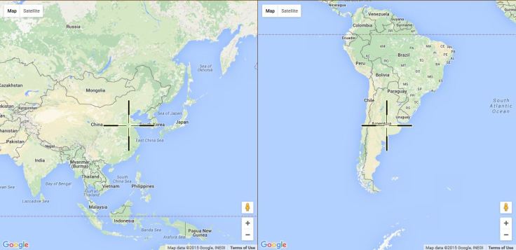
The antipode of any place is the spot of opposite side of Earth; this is like a geographic version of Bizarro Superman (it is also the name of journal for radical geography). Two points are considered antipodal if they are are on opposite sides of a Great Circle from each other (Check out Great Circle mapper). I knew I never would be able to dig a hole to China from the United States…I guess I’ll have to go to Argentina with my shovel to dig my tunnel.
The close race comes after a decade of leadership by Stephen Harper, whose relationship with Barack Obama has suffered. But a victory for Justin Trudeau and the Liberals on Monday could help the US and Canada forge renewed ties
The world’s largest dam was created to generate more energy for China’s ever-expanding economy and to increase the interior economic development by increasing the navigability of the river. The dam also can control downstream flooding and protect important industrial centers such as Shanghai. This ambitious hydroelectric dam produces the same amount of energy as 18 nuclear power plants. This dam also displaced over 1 million people as the reservoir flooded properties upstream. The Three Gorges Dam prevents the nutrient-rich sediments from being deposited downstream; this heightens Chinese farmers’ need for fertilizers, this has led to drought downstream and limits residents’ water access. The dam also disrupted the local ecology (part of the reason the Yangtze River Dolphin went extinct), preventing fish to migrate to upstream breeding grounds.
For good and ill, the dam has profoundly modified the environment and this video animation from NASA is a powerful demonstration of the changes.
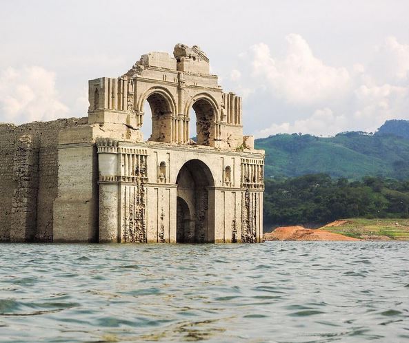
A 16th century church has emerged from the receding waters of the Nezahualcoyotl reservoir in the southern Mexican state of Chiapas. This is the second time water levels have dropped low enough to reveal the church since the reservoir was completed in 1966.
Like millions of other Americans, I watch the NFL on a regular basis. However, just like millions of other viewers, most Sundays I am not sure which games will be on my television. For years, the strange geographic structures that underpinned league broadcasts were almost entirely obscured from the average consumer. People would turn on their TVs expecting to see one game only to be disappointed by another.
The top map is essentially a major market analysis of sports teams and shows to some extent the media hinterlands of America’s major cities. The second map I find even more interesting; all teams are regional, but a select few have larger national followings (if you are a fan of the Packers, Steelers, 49ers or Cowboys and are not from those areas, maybe I can guess your age). There are many other maps in this interesting sports geography article. What patterns do you see? Explanations?