Search

GEOGRAPHY EDUCATION

Supporting geography educators everywhere with current digital resources.

Category

Uncategorized

WWII ‘Mapping Maidens’ Chart Course for Today’s Mapmakers

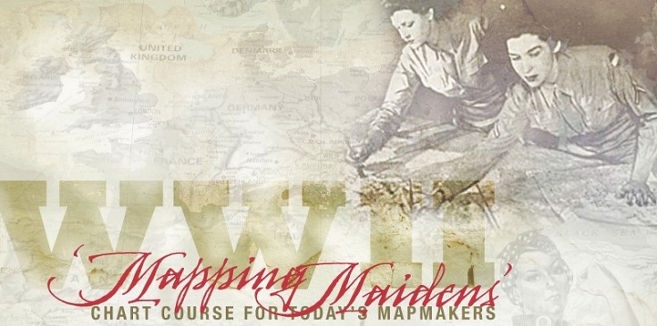
“As the demand for its products escalated early in World War II, the Army Map Service, a heritage organization of the National Geospatial-Intelligence Agency, was losing much of its largely male workforce to the armed forces. A solution to the urgent need for replacements emerged when the University of Chicago’s Geography Department developed a course in military map making and began offering it to women’s colleges in the East and Midwest.”

Women in science are awesome and we need to encourage girls in STEM disciplines, especially geospatial technologies…hearing this story of women in the past might help to inspire a future generation. 

Tags: mapping, cartographywar, gender, STEM, geospatial.

City Centers Are Doing Better than Inner Suburbs

A new report tracks demographic trends across 66 U.S. metro areas.  The report provides comprehensive evidence for Aaron Renn’s “new donut” model of cities (pictured in above image, on the right). Renn’s model proposes that city centers and outer-ring suburbs are doing well economically, but inner-ring suburbs are struggling with a new influx of poverty.”

Tags: urban, economic, urban models, APHG.

Source: www.citylab.com

India-Pakistan border Ceremony

Fascinating footage of a traditional ceremony that takes place on the Pakistan India border. From the BBC

Source: www.youtube.com

This is a fascinating political display that shows a degree of cooperation, but is made into a sports-like event because of the geopolitical tension/passion between these two South Asian neighbors.  They have ‘toned down‘ the overtly display of hostility in recent years.  Some love this border ceremony and others fear that they are playing with fire, fanning the flames of nationalism that only exacerbates the tension.  Just last year, this border checkpoint was the site of a terrorist attack that killed 50.  Click here for more information about the border tension in the Pakistan/India/China borderland.


Tags: bordersgeopolitics, political, territoriality, video, India, South Asia, Pakistan.

Volcanic Eruption

WebCams de Mexico archives the best of webcam videos in Mexico.”

Source: www.youtube.com

What does a volcanic eruption look like?  Just like this. 


Tags: disastersMexico, physical, volcano.

These twins can teach us a lot about racial identity

Maria says she’s black and Lucy says she’s white. Together, they prove none of this makes sense.

Source: www.vox.com

These twins also have three siblings and they say “we are at opposite ends of the [skin color] spectrum and they are all somewhere in between.”  Their lives show that the differences underlying the cultural constructs of “white” and “black” as discrete categories isn’t defensible, but it doesn’t mean that it isn’t culturally important.  As stated in the article, “here’s no question that the way people categorize Lucy and Maria, and the way they think of themselves, will affect their lives.  That’s because, even though race is highly subjective, racism and discrimination based on what people believe about race are very real.”

Tags: culturerace.

The Speed Burden [Costs of Sprawl]

The need for speed devours huge chunks of American cities and leaves the edges of the expressways worthless. Busy streets, for almost all of human history, created the greatest real estate value because they delivered customers and clients to the businesses operating there. This in turn cultivated the highest tax revenues in town, both from higher property taxes and from elevated sales taxes. But you can’t set up shop on the side of an expressway. How can cities afford to spend so much to create thoroughfares with no adjoining property value?

Source: www.originalgreen.org

That is is the ENTIRE city of Florence, Italy on the left, while there is area surrounding just one cloverleaf interchange in Atlanta, Georgia on the right.  The high speed on the highways is one of the costs of sprawl.   

Tags: transportation, planning, sprawl, scale

Augmented Reality Sandbox

“Realtime topographic contour line generation.”

Source: www.youtube.com

Many of our first experiments of creating landforms and designing a new world started in the sandbox (you can only image what I do at the beach).  This video shows how that early childhood activity can make for an excellent classroom demonstration to shows how Earth’s physical systems work.  If you don’t happen to have a digital topographic map to superimpose on the sandbox and a GPU-based water simulation, then at least you’ve got this video.  Click here to learn more about this UC Davis project on the visualization of lake ecosystems.

Tags: water, physical, geomorphology, landforms, visualization.

Teaching the Geography of Food

“Food. It’s something we all think about, talk about, and need. So how do we teach the geography of food?  In the presentation I’ll share some of my favorite resources for teaching the content as well as some pedagogical tips.  Many of these resources are found in an article on National Geographic’s website that I wrote on the topic on my personal site on a wide range of geographic issues, including food resources.

  • Tip#1: Don’t demonize agribusiness or romanticize the family farm. 
  • Tip #2: Use data and maps.  Here is a map in ArcGIS online on rural land use activities with a handy dandy instruction guide, ready to go (many more APHG GeoInquiries from ESRI set to be released soon). 
  • Tip #3: Connect them personally into the web of food systems and show how it impacts them. 
  • Tip #4: Let this be one of those units that connects to all the themes of the course, especially population, culture, political, and the environment.  

Tagsfoodeconomicfood production, agribusiness, agriculture.

Gerrymandering Visualized

By simplifying gerrymandering we see how problematic it really is.

Source: www.washingtonpost.com

The redistricting process is far from neutral; to be fair we should remember that gerrymandering is has happened on all ends of the political spectrum.  Which map do you think is the best way to divide these districts?  What is the fairest way to divide them?

Tags: gerrymandering, political, mapping, census, unit 4 political.

Blog at WordPress.com.

Up ↑