This video is geared for photographers, demonstrating the technical abilities of camera, but the images of the varied housing types and skylines of Rio de Janeiro are stunning. To appreciate the favelas and Sugarloaf Mountains more fully, maximize the display and watch on the largest screen possible.
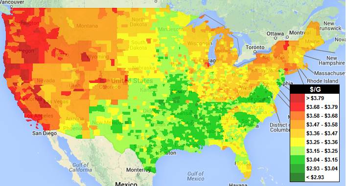
“Now you can see what gas prices are around the U.S. at a glance. Areas are color coded according to their price for the average price for regular unleaded gasoline. Click here for the Canada National Gas Price Heat Map.”
In 2012, this visualization of gas prices by county in the United States was because high gas prices were hitting Americans hard in the pocketbooks and became a major political hot-button topic. Today, this map still shows the regional variations in prices (so sorry to my California friends), but the recent drop in prices makes most consumers give a sigh of relief.. Supply and demand works beautifully on a two-axis graph, but supply and demand happen somewhere, giving a simple chart added complexity since it’s spatially contingent and we must make the assumption and caveat explicit.
Questions to Ponder: Why are the prices for a certain commodity higher in one region than another? What factors lead to the spatial differences in the relative economic value in one region over another?
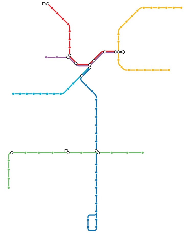
I’m a sucker for online quizzes like this one only showing only the transit system of the cities. This isn’t just about knowing a city, but also identifying regional and urban patterns. If you want quizzes with more direct applicability in the classroom, click here for online regional quizzes.
The Jewish population in Europe has dropped significantly over the last several decades – most dramatically in Eastern Europe and the countries that make up the former Soviet Union.
It’s been seven decades since the end of the Holocaust, an event that decimated the Jewish population in Europe. In the years since then, the number of European Jews has continued to decline for a variety of reasons. And now, concerns over renewed anti-Semitism on the continent have prompted Jewish leaders to talk of a new “exodus” from the region.
There are still more than a million Jews living in Europe, according to 2010 Pew Research Center estimates. But that number has dropped significantly over the last several decades – most dramatically in Eastern Europe and the countries that make up the former Soviet Union, according to historical research by Sergio DellaPergola of the Hebrew University of Jerusalem.
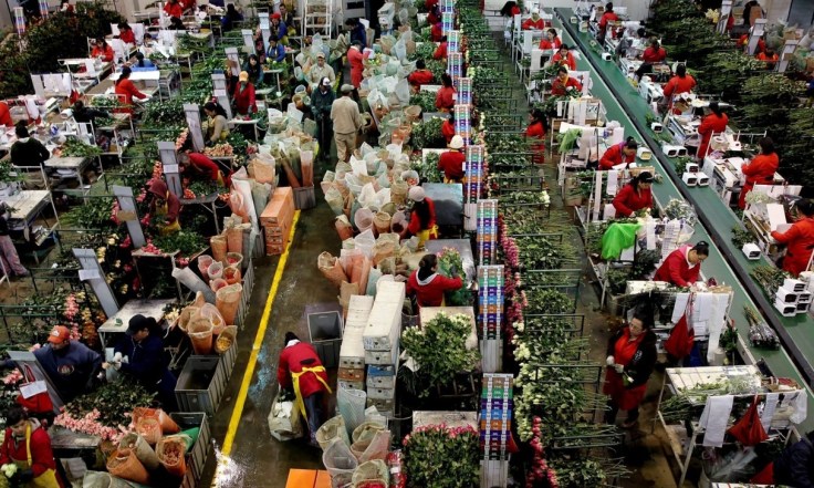
Valentines Day is this one day when one product — a red rose — is worth two or three times more than it is at any other time of the year. If a florist catches that window, he’s golden. But the process of getting the roses to is fraught with risk, middlemen, crazy expense and bad weather.
This NPR podcast looks at the economic fluctuations of the flower market based on the cultural festival that is Valentines Day, and this Guardian articleexamines the economic development issues in the commodity chain for cut flowers (focused on Colombia).
“”February 11, 2015 marks five years in space for NASA’s Solar Dynamics Observatory, which provides incredibly detailed images of the whole sun 24 hours a day. Capturing an image more than once per second, SDO has provided an unprecedentedly clear picture of how massive explosions on the sun grow and erupt ever since its launch on Feb. 11, 2010. The imagery is also captivating, allowing one to watch the constant ballet of solar material through the sun’s atmosphere, the corona.”
As Phil Plait states in this Slate article, “There’s so much to take in there. Rolling sunspots, eruptive prominences, collapsing filaments, solar flares, the Transit of Venus (twice!)…SDO is far more than I imagined, and has revealed our active and complex star far better than anything before it.”
“There’s nothing more irritating to a pedant’s ear and nothing more flabbergasting than realizing you’ve been pronouncing the name of so many places wrong, your entire life! Despite the judgment we exhibit toward people who err in enunciating, we all mispronounce a word from time to time, despite our best efforts. Well, now it’s time we can really stop mispronouncing the following places.”
I’ve only been mispronouncing 8 of them, but many of these toponyms (place names) are chronically mispronounced. Some of these have curious local of pronouncing the name, while others show that translating one language into another can be quite difficult since many sounds don’t naturally flow off the tongue of non-native speakers.
Geography isn’t just a body of knowledge that someone understands; it’s about decision-making to evaluate the impacts and taking actions to make the world a better place. This NY Times articleis a great example of how geospatial tools can monitor human/environmental issues to be able to effectuate change.
“Walk along the streets of London and it’s not uncommon to hear a variety of langauges jostling for space in your eardrums. Step inside a tube carriage on the underground and the story is no different.
Using a map of tube journeys and busy stations that he had previously created, O’Brien used 2011 Census data to add the second most commonly spoken language that people who live nearby speak.”