Search

GEOGRAPHY EDUCATION

Supporting geography educators everywhere with current digital resources.

Navigating the East China Sea

See on Scoop.it – Geography Education
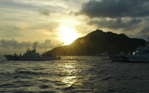
How to ease tensions between Beijing and Tokyo over an uninhabited string of islands.

Seth Dixon‘s insight:

Experts are saying that Chinese-Japanese relations are as bad as they’ve been since the end of World War II.  Why all the commotion?  The tension has been heightened in the last few months when China claimed control over the airspace in  the East China Sea. Then the Japanese Prime Minister also gave offering to a shrine to honor World War II soldiers (veterans and heroes to some Japanese, war criminals to most of the international community).  China sees this as proof that Japan is becoming more militaristic and willing to exert more power in East Asia.  However, at the root of this issue is that both Japan and China claim certain islands and that is increasingly becoming a sticking point in foreign relations.  See this book review on “Asia’ Cauldron” for more context on the East China Sea.      

Tags: borders, political, conflict, China, Japan, East Asia.

See on www.washingtonpost.com

Venice wants out of Italy

See on Scoop.it – Geography Education

VENICE, Italy – Venice, renowned for incomparable Gothic architecture and placid canals plied by gondolas that make it one of the most recognizable cities in the world, may have had enough of Italy.

Seth Dixon‘s insight:

Some of the wealthiest regions of the poorest countries of the European Union are seeking for greater regional autonomy and even independence.  As one resident said, “I have always felt as a Venetian first, and Italian second.”  The scale at which people construct their primary identities and political loyalties play a key role to the political geographic concept of devolution, where power shifts from a central authority to more local control.  So independence moves are to start negotiating.  As another Venetian said, “I think we’ll end up with a little more autonomy and a little more pride in our city” and not actual independence.

Tags: Italy,  political, economic, states, autonomy, devolution.

See on www.usatoday.com

Feeding 9 Billion

See on Scoop.it – Geography Education

When we think about threats to the environment, we tend to picture cars and smokestacks, not dinner. But the truth is, our need for food poses one of the biggest dangers to the planet.

Seth Dixon‘s insight:

Agricultural production is one of the ways in which people modify the environment more than any other.  Global population is expected to top out at around 9 billion around 2050, so will we be able to sustainably feed all of the entire human population?  This one question brings up many more spatial, environmental, political and social questions–this interactive feature nicely addresses many of the pertinent issues in a very accessible manner.    

Tags: sustainability, agriculture, food production, environment modify, unit 5 agriculture. 

See on www.nationalgeographic.com

The Next America

See on Scoop.it – Geography Education

Demographic transformations are dramas in slow motion. America is in the midst of two right now. Our population is becoming majority non-white at the same time a record share is going gray.

Seth Dixon‘s insight:

The demographic shifts in the United States are transforming the cultural fabric of the country and this interactive feature from the Pew Research Center explores some of these changes.  Interracial marriage, declining fertility rates, migration, economic opportunities and politics are just some of the issues that can be seen in these excellent populations pyramids, charts, videos and graphs.      

Tag: declining populations, population, demographic transition model, USA.

See on www.pewresearch.org

Using State Maps in School

“Have you ever seen a map and marveled over all of the information that it contains? It is incredible how maps can capture so much of the real world and depict so many places. From big cities to small towns, maps use characteristics such as topography, hydrography, industry, and recreation to tell the story of a place.”

Seth Dixon‘s insight:

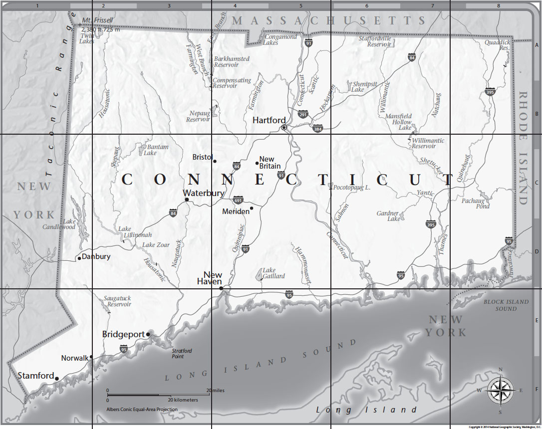
National Geographic Education has just finished producing all of 50 State Tabletop Mapmaker kits which focus on basic mapping skills for younger audiences.  This set of tiled 8.5 x 11 sheets really expands what you can do and to help educators know what to do with these resources, they wrote this article that shows 9 ways to use these new state maps in your classroom.  I’m looking forward to printing off the Rhode Island state map!

Tags: National Geographic. mapping, K12.

See on blog.education.nationalgeographic.com

CT map

Economic Decline and Sense of Place

West Virginia, Still Home from Hollow Interactive on Vimeo.

“McDowell County, situated in the coalfields of West Virginia, has experienced a great boom-and-bust since 1950. But despite the economic decline and population loss, many still call it home and feel a great sense of purpose among the mountains. Residents speak about their connection to this place and the meaning of ‘home.’ Hear more stories at hollowdocumentary.com ”

Seth Dixon‘s insight:

This video perfectly exemplifies some key geographic ideas; sense of place, regional economic decline, migration and resource extraction.  This video would be great to shows students and then get them to analyze the geographic context that creates a place like McDowell County, West Virginia.  This will be a great addition to my Place-Based Geography Videos StoryMap.  

Tags: economic, place, industry, location, migration, APHG, poverty, socioeconomic,

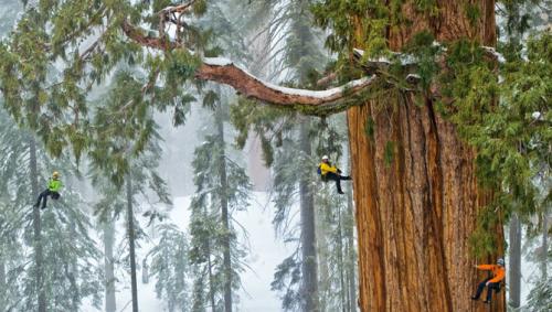
The World’s Largest Trees

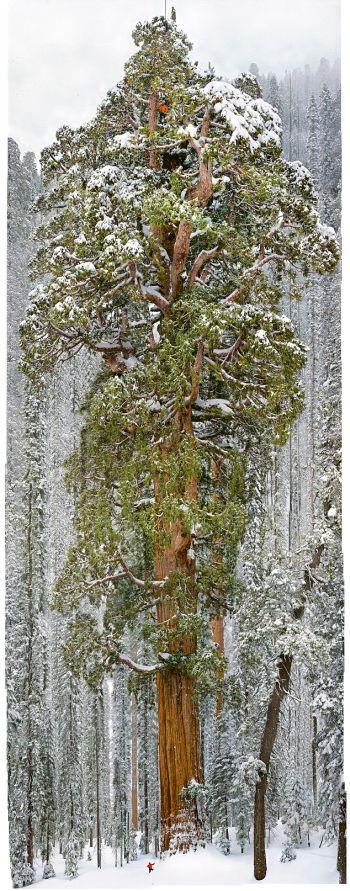
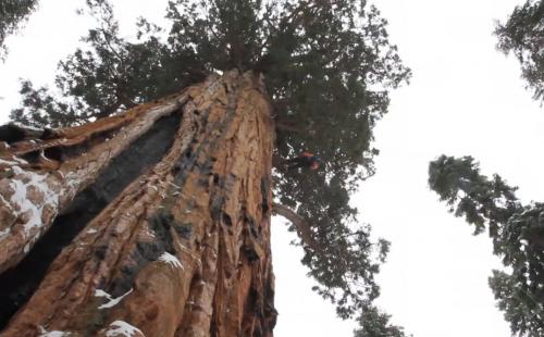
“The world’s second-largest known tree, the President, in Sequoia National Park is photographed by National Geographic magazine photographer Michael ‘Nick’ Nichols for the December 2012 issue.”

Seth Dixon‘s insight:

There is a beauty and magnificent in nature, both is the microscopic and delicate as well as the grand and powerful.  The biosphere’s diversity is a great part of it’s allure that keeps geographers exploring for to understand the mysteries on our planet.  This incredible image at the end of this project really is stunning.  

Tags: biogeography, environment, ecology, historical, California.

See on www.youtube.com

Sequoia

President1 President

Globalization and the Textile Industry

“On the 100th anniversary of the Triangle Shirtwaist Factory Fire, little has changed in the global sweatshop economy. Workers are again trapped and burned to death behind locked exit gates.”

Seth Dixon‘s insight:

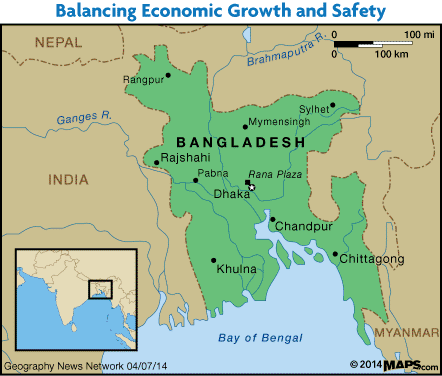
One of the first industries to be impacted by what is today called globalization was the textile industry and the successive waves of globalization continue to alter the geography of the textile industry.  This video shows how historical problems in the U.S. textile industry are seen today in countries such as Bangladesh as does this interactive feature.  The following paragraph is from a Geography News Network podcast / article that Julie Dixon and I co-authored for Maps101 about the Bangladeshi garment industry: 

Many developing countries with the majority of their laborers working in agriculture welcome outsourced labor from the West. This is seen as a way to nurture industrialization, even if it is on the terms of trans-national corporations. Countless workers seek employment in textile factories simply because low pay is still an entry into the cash economy and it is one of the few jobs rural migrants can find when they first enter the big city. In such locations, Western labor, construction, and environmental standards are not priorities because the population’s basic needs haven’t been met, so the responsibility falls to the global companies—but their aim is to cut costs as much as possible to remain competitive.  From its emergence in textiles back in the late 1970’s, Bangladesh in 2013 made $19 billion in the export-oriented, ready-made garment industry, employing 4 million workers, most of whom are women. 

Listen to more of this Geography News Network podcast or read it here.

Tags: Bangladesh, poverty, development, economic, globalization, industry, labor.

See on www.youtube.com

20140407_94_bangladesh

The Science behind Google Earth

See on Scoop.it – Geography Education

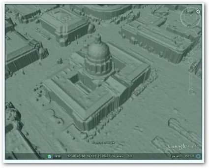
“Google is using a new technology to automatically generate  3D buildings from 45-degree angle aerial photography made by overlapping passes of aircraft.  The aerial photos are combined to create 3D models.”

Seth Dixon‘s insight:

Some of the nuts and bolts behind Google Earth might be difficult to replicate in the computer lab, but it is critical to conceptually understand how geospatial data is used today.  This series of images shows how important remote sensing is for our modern digital mapping platforms.  

Tags: cartography, visualization, mapping, remote sensing, google.

See on worldcadaccess.typepad.com

Create a free website or blog at WordPress.com.

Up ↑