For the most part in American culture, intellectual struggle in school children is seen as an indicator of weakness, while in Eastern cultures it is not only tolerated, it is often used to measure emotional strength.
See on www.npr.org
For the most part in American culture, intellectual struggle in school children is seen as an indicator of weakness, while in Eastern cultures it is not only tolerated, it is often used to measure emotional strength.
See on www.npr.org
This map show Mother’s Day celebration dates around the world.
While most of the world celebrates Mother’s day in May, March 21st (the vernal equinox) is day most countries in the Middle East celebrate Mother’s Day. Happy Mother’s Day!
See on chartsbin.com
Try the Population Bracketology game from @uscensusbureau! Weekly data visualization from the U.S. Census Bureau compares populations for US states and metro areas.
Get into the spirit of March Madness by challenging your knowledge on the sizes of Metropolitan Statistic Areas. I got a 56 on my first stab…what can you get?
See on www.census.gov
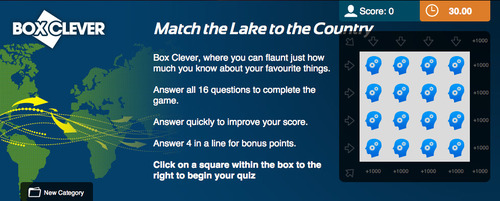
Can you locate these famous lakes? Challenge your knowledge of lakes from around the world – some more well known than others – in our Lakes and Countries Quiz.
See on www.quizfortune.com
An arid region grew even drier between 2003 and 2009 due to human consumption of water for drinking and agriculture.
As drought conditions have hit the Middle East, growing populations are using more water per capita then ever. See this on Google Earth with this KMZ file.
Tags: water, environment, consumption, resources, environment depend, Middle East, Iraq.
See on earthobservatory.nasa.gov
Free site dedicated to help teachers educate and engage students using Google Earth
GE Teach is a phenomenal site, designed by an AP teacher to bring geospatial technologies into the classroom in a way that is incredibly user-friendly. This site allows you to use Google Earth with clickable layers. With multiple data layers of physical and human geography variables, this interactive globe puts spatial information in powerful, yet fun, student-inspired platform. Click here for a video tutorial.
Tags: google, virtual tours, geospatial, edtech.
See on www.geteach.com
Presenters: Rich Schultz and Joseph Kerski
FREE NCGE Informational Webinar
“Professional development opportunities for Advanced Placement Human Geography (APHG) teachers are currently limited to short workshops lacking long-term emphasis on pedagogy. Thus, a new Graduate Certificate Program in APHG has been created to provide teachers with a completely online opportunity to complete courses designed specifically to address the pedagogical aspects of teaching APHG.“
This recent announcement generated a lot of enthusiasm in the APHG community, but since the idea itself is such a different approach, many teachers had some questions about how this would work. Through NCGE, there will be a free webinar this Wednesday (3/20) to more fully explain the program and to answer any question that you may have. Register here for this free webinar.
The brackets are rarely as “regional” as the names Midwest, West, South and East would suggest; still a map of all the participating teams shows that there a geography to basketball participation. See also this collection of maps visualizing basketball fandom. Also, what about the high schools areas that produce college basketball players? What patterns to you see?
See on billsportsmaps.com
Chiwa – Mchinji, Malawi Shot over a period of 18 months, Italian photographer Gabriele Galimberti’s project Toy Stories compiles photos of children from around the world with their prized possesions—their toys.
How are the lives of these children different from those in your neighborhood? How are their lives the same?
See on www.featureshoot.com