Search

GEOGRAPHY EDUCATION

Supporting geography educators everywhere with current digital resources.

Why leave the West for India?

Rising numbers of people of Indian origin born in the West are moving to the country their parents left decades ago in search of opportunity and a cultural connection, reports the BBC’s Rajini Vaidyanathan.

Since 2005, the Indian government has been encouraging people of Indian descent and former Indian nationals to return to India.  For many Indians living in the UK, there are more and better economic opportunities for them within India.   Migrants have many reasons for moving (including cultural factors), but the primary pull factor is most certainly India’s ascendant importance in the global economy and rising IT industries. 


Tags: India, South Asia, migration, immigration, Europe, colonialism, unit 2 population

See on www.bbc.co.uk

Museum of Natural History

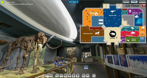
The Smithsonian Museum of Natural History is a fabulous resource in Washington D.C., but now this museum available virtually.  Teachers can now bring the museums to the classroom with these fantastic Smithsonian virtual tours.

Tags: biogeography, virtual tours, environment, ecology, historical, physical.

See on www.mnh.si.edu

Earthscapes

The U.S. Postal Service celebrates the beauty and diversity of America’s landscapes as seen from above with the Earthscapes (Forever®) stamps.Offering an opportunity to see the world in a new way, the 15 stamps are issued in 3 rows of 5, showing 3…

These stamps are the perfect way to decorate your letters while showing your love for the Earth and geography. 

Tags: images, art, landscape

See on store.usps.com

Ghosts of War

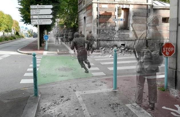
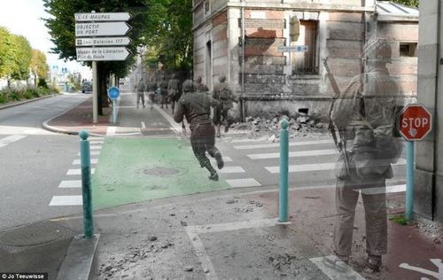
The remarkable pictures show scenes from France today with atmospheric photographs taken in the same place during the war superimposed on top.

In this fastinating set of images, Dutch artist and historian Jo Teeuwisse merges her passion literally by superimposing World War II photographs on to modern pictures of the where the photos were originally taken.  This serves as a reminder that places are rich with history; to understand the geography of a place, one must also know it’s history (and vice versa).

Tags: Europe, war, images, historial, place.

See on www.dailymail.co.uk

Making National Geographic Maps

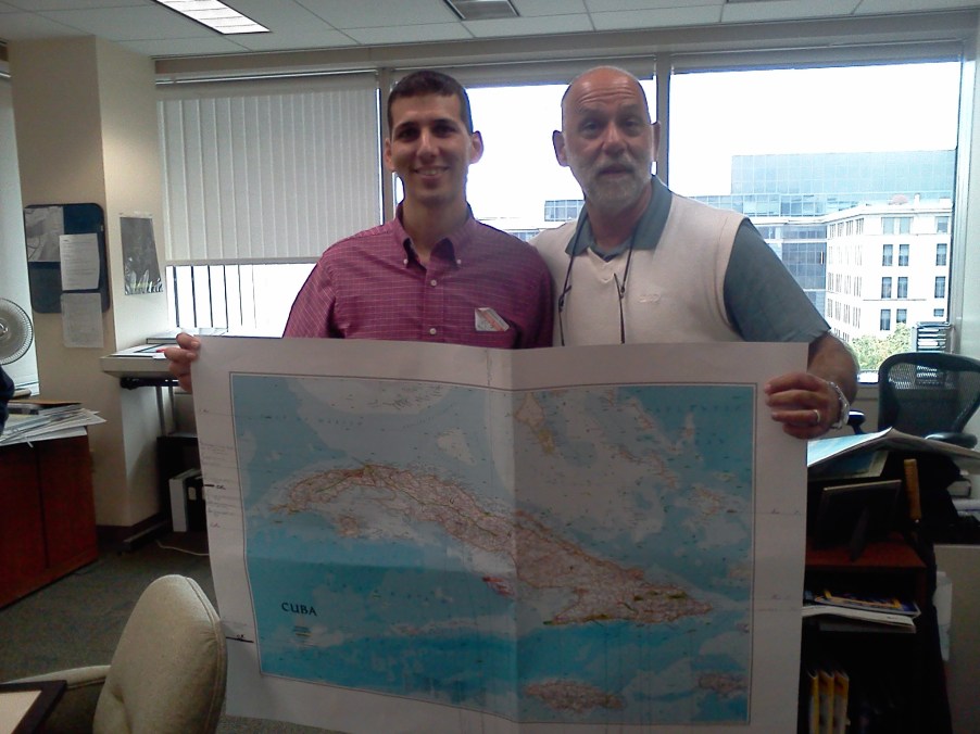
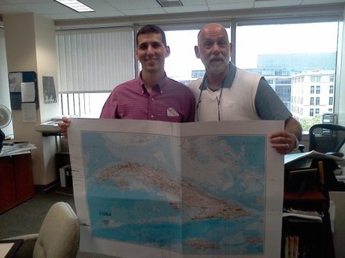
This map of Cuba, National Geographic’s first map of Cuba in over 100 years, has an incredible backstory. 

While touring the National Geographic headquartes, the cartographer Juan Valdés (pictured here with me) told me the story of his early days living in Cuba before Castro,  Pictured is one of his 36 meticulous drafts produced to create this cartographic masterpiece of his home country.  To hear it in his own words, embedded in this link is a 18 minute video of his talk at National Geographic on Cuba and the production of the map.  The last 7 minutes are especially helpful for mapping students to see all the decisions and stages involved in creating a professional reference map.

Tags: cartography, mapping, National Geographic, Latin America, Unit 1 GeoPrinciples.

See on rigea.org

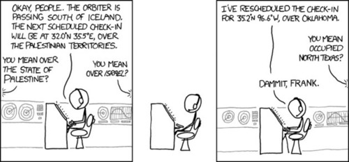
What is in a Name?

Tags: Middle East, political, states, perspective, unit 4 political.

See on xkcd.com

Economics behind Gangnam Style

The viral hit isn’t a fluke. South Korea has been cultivating a global music business for decades.

You may already know that I’ve been fascinating watching the cultural diffusion of Gangnam Style throughout the world as mentioned previously.  This NPR podcast looks at the economic infrastructure of the South Korean music industry that explains in greater detail how this video went viral.  The distribution of this video is dependent in part on the technological sophistication and economic strategies of South Korea to associate their brands with cultural cachet.  

Tags: popular culture, industry, diffusion, globalization, technology, economic, unit 6 industry.

See on www.npr.org

Around the world, perceptions of Obama-Romney contest lag reality

With Obama still popular overseas, many leaders appear unprepared for a possible Romney victory.

The election looks very different at a variety of scales (and in different places).  Deep in the Northeast, it’s hard to imagine Romney winning, while in the Intermountain West you might be confused why this isn’t projected to by a Republican landslide.  Internationally, it’s clear that most of the world favors (and consequently have imagined that their approval is mirrored in the United States) President Obama. 

See on www.washingtonpost.com

OpenStreetMap

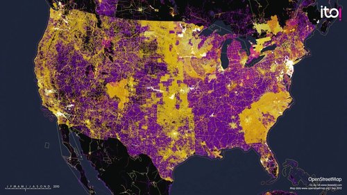
An animation showing edits to http://OpenStreetMap.org over the period 2007-2012.

OpenStreetMap recently had it’s “State of the Map” conference (Oct. 13-14) in Portland, Oregon. This video was embedded in a great article entitled “The New Cartographers” that summarizes some of the current issues discussed at the conference as well as concerns that confont the project.  The project has experienced exponential growth and is a major player in the world of online mapping (think Wikipedia for maps).

Questions to Ponder: What are some advantages (and disadvantages) to an open source mapping data set?  What do you imagine is the future for the world largest open-source mapping data?

Tags: mapping, cartography, geospatial, social media.

See on vimeo.com

Blog at WordPress.com.

Up ↑