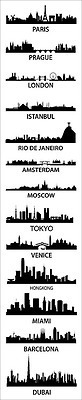
These skylines are not to scale, but are composite skylines to groups together the iconic representations of the particular cities into one.
Tags: urban, Paris, London, place, tourism.
See on cognacandcoffee.tumblr.com
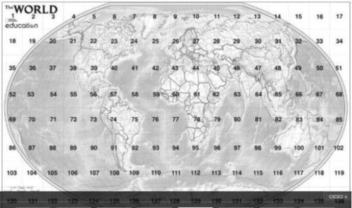
I love National Geographic’s MapMaker Kit as a great way to have students produce their own oversized Mega Maps (8 rows of 17 columns), especially if you only have access to a printer that p…
Here are 6 lessons and activities designed around National Geographic’s Mega Maps and Tabletop Maps that can be printed with ordinary 8.5 x11 sheets of paper. This is a perfect way to celebrate and get ready for Geography Awareness Week (Nov . 11-17).
Tags: mapping, K12, National Geographic, Geography Education.
See on rigea.org
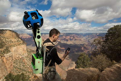
The term “street view” in Google Maps is continually getting stretched as the world’s oceans, canyons, mountains and even cemeteries are being added to this ever-expanding database.
Tags: Google, mapping, cartography, geospatial, cemetery.
See on googleblog.blogspot.fr
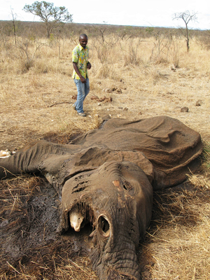
In an impoverished country, elephant poaching is a quick way to make big money. A pair of poachers explain how they track and kill elephants in one of Africa’s top game reserves.
The illegal sale of ivory in places such as Asia drive the elephant poachers to prey on Elephants in protected game reserves and national parks. The Selous Game Reserve is larger than Switzerland and yet they only have 10 rangers to protect and patrol the wildlife.
Tags: biogeography, poverty, globalization, Africa, consumption, resources, ecology, podcast.
See on www.npr.org
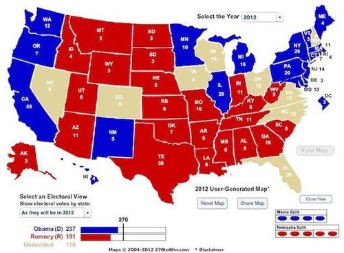
Right now, the conventional wisdom says that there are just nine states that might go either way on Nov. 6th.
Not all votes are created equally; votes in these 9 key states have a greater likelihood of impacting the actual outcome of the Presidential election. If we assume that the other states vote as anticipated, and that each candidate has an equal opportunity in the remaining 9 states (yes, these are a major assumptions, but work with me), than President Obama has a 84% likelihood of winning in the 512 possible permuations. Geographer Andy Baker has created a video that provides a solid non-partisan analysis of the political geography of these states (and other) states.
Tags: political, unit 4 political.
See on www.theatlanticwire.com
WEATHER GANG | With computer models locked in on the eventuality of a punishing blow for East Coast from Hurricane Sandy, analyses suggest this storm may be unlike anything the region has ever experienced.
This weekend’s storm for the East coast is especially interesting. I won’t pretend to be a meteorologist, so I’ll quote one: “The upper-air steering pattern that is part of the puzzle is not all that unheard of. It happens when the atmosphere gets blocked over the Atlantic and the flow over the U.S. doubles back on itself. Sometimes big winter storms are involved. The freak part is that a hurricane happens to be in the right place in the world to get sucked into this doubled-back channel of air and pulled inland from the coast.” Stay safe everyone on the east coast.
Tags: weather and climate, physical, disasters.
See on www.washingtonpost.com
TED Talks For the past two years, photographer Lisa Kristine has traveled the world, documenting the unbearably harsh realities of modern-day slavery.
This is a chilling glimpse into the worst and darkest side of the economic systems of geography and labor in the world. It is estimated that there are more than 25 million people who today live in state that can be described as modern-day slavery. We should not discuss slavery only in the past tense, and yet it conflicts with how most people conceptualize the world today.
Questions to Ponder: How can this even be happening in the 21st century? What geographic and economic forces lead to these situations portrayed in this TED talk? What realistically could be done to lessen the amount of slavery in the world today?
Tags: TED, labor, economic, class, poverty, South Asia, Africa, video.
See on www.ted.com
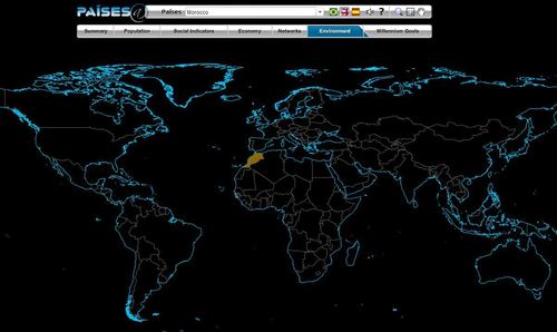
The Brazilian government’s geographic department (Instituto Brasileiro de Geografia e Estatística-roughly equivalent to the U.S. Census Bureau) has compiled an fantastic interactive world factbook (available in English and Spanish as well as Portuguese). The ease of navigation allows the user to conduct a specific search of simply explore demographic, economic, environmental and development data on any country in the world.
Tags: population, worldwide, statistics, mapping, zbestofzbest.
See on www.ibge.gov.br
Theories about our right-wing and left-wing mind-sets don’t explain why they are tied to geography.
While not endorsing all the cultural assumptions in the article, this is still an interesting exploration into expalining why distinct places are are politically aligned with particular parties.
Questions to ponder: What portions of the author’s argument do you agree (or disagree) with? What do you see as the reasons behind the spatial distributions of “blue” and “red” in the United States?
Tags: political, place, USA, culture, unit 4 political.