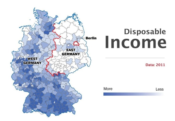
“While 75 percent of Germans who live in the east said that they considered their country’s reunification a success, only half of western Germans agreed. With eastern and western Germans blaming each other for past mistakes over the past two years, that frustration has likely increased. Younger citizens, especially — who do not usually identify themselves with their area of origin as strongly anymore — have grown worried about the persistent skepticism on both sides. But where do those divisions come from? And how different are eastern and western Germany today?”
Source: www.washingtonpost.com
This series of 10 maps (and 1 satellite image) highlights many of the cultural and economic divisions between East and West, despite efforts to in the last 26 years to smooth out these discrepancies. The social geographies imposed by the Iron Curtain and the Berlin Wall are still being felt from this relic border and will for years to come.
Tags: Germany, industry, labor, economic, historical, political, borders.
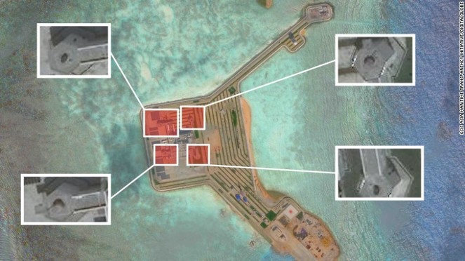 New satellite imagery indicates that China has installed weapon systems on all seven artificial islands it has built in the contested waters of the South China Sea, a move that’s likely alarm the country’s neighbors.