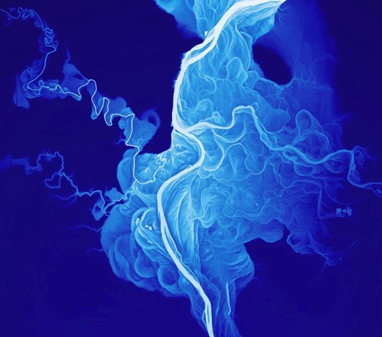
“If you measure the contours of a river valley with Lidar (like radar with lasers), you get a beautiful map of all the historical river channels.”
Source: kottke.org
This particular image is fantastic for teaching about geomorphology and river systems. Students can ‘see’ the historical layers of a meandering stream winding it’s way across the landscape. Here’s a meandering stream image (Willamette River, Oregon) that shows the dynamism of fluvial processes quite nicely.
Tags: physical, fluvial, geomorphology, erosion, landscape.


Leave a comment