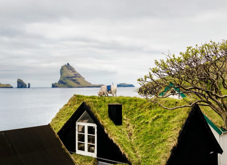
“How do you get Google to visit your small, remote island group with its Street View vehicles, and digitize your roads for the benefit of locals and tourists alike? If you are the Faroe Islands, then you exploit your local resources to roll your own Street View, in the hopes of attracting Google’s attention. Behold: Sheep View 360, a solar-powered 360-degree camera, mounted on a sheep’s back. Sheep View takes advantage of one great Street View feature: You can upload your own images to Google’s service. So Durita Dahl Andreassen, working for the tourist site Visit Faroe Islands, decided to kick-start the Faroe Islands’ entry by putting the camera on a sheep and letting it wander free, then uploading the photos.”
Source: www.fastcoexist.com
I think this is my favorite mapping story of the year…I’m sharing this just because I can. Google wouldn’t originally bring its Street View-recording cars to the islands (part of Denmark), so a solar-powered, ovine-mounted camera was put to work. Fact can be stranger than fiction.
Tags: google, mapping, cartography, technology, Denmark,


Leave a comment